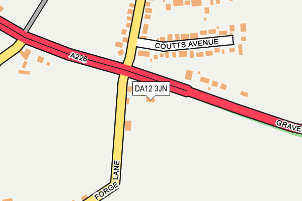
DA12 3JN is located in the Higham & Shorne electoral ward, within the local authority district of Gravesham and the English Parliamentary constituency of Gravesham. The Sub Integrated Care Board (ICB) Location is NHS Kent and Medway ICB - 91Q and the police force is Kent. This postcode has been in use since January 1980.


GetTheData
Source: OS OpenMap – Local (Ordnance Survey)
Source: OS VectorMap District (Ordnance Survey)
Licence: Open Government Licence (requires attribution)
| Easting | 569434 |
| Northing | 171697 |
| Latitude | 51.418966 |
| Longitude | 0.435347 |
GetTheData
Source: Open Postcode Geo
Licence: Open Government Licence
| Country | England |
| Postcode District | DA12 |
➜ See where DA12 is on a map ➜ Where is Shorne? | |
GetTheData
Source: Land Registry Price Paid Data
Licence: Open Government Licence
Elevation or altitude of DA12 3JN as distance above sea level:
| Metres | Feet | |
|---|---|---|
| Elevation | 50m | 164ft |
Elevation is measured from the approximate centre of the postcode, to the nearest point on an OS contour line from OS Terrain 50, which has contour spacing of ten vertical metres.
➜ How high above sea level am I? Find the elevation of your current position using your device's GPS.
GetTheData
Source: Open Postcode Elevation
Licence: Open Government Licence
| Ward | Higham & Shorne |
| Constituency | Gravesham |
GetTheData
Source: ONS Postcode Database
Licence: Open Government Licence
| Shorne Crossroads (Forge Lane) | Shorne | 49m |
| Shorne Crossroads (Gravesend Road) | Shorne | 58m |
| Shorne Crossroads (Forge Lane) | Shorne | 71m |
| Shorne Crossroads (Gravesend Road) | Shorne | 98m |
| The Copperfields (Gravesend Road) | Shorne | 332m |
| Higham Station | 2.3km |
| Strood Station | 5.2km |
| Cuxton Station | 5.3km |
GetTheData
Source: NaPTAN
Licence: Open Government Licence
GetTheData
Source: ONS Postcode Database
Licence: Open Government Licence


➜ Get more ratings from the Food Standards Agency
GetTheData
Source: Food Standards Agency
Licence: FSA terms & conditions
| Last Collection | |||
|---|---|---|---|
| Location | Mon-Fri | Sat | Distance |
| Coutts Avenue | 16:00 | 09:00 | 126m |
| Shorne Post Office | 16:00 | 09:00 | 542m |
| Peartree Lane | 16:00 | 09:00 | 1,389m |
GetTheData
Source: Dracos
Licence: Creative Commons Attribution-ShareAlike
The below table lists the International Territorial Level (ITL) codes (formerly Nomenclature of Territorial Units for Statistics (NUTS) codes) and Local Administrative Units (LAU) codes for DA12 3JN:
| ITL 1 Code | Name |
|---|---|
| TLJ | South East (England) |
| ITL 2 Code | Name |
| TLJ4 | Kent |
| ITL 3 Code | Name |
| TLJ43 | Kent Thames Gateway |
| LAU 1 Code | Name |
| E07000109 | Gravesham |
GetTheData
Source: ONS Postcode Directory
Licence: Open Government Licence
The below table lists the Census Output Area (OA), Lower Layer Super Output Area (LSOA), and Middle Layer Super Output Area (MSOA) for DA12 3JN:
| Code | Name | |
|---|---|---|
| OA | E00123377 | |
| LSOA | E01024301 | Gravesham 010E |
| MSOA | E02005064 | Gravesham 010 |
GetTheData
Source: ONS Postcode Directory
Licence: Open Government Licence
| DA12 3JW | Gravesend Road | 146m |
| DA12 3HJ | Coutts Avenue | 152m |
| DA12 3DP | Forge Lane | 254m |
| DA12 3HL | Green Farm Lane | 256m |
| DA12 3HP | Burdett Avenue | 257m |
| DA12 3JL | Gravesend Road | 276m |
| DA12 3DR | Forge Lane | 277m |
| DA12 3HG | Robinsons Cottages | 337m |
| DA12 3DS | Malthouse Lane | 376m |
| DA12 3JJ | Gravesend Road | 424m |
GetTheData
Source: Open Postcode Geo; Land Registry Price Paid Data
Licence: Open Government Licence