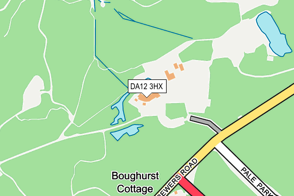
DA12 3HX is located in the Higham & Shorne electoral ward, within the local authority district of Gravesham and the English Parliamentary constituency of Gravesham. The Sub Integrated Care Board (ICB) Location is NHS Kent and Medway ICB - 91Q and the police force is Kent. This postcode has been in use since April 1987.


GetTheData
Source: OS OpenMap – Local (Ordnance Survey)
Source: OS VectorMap District (Ordnance Survey)
Licence: Open Government Licence (requires attribution)
| Easting | 568334 |
| Northing | 169974 |
| Latitude | 51.403815 |
| Longitude | 0.418725 |
GetTheData
Source: Open Postcode Geo
Licence: Open Government Licence
| Country | England |
| Postcode District | DA12 |
➜ See where DA12 is on a map | |
GetTheData
Source: Land Registry Price Paid Data
Licence: Open Government Licence
Elevation or altitude of DA12 3HX as distance above sea level:
| Metres | Feet | |
|---|---|---|
| Elevation | 110m | 361ft |
Elevation is measured from the approximate centre of the postcode, to the nearest point on an OS contour line from OS Terrain 50, which has contour spacing of ten vertical metres.
➜ How high above sea level am I? Find the elevation of your current position using your device's GPS.
GetTheData
Source: Open Postcode Elevation
Licence: Open Government Licence
| Ward | Higham & Shorne |
| Constituency | Gravesham |
GetTheData
Source: ONS Postcode Database
Licence: Open Government Licence
| Shorne Woods Country Park (Brewers Road) | Shorne | 154m |
| Shorne Woods Country Park (Brewers Road) | Shorne | 199m |
| Racefield Close (Tanyard Hill) | Shorne Ridgeway | 1,069m |
| Racefield Close (Tanyard Hill) | Shorne Ridgeway | 1,081m |
| Village Hall (The Street) | Shorne | 1,420m |
| Sole Street Station | 3.6km |
| Higham Station | 4.2km |
| Cuxton Station | 4.5km |
GetTheData
Source: NaPTAN
Licence: Open Government Licence
GetTheData
Source: ONS Postcode Database
Licence: Open Government Licence


➜ Get more ratings from the Food Standards Agency
GetTheData
Source: Food Standards Agency
Licence: FSA terms & conditions
| Last Collection | |||
|---|---|---|---|
| Location | Mon-Fri | Sat | Distance |
| Peartree Lane | 16:00 | 09:00 | 1,069m |
| Shorne Post Office | 16:00 | 09:00 | 1,504m |
| Vigilante Way | 17:45 | 11:45 | 1,920m |
GetTheData
Source: Dracos
Licence: Creative Commons Attribution-ShareAlike
The below table lists the International Territorial Level (ITL) codes (formerly Nomenclature of Territorial Units for Statistics (NUTS) codes) and Local Administrative Units (LAU) codes for DA12 3HX:
| ITL 1 Code | Name |
|---|---|
| TLJ | South East (England) |
| ITL 2 Code | Name |
| TLJ4 | Kent |
| ITL 3 Code | Name |
| TLJ43 | Kent Thames Gateway |
| LAU 1 Code | Name |
| E07000109 | Gravesham |
GetTheData
Source: ONS Postcode Directory
Licence: Open Government Licence
The below table lists the Census Output Area (OA), Lower Layer Super Output Area (LSOA), and Middle Layer Super Output Area (MSOA) for DA12 3HX:
| Code | Name | |
|---|---|---|
| OA | E00123375 | |
| LSOA | E01024300 | Gravesham 010D |
| MSOA | E02005064 | Gravesham 010 |
GetTheData
Source: ONS Postcode Directory
Licence: Open Government Licence
| DA12 3HD | Brewers Road | 221m |
| DA12 3LB | Brewers Road | 668m |
| DA12 3LH | Hanbury Cottages | 904m |
| DA12 3EL | Racefield Close | 925m |
| DA12 3LN | The Ridgeway | 940m |
| DA12 3LL | Gothic Cottages | 950m |
| DA12 3HH | Woodlands Lane | 960m |
| DA12 3LD | Pondfield Lane | 961m |
| DA12 3HE | Shorne Ifield Road | 995m |
| DA12 3LW | The Ridgeway | 1008m |
GetTheData
Source: Open Postcode Geo; Land Registry Price Paid Data
Licence: Open Government Licence