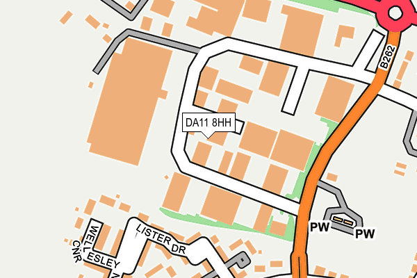
DA11 8HH is located in the Northfleet & Springhead electoral ward, within the local authority district of Gravesham and the English Parliamentary constituency of Gravesham. The Sub Integrated Care Board (ICB) Location is NHS Kent and Medway ICB - 91Q and the police force is Kent. This postcode has been in use since February 1990.


GetTheData
Source: OS OpenMap – Local (Ordnance Survey)
Source: OS VectorMap District (Ordnance Survey)
Licence: Open Government Licence (requires attribution)
| Easting | 562132 |
| Northing | 173266 |
| Latitude | 51.435196 |
| Longitude | 0.331175 |
GetTheData
Source: Open Postcode Geo
Licence: Open Government Licence
| Country | England |
| Postcode District | DA11 |
➜ See where DA11 is on a map ➜ Where is Northfleet? | |
GetTheData
Source: Land Registry Price Paid Data
Licence: Open Government Licence
Elevation or altitude of DA11 8HH as distance above sea level:
| Metres | Feet | |
|---|---|---|
| Elevation | 10m | 33ft |
Elevation is measured from the approximate centre of the postcode, to the nearest point on an OS contour line from OS Terrain 50, which has contour spacing of ten vertical metres.
➜ How high above sea level am I? Find the elevation of your current position using your device's GPS.
GetTheData
Source: Open Postcode Elevation
Licence: Open Government Licence
| Ward | Northfleet & Springhead |
| Constituency | Gravesham |
GetTheData
Source: ONS Postcode Database
Licence: Open Government Licence
| Springhead Enterprise Park (Springhead Road) | Northfleet | 149m |
| Springhead Enterprise Park (Springhead Road) | Northfleet | 191m |
| Bonham Way (Springhead Parkway) | Springhead Park | 238m |
| Springhead Road (Thames Way) | Northfleet | 241m |
| Bonham Way (Springhead Parkway) | Springhead Park | 268m |
| Ebbsfleet International Station | 1.1km |
| Northfleet Station | 1.3km |
| Swanscombe Station | 2.2km |
GetTheData
Source: NaPTAN
Licence: Open Government Licence
| Median download speed | 80.0Mbps |
| Average download speed | 56.8Mbps |
| Maximum download speed | 80.00Mbps |
| Median upload speed | 20.0Mbps |
| Average upload speed | 14.1Mbps |
| Maximum upload speed | 20.00Mbps |
GetTheData
Source: Ofcom
Licence: Ofcom Terms of Use (requires attribution)
GetTheData
Source: ONS Postcode Database
Licence: Open Government Licence


➜ Get more ratings from the Food Standards Agency
GetTheData
Source: Food Standards Agency
Licence: FSA terms & conditions
| Last Collection | |||
|---|---|---|---|
| Location | Mon-Fri | Sat | Distance |
| Waterdales | 17:30 | 11:45 | 479m |
| Waterdales Post Office | 17:30 | 11:45 | 510m |
| Dover Road | 17:30 | 11:30 | 819m |
GetTheData
Source: Dracos
Licence: Creative Commons Attribution-ShareAlike
The below table lists the International Territorial Level (ITL) codes (formerly Nomenclature of Territorial Units for Statistics (NUTS) codes) and Local Administrative Units (LAU) codes for DA11 8HH:
| ITL 1 Code | Name |
|---|---|
| TLJ | South East (England) |
| ITL 2 Code | Name |
| TLJ4 | Kent |
| ITL 3 Code | Name |
| TLJ43 | Kent Thames Gateway |
| LAU 1 Code | Name |
| E07000109 | Gravesham |
GetTheData
Source: ONS Postcode Directory
Licence: Open Government Licence
The below table lists the Census Output Area (OA), Lower Layer Super Output Area (LSOA), and Middle Layer Super Output Area (MSOA) for DA11 8HH:
| Code | Name | |
|---|---|---|
| OA | E00167468 | |
| LSOA | E01024280 | Gravesham 006A |
| MSOA | E02005060 | Gravesham 006 |
GetTheData
Source: ONS Postcode Directory
Licence: Open Government Licence
| DA11 8HD | Springhead Enterprise Park | 93m |
| DA11 8FF | Lister Drive | 149m |
| DA11 8HN | Springhead Enterprise Park | 199m |
| DA11 8FN | Fielden Terrace | 210m |
| DA11 8FJ | Darwin Rise | 216m |
| DA11 8BF | Springhead Parkway | 219m |
| DA11 8FL | Wellesley Corner | 226m |
| DA11 8FH | Tyler Close | 228m |
| DA11 8FP | Tourtel Yard | 257m |
| DA11 8AD | Springhead Parkway | 273m |
GetTheData
Source: Open Postcode Geo; Land Registry Price Paid Data
Licence: Open Government Licence