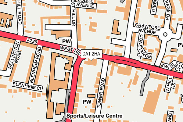
DA1 2HA is located in the West Hill electoral ward, within the local authority district of Dartford and the English Parliamentary constituency of Dartford. The Sub Integrated Care Board (ICB) Location is NHS Kent and Medway ICB - 91Q and the police force is Kent. This postcode has been in use since January 1980.


GetTheData
Source: OS OpenMap – Local (Ordnance Survey)
Source: OS VectorMap District (Ordnance Survey)
Licence: Open Government Licence (requires attribution)
| Easting | 553471 |
| Northing | 174185 |
| Latitude | 51.445864 |
| Longitude | 0.207043 |
GetTheData
Source: Open Postcode Geo
Licence: Open Government Licence
| Country | England |
| Postcode District | DA1 |
➜ See where DA1 is on a map ➜ Where is Dartford? | |
GetTheData
Source: Land Registry Price Paid Data
Licence: Open Government Licence
Elevation or altitude of DA1 2HA as distance above sea level:
| Metres | Feet | |
|---|---|---|
| Elevation | 30m | 98ft |
Elevation is measured from the approximate centre of the postcode, to the nearest point on an OS contour line from OS Terrain 50, which has contour spacing of ten vertical metres.
➜ How high above sea level am I? Find the elevation of your current position using your device's GPS.
GetTheData
Source: Open Postcode Elevation
Licence: Open Government Licence
| Ward | West Hill |
| Constituency | Dartford |
GetTheData
Source: ONS Postcode Database
Licence: Open Government Licence
| West Hill | Dartford | 33m |
| West Hill | Dartford | 55m |
| Boys' Grammar School (Shepherds Lane) | Dartford | 110m |
| Boys' Grammar School (Shepherds Lane) | Dartford | 129m |
| Priory Hill (West Hill) | Dartford | 244m |
| Dartford Station | 0.9km |
| Crayford Station | 2km |
| Slade Green Station | 2.7km |
GetTheData
Source: NaPTAN
Licence: Open Government Licence
GetTheData
Source: ONS Postcode Database
Licence: Open Government Licence


➜ Get more ratings from the Food Standards Agency
GetTheData
Source: Food Standards Agency
Licence: FSA terms & conditions
| Last Collection | |||
|---|---|---|---|
| Location | Mon-Fri | Sat | Distance |
| Dartford Mail Centre | 19:30 | 12:45 | 211m |
| West Hill Meter Box | 19:30 | 211m | |
| West Hill Schools | 17:30 | 12:00 | 318m |
GetTheData
Source: Dracos
Licence: Creative Commons Attribution-ShareAlike
The below table lists the International Territorial Level (ITL) codes (formerly Nomenclature of Territorial Units for Statistics (NUTS) codes) and Local Administrative Units (LAU) codes for DA1 2HA:
| ITL 1 Code | Name |
|---|---|
| TLJ | South East (England) |
| ITL 2 Code | Name |
| TLJ4 | Kent |
| ITL 3 Code | Name |
| TLJ43 | Kent Thames Gateway |
| LAU 1 Code | Name |
| E07000107 | Dartford |
GetTheData
Source: ONS Postcode Directory
Licence: Open Government Licence
The below table lists the Census Output Area (OA), Lower Layer Super Output Area (LSOA), and Middle Layer Super Output Area (MSOA) for DA1 2HA:
| Code | Name | |
|---|---|---|
| OA | E00122781 | |
| LSOA | E01024185 | Dartford 003F |
| MSOA | E02005030 | Dartford 003 |
GetTheData
Source: ONS Postcode Directory
Licence: Open Government Licence
| DA1 2HJ | West Hill | 39m |
| DA1 2JA | Sanctuary Close | 93m |
| DA1 2HE | Tower Road | 102m |
| DA1 2NL | Shepherds Lane | 120m |
| DA1 2EU | West Hill | 152m |
| DA1 3EE | Dartford Road | 157m |
| DA1 3DX | Lodge Avenue | 166m |
| DA1 3DU | West Hill Drive | 175m |
| DA1 2HH | Alexandra Terrace | 181m |
| DA1 3EB | Blenheim Road | 203m |
GetTheData
Source: Open Postcode Geo; Land Registry Price Paid Data
Licence: Open Government Licence