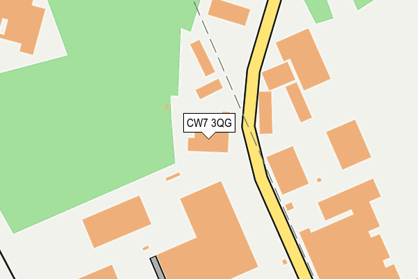
CW7 3QG is located in the Winsford Wharton electoral ward, within the unitary authority of Cheshire West and Chester and the English Parliamentary constituency of Eddisbury. The Sub Integrated Care Board (ICB) Location is NHS Cheshire and Merseyside ICB - 27D and the police force is Cheshire. This postcode has been in use since February 1990.


GetTheData
Source: OS OpenMap – Local (Ordnance Survey)
Source: OS VectorMap District (Ordnance Survey)
Licence: Open Government Licence (requires attribution)
| Easting | 366713 |
| Northing | 367477 |
| Latitude | 53.203315 |
| Longitude | -2.499792 |
GetTheData
Source: Open Postcode Geo
Licence: Open Government Licence
| Country | England |
| Postcode District | CW7 |
➜ See where CW7 is on a map ➜ Where is Winsford? | |
GetTheData
Source: Land Registry Price Paid Data
Licence: Open Government Licence
Elevation or altitude of CW7 3QG as distance above sea level:
| Metres | Feet | |
|---|---|---|
| Elevation | 50m | 164ft |
Elevation is measured from the approximate centre of the postcode, to the nearest point on an OS contour line from OS Terrain 50, which has contour spacing of ten vertical metres.
➜ How high above sea level am I? Find the elevation of your current position using your device's GPS.
GetTheData
Source: Open Postcode Elevation
Licence: Open Government Licence
| Ward | Winsford Wharton |
| Constituency | Eddisbury |
GetTheData
Source: ONS Postcode Database
Licence: Open Government Licence
| Meridean House (Road One) | Winsford Industrial Estate | 92m |
| Navigation Park (Road One) | Winsford Industrial Estate | 121m |
| Premier Park (Road One) | Winsford Industrial Estate | 180m |
| Premier Park (Road One) | Winsford Industrial Estate | 206m |
| Bostock Road (Road One) | Winsford Industrial Estate | 441m |
| Winsford Station | 1.5km |
| Hartford Station | 5.6km |
GetTheData
Source: NaPTAN
Licence: Open Government Licence
| Median download speed | 26.7Mbps |
| Average download speed | 23.3Mbps |
| Maximum download speed | 33.73Mbps |
| Median upload speed | 2.0Mbps |
| Average upload speed | 2.5Mbps |
| Maximum upload speed | 4.69Mbps |
GetTheData
Source: Ofcom
Licence: Ofcom Terms of Use (requires attribution)
Estimated total energy consumption in CW7 3QG by fuel type, 2015.
| Consumption (kWh) | 73,789 |
|---|---|
| Meter count | 7 |
| Mean (kWh/meter) | 10,541 |
| Median (kWh/meter) | 7,786 |
GetTheData
Source: Postcode level gas estimates: 2015 (experimental)
Source: Postcode level electricity estimates: 2015 (experimental)
Licence: Open Government Licence
GetTheData
Source: ONS Postcode Database
Licence: Open Government Licence


➜ Get more ratings from the Food Standards Agency
GetTheData
Source: Food Standards Agency
Licence: FSA terms & conditions
| Last Collection | |||
|---|---|---|---|
| Location | Mon-Fri | Sat | Distance |
| Whitlow Lane | 16:30 | 09:00 | 2,219m |
| Queens Hotel | 17:30 | 11:30 | 2,386m |
| Moulton So | 16:45 | 11:30 | 2,412m |
GetTheData
Source: Dracos
Licence: Creative Commons Attribution-ShareAlike
The below table lists the International Territorial Level (ITL) codes (formerly Nomenclature of Territorial Units for Statistics (NUTS) codes) and Local Administrative Units (LAU) codes for CW7 3QG:
| ITL 1 Code | Name |
|---|---|
| TLD | North West (England) |
| ITL 2 Code | Name |
| TLD6 | Cheshire |
| ITL 3 Code | Name |
| TLD63 | Cheshire West and Chester |
| LAU 1 Code | Name |
| E06000050 | Cheshire West and Chester |
GetTheData
Source: ONS Postcode Directory
Licence: Open Government Licence
The below table lists the Census Output Area (OA), Lower Layer Super Output Area (LSOA), and Middle Layer Super Output Area (MSOA) for CW7 3QG:
| Code | Name | |
|---|---|---|
| OA | E00168838 | |
| LSOA | E01018749 | Cheshire West and Chester 035D |
| MSOA | E02003886 | Cheshire West and Chester 035 |
GetTheData
Source: ONS Postcode Directory
Licence: Open Government Licence
| CW7 3BA | Wharton Bridge | 351m |
| CW7 3AY | Wharton Gardens | 417m |
| CW7 3AX | Park Avenue | 451m |
| CW7 3AZ | Wharton Gardens | 455m |
| CW7 3HX | Bradbury Road | 460m |
| CW7 3AT | Carver Close | 500m |
| CW7 3BD | Bostock Road | 504m |
| CW7 3UT | Orton Close | 519m |
| CW7 3AU | Wharton Road | 520m |
| CW7 3UU | Orton Close | 521m |
GetTheData
Source: Open Postcode Geo; Land Registry Price Paid Data
Licence: Open Government Licence