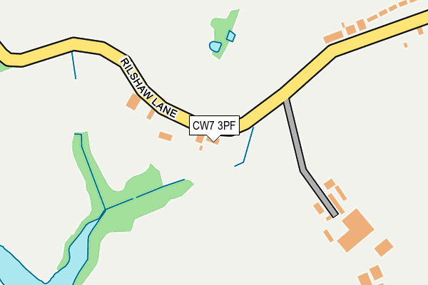
CW7 3PF lies on Rilshaw Lane in Winsford. CW7 3PF is located in the Winsford Gravel electoral ward, within the unitary authority of Cheshire West and Chester and the English Parliamentary constituency of Eddisbury. The Sub Integrated Care Board (ICB) Location is NHS Cheshire and Merseyside ICB - 27D and the police force is Cheshire. This postcode has been in use since January 1980.


GetTheData
Source: OS OpenMap – Local (Ordnance Survey)
Source: OS VectorMap District (Ordnance Survey)
Licence: Open Government Licence (requires attribution)
| Easting | 366311 |
| Northing | 365540 |
| Latitude | 53.185879 |
| Longitude | -2.505605 |
GetTheData
Source: Open Postcode Geo
Licence: Open Government Licence
| Street | Rilshaw Lane |
| Town/City | Winsford |
| Country | England |
| Postcode District | CW7 |
➜ See where CW7 is on a map ➜ Where is Winsford? | |
GetTheData
Source: Land Registry Price Paid Data
Licence: Open Government Licence
Elevation or altitude of CW7 3PF as distance above sea level:
| Metres | Feet | |
|---|---|---|
| Elevation | 30m | 98ft |
Elevation is measured from the approximate centre of the postcode, to the nearest point on an OS contour line from OS Terrain 50, which has contour spacing of ten vertical metres.
➜ How high above sea level am I? Find the elevation of your current position using your device's GPS.
GetTheData
Source: Open Postcode Elevation
Licence: Open Government Licence
| Ward | Winsford Gravel |
| Constituency | Eddisbury |
GetTheData
Source: ONS Postcode Database
Licence: Open Government Licence
2018 20 JUL £240,000 |
RILSHAW HOUSE FARM, RILSHAW LANE, WINSFORD, CW7 3PF 2016 30 JUN £660,000 |
2015 9 SEP £130,000 |
GetTheData
Source: HM Land Registry Price Paid Data
Licence: Contains HM Land Registry data © Crown copyright and database right 2025. This data is licensed under the Open Government Licence v3.0.
| Delaisy Way (Station Road) | Wharton | 507m |
| Rookery Rise (Station Road) | Wharton | 531m |
| Rookery Rise (Station Road) | Wharton | 532m |
| Princes Feathers (Station Road) | Wharton | 542m |
| Nun House Drive (Station Road) | Wharton | 688m |
| Winsford Station | 0.9km |
GetTheData
Source: NaPTAN
Licence: Open Government Licence
| Percentage of properties with Next Generation Access | 100.0% |
| Percentage of properties with Superfast Broadband | 50.0% |
| Percentage of properties with Ultrafast Broadband | 0.0% |
| Percentage of properties with Full Fibre Broadband | 0.0% |
Superfast Broadband is between 30Mbps and 300Mbps
Ultrafast Broadband is > 300Mbps
| Median download speed | 25.4Mbps |
| Average download speed | 27.9Mbps |
| Maximum download speed | 62.72Mbps |
| Median upload speed | 4.2Mbps |
| Average upload speed | 4.9Mbps |
| Maximum upload speed | 9.76Mbps |
| Percentage of properties unable to receive 2Mbps | 0.0% |
| Percentage of properties unable to receive 5Mbps | 0.0% |
| Percentage of properties unable to receive 10Mbps | 0.0% |
| Percentage of properties unable to receive 30Mbps | 50.0% |
GetTheData
Source: Ofcom
Licence: Ofcom Terms of Use (requires attribution)
GetTheData
Source: ONS Postcode Database
Licence: Open Government Licence


➜ Get more ratings from the Food Standards Agency
GetTheData
Source: Food Standards Agency
Licence: FSA terms & conditions
| Last Collection | |||
|---|---|---|---|
| Location | Mon-Fri | Sat | Distance |
| Queens Hotel | 17:30 | 11:30 | 1,745m |
| St Georges Road | 17:30 | 11:30 | 2,085m |
| Over So | 17:00 | 11:30 | 2,345m |
GetTheData
Source: Dracos
Licence: Creative Commons Attribution-ShareAlike
The below table lists the International Territorial Level (ITL) codes (formerly Nomenclature of Territorial Units for Statistics (NUTS) codes) and Local Administrative Units (LAU) codes for CW7 3PF:
| ITL 1 Code | Name |
|---|---|
| TLD | North West (England) |
| ITL 2 Code | Name |
| TLD6 | Cheshire |
| ITL 3 Code | Name |
| TLD63 | Cheshire West and Chester |
| LAU 1 Code | Name |
| E06000050 | Cheshire West and Chester |
GetTheData
Source: ONS Postcode Directory
Licence: Open Government Licence
The below table lists the Census Output Area (OA), Lower Layer Super Output Area (LSOA), and Middle Layer Super Output Area (MSOA) for CW7 3PF:
| Code | Name | |
|---|---|---|
| OA | E00094573 | |
| LSOA | E01018735 | Cheshire West and Chester 042B |
| MSOA | E02003890 | Cheshire West and Chester 042 |
GetTheData
Source: ONS Postcode Directory
Licence: Open Government Licence
| CW7 3PE | Rilshaw Lane | 310m |
| CW7 3HL | Woodlark Close | 311m |
| CW7 3EA | Rookery Rise | 345m |
| CW7 3UB | Spinney Close | 396m |
| CW7 3FA | Linnet Close | 403m |
| CW7 3ED | Merlin Close | 414m |
| CW7 3EB | Fieldfare | 428m |
| CW7 3UA | Acorn Close | 474m |
| CW7 3FR | Pinetree Close | 477m |
| CW7 3UD | Elmwood Grove | 482m |
GetTheData
Source: Open Postcode Geo; Land Registry Price Paid Data
Licence: Open Government Licence