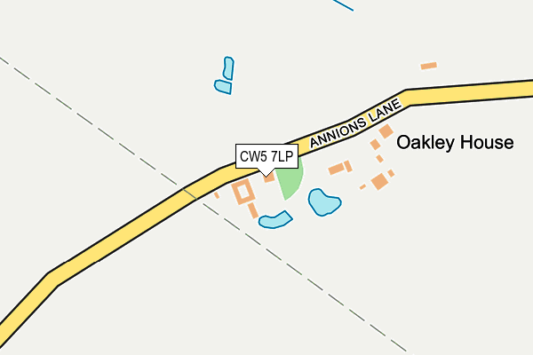
CW5 7LP lies on Annions Lane in Wybunbury, Nantwich. CW5 7LP is located in the Wybunbury electoral ward, within the unitary authority of Cheshire East and the English Parliamentary constituency of Crewe and Nantwich. The Sub Integrated Care Board (ICB) Location is NHS Cheshire and Merseyside ICB - 27D and the police force is Cheshire. This postcode has been in use since June 1981.


GetTheData
Source: OS OpenMap – Local (Ordnance Survey)
Source: OS VectorMap District (Ordnance Survey)
Licence: Open Government Licence (requires attribution)
| Easting | 368610 |
| Northing | 350094 |
| Latitude | 53.047181 |
| Longitude | -2.469686 |
GetTheData
Source: Open Postcode Geo
Licence: Open Government Licence
| Street | Annions Lane |
| Locality | Wybunbury |
| Town/City | Nantwich |
| Country | England |
| Postcode District | CW5 |
➜ See where CW5 is on a map | |
GetTheData
Source: Land Registry Price Paid Data
Licence: Open Government Licence
Elevation or altitude of CW5 7LP as distance above sea level:
| Metres | Feet | |
|---|---|---|
| Elevation | 60m | 197ft |
Elevation is measured from the approximate centre of the postcode, to the nearest point on an OS contour line from OS Terrain 50, which has contour spacing of ten vertical metres.
➜ How high above sea level am I? Find the elevation of your current position using your device's GPS.
GetTheData
Source: Open Postcode Elevation
Licence: Open Government Licence
| Ward | Wybunbury |
| Constituency | Crewe And Nantwich |
GetTheData
Source: ONS Postcode Database
Licence: Open Government Licence
| Gorsey Bank Crescent (Main Road) | Wybunbury | 749m |
| Gorsey Bank Crescent (Main Road) | Wybunbury | 785m |
| Second Dig Lane (London Road) | Stapeley | 896m |
| Haymoor Green Road (Wybunbury Lane) | Haymoor Green | 899m |
| Second Dig Lane (London Road) | Stapeley | 926m |
| Nantwich Station | 3.8km |
| Crewe Station | 5.3km |
GetTheData
Source: NaPTAN
Licence: Open Government Licence
| Percentage of properties with Next Generation Access | 100.0% |
| Percentage of properties with Superfast Broadband | 75.0% |
| Percentage of properties with Ultrafast Broadband | 0.0% |
| Percentage of properties with Full Fibre Broadband | 0.0% |
Superfast Broadband is between 30Mbps and 300Mbps
Ultrafast Broadband is > 300Mbps
| Percentage of properties unable to receive 2Mbps | 0.0% |
| Percentage of properties unable to receive 5Mbps | 0.0% |
| Percentage of properties unable to receive 10Mbps | 25.0% |
| Percentage of properties unable to receive 30Mbps | 25.0% |
GetTheData
Source: Ofcom
Licence: Ofcom Terms of Use (requires attribution)
GetTheData
Source: ONS Postcode Database
Licence: Open Government Licence


➜ Get more ratings from the Food Standards Agency
GetTheData
Source: Food Standards Agency
Licence: FSA terms & conditions
| Last Collection | |||
|---|---|---|---|
| Location | Mon-Fri | Sat | Distance |
| Pinfold Corner | 16:30 | 08:15 | 484m |
| Howbeck | 16:15 | 08:30 | 883m |
| Haymoor Green | 16:00 | 08:30 | 925m |
GetTheData
Source: Dracos
Licence: Creative Commons Attribution-ShareAlike
The below table lists the International Territorial Level (ITL) codes (formerly Nomenclature of Territorial Units for Statistics (NUTS) codes) and Local Administrative Units (LAU) codes for CW5 7LP:
| ITL 1 Code | Name |
|---|---|
| TLD | North West (England) |
| ITL 2 Code | Name |
| TLD6 | Cheshire |
| ITL 3 Code | Name |
| TLD62 | Cheshire East |
| LAU 1 Code | Name |
| E06000049 | Cheshire East |
GetTheData
Source: ONS Postcode Directory
Licence: Open Government Licence
The below table lists the Census Output Area (OA), Lower Layer Super Output Area (LSOA), and Middle Layer Super Output Area (MSOA) for CW5 7LP:
| Code | Name | |
|---|---|---|
| OA | E00093441 | |
| LSOA | E01033378 | Cheshire East 049H |
| MSOA | E02003837 | Cheshire East 049 |
GetTheData
Source: ONS Postcode Directory
Licence: Open Government Licence
| CW5 7HD | Wybunbury Lane | 464m |
| CW5 7LR | Main Road | 489m |
| CW5 7NL | Chads Green | 536m |
| CW5 7NY | Riddings Lane | 609m |
| CW5 7NX | Howbeck Crescent | 664m |
| CW5 7LT | Valebrook Drive | 671m |
| CW5 7JU | London Road | 710m |
| CW5 7LU | St Chads Close | 718m |
| CW5 7HF | Stock Lane | 720m |
| CW5 7SF | Glebe Close | 772m |
GetTheData
Source: Open Postcode Geo; Land Registry Price Paid Data
Licence: Open Government Licence