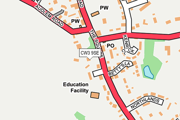
CW3 9SE is located in the Market Drayton East electoral ward, within the unitary authority of Shropshire and the English Parliamentary constituency of North Shropshire. The Sub Integrated Care Board (ICB) Location is NHS Shropshire, Telford and Wrekin ICB - M2L0M and the police force is West Mercia. This postcode has been in use since January 1980.


GetTheData
Source: OS OpenMap – Local (Ordnance Survey)
Source: OS VectorMap District (Ordnance Survey)
Licence: Open Government Licence (requires attribution)
| Easting | 373058 |
| Northing | 342250 |
| Latitude | 52.976932 |
| Longitude | -2.402681 |
GetTheData
Source: Open Postcode Geo
Licence: Open Government Licence
| Country | England |
| Postcode District | CW3 |
➜ See where CW3 is on a map ➜ Where is Woore? | |
GetTheData
Source: Land Registry Price Paid Data
Licence: Open Government Licence
Elevation or altitude of CW3 9SE as distance above sea level:
| Metres | Feet | |
|---|---|---|
| Elevation | 140m | 459ft |
Elevation is measured from the approximate centre of the postcode, to the nearest point on an OS contour line from OS Terrain 50, which has contour spacing of ten vertical metres.
➜ How high above sea level am I? Find the elevation of your current position using your device's GPS.
GetTheData
Source: Open Postcode Elevation
Licence: Open Government Licence
| Ward | Market Drayton East |
| Constituency | North Shropshire |
GetTheData
Source: ONS Postcode Database
Licence: Open Government Licence
| The Square (Nantwich Road) | Woore | 19m |
| The Square (Nantwich Road) | Woore | 25m |
| Leonards Way Jct (A525) | Woore | 147m |
| Leonards Way Jct (A525) | Woore | 157m |
| Crossroads (A51) | Ireland's Cross | 961m |
GetTheData
Source: NaPTAN
Licence: Open Government Licence
GetTheData
Source: ONS Postcode Database
Licence: Open Government Licence


➜ Get more ratings from the Food Standards Agency
GetTheData
Source: Food Standards Agency
Licence: FSA terms & conditions
| Last Collection | |||
|---|---|---|---|
| Location | Mon-Fri | Sat | Distance |
| Gravenhunger | 16:30 | 09:00 | 651m |
| Bridgemere Lane | 16:15 | 08:30 | 3,655m |
| Bellaport Road | 10:30 | 10:30 | 4,471m |
GetTheData
Source: Dracos
Licence: Creative Commons Attribution-ShareAlike
The below table lists the International Territorial Level (ITL) codes (formerly Nomenclature of Territorial Units for Statistics (NUTS) codes) and Local Administrative Units (LAU) codes for CW3 9SE:
| ITL 1 Code | Name |
|---|---|
| TLG | West Midlands (England) |
| ITL 2 Code | Name |
| TLG2 | Shropshire and Staffordshire |
| ITL 3 Code | Name |
| TLG22 | Shropshire |
| LAU 1 Code | Name |
| E06000051 | Shropshire |
GetTheData
Source: ONS Postcode Directory
Licence: Open Government Licence
The below table lists the Census Output Area (OA), Lower Layer Super Output Area (LSOA), and Middle Layer Super Output Area (MSOA) for CW3 9SE:
| Code | Name | |
|---|---|---|
| OA | E00147173 | |
| LSOA | E01028899 | Shropshire 002E |
| MSOA | E02006016 | Shropshire 002 |
GetTheData
Source: ONS Postcode Directory
Licence: Open Government Licence
| CW3 9SD | The Square | 49m |
| CW3 9QY | The Boundary | 79m |
| CW3 9SJ | Churchfields | 107m |
| CW3 9SA | Nantwich Road | 129m |
| CW3 9SL | Kenrick Close | 136m |
| CW3 9RZ | Swan Farm Lane | 165m |
| CW3 9SQ | London Road | 177m |
| CW3 9SB | Nantwich Road | 208m |
| CW3 9SF | London Road | 210m |
| CW3 9SY | Westfields Rise | 234m |
GetTheData
Source: Open Postcode Geo; Land Registry Price Paid Data
Licence: Open Government Licence