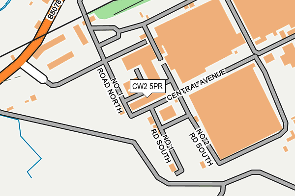
CW2 5PR is located in the Haslington electoral ward, within the unitary authority of Cheshire East and the English Parliamentary constituency of Crewe and Nantwich. The Sub Integrated Care Board (ICB) Location is NHS Cheshire and Merseyside ICB - 27D and the police force is Cheshire. This postcode has been in use since August 1992.


GetTheData
Source: OS OpenMap – Local (Ordnance Survey)
Source: OS VectorMap District (Ordnance Survey)
Licence: Open Government Licence (requires attribution)
| Easting | 378019 |
| Northing | 354150 |
| Latitude | 53.084128 |
| Longitude | -2.329616 |
GetTheData
Source: Open Postcode Geo
Licence: Open Government Licence
| Country | England |
| Postcode District | CW2 |
➜ See where CW2 is on a map ➜ Where is Radway Green? | |
GetTheData
Source: Land Registry Price Paid Data
Licence: Open Government Licence
Elevation or altitude of CW2 5PR as distance above sea level:
| Metres | Feet | |
|---|---|---|
| Elevation | 80m | 262ft |
Elevation is measured from the approximate centre of the postcode, to the nearest point on an OS contour line from OS Terrain 50, which has contour spacing of ten vertical metres.
➜ How high above sea level am I? Find the elevation of your current position using your device's GPS.
GetTheData
Source: Open Postcode Elevation
Licence: Open Government Licence
| Ward | Haslington |
| Constituency | Crewe And Nantwich |
GetTheData
Source: ONS Postcode Database
Licence: Open Government Licence
| Holly House Hotel (Crewe Road) | Radway Green | 517m |
| Holly House Hotel (Crewe Road) | Radway Green | 559m |
| White Moss (Butterton Lane) | Radway Green | 645m |
| White Moss (Butterton Lane) | Radway Green | 659m |
| Close Lane (Crewe Road) | Radway Green | 703m |
| Alsager Station | 2.3km |
GetTheData
Source: NaPTAN
Licence: Open Government Licence
| Median download speed | 32.8Mbps |
| Average download speed | 36.0Mbps |
| Maximum download speed | 58.54Mbps |
| Median upload speed | 7.8Mbps |
| Average upload speed | 10.2Mbps |
| Maximum upload speed | 20.00Mbps |
GetTheData
Source: Ofcom
Licence: Ofcom Terms of Use (requires attribution)
GetTheData
Source: ONS Postcode Database
Licence: Open Government Licence


➜ Get more ratings from the Food Standards Agency
GetTheData
Source: Food Standards Agency
Licence: FSA terms & conditions
| Last Collection | |||
|---|---|---|---|
| Location | Mon-Fri | Sat | Distance |
| Crewe Road | 16:30 | 10:30 | 1,810m |
| The Pet Shop | 17:15 | 10:30 | 1,894m |
| Alsager Post Office | 17:30 | 11:30 | 2,554m |
GetTheData
Source: Dracos
Licence: Creative Commons Attribution-ShareAlike
The below table lists the International Territorial Level (ITL) codes (formerly Nomenclature of Territorial Units for Statistics (NUTS) codes) and Local Administrative Units (LAU) codes for CW2 5PR:
| ITL 1 Code | Name |
|---|---|
| TLD | North West (England) |
| ITL 2 Code | Name |
| TLD6 | Cheshire |
| ITL 3 Code | Name |
| TLD62 | Cheshire East |
| LAU 1 Code | Name |
| E06000049 | Cheshire East |
GetTheData
Source: ONS Postcode Directory
Licence: Open Government Licence
The below table lists the Census Output Area (OA), Lower Layer Super Output Area (LSOA), and Middle Layer Super Output Area (MSOA) for CW2 5PR:
| Code | Name | |
|---|---|---|
| OA | E00093173 | |
| LSOA | E01018465 | Cheshire East 041A |
| MSOA | E02003831 | Cheshire East 041 |
GetTheData
Source: ONS Postcode Directory
Licence: Open Government Licence
| CW1 5UJ | Radway Green Road | 467m |
| ST7 2JL | Crewe Road | 621m |
| CW2 5PQ | 746m | |
| ST7 2JP | Close Lane | 775m |
| ST7 2JR | Close Lane | 812m |
| ST7 2JJ | Crewe Road | 883m |
| ST7 2JT | Close Lane | 887m |
| ST7 2JS | Close Lane | 895m |
| ST7 2JY | Plough Croft | 915m |
| ST7 2UB | Crewe Road | 985m |
GetTheData
Source: Open Postcode Geo; Land Registry Price Paid Data
Licence: Open Government Licence