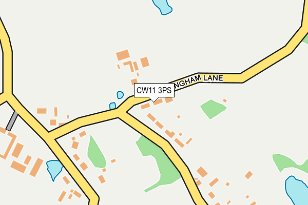
CW11 3PS lies on Warmingham Lane in Moston, Sandbach. CW11 3PS is located in the Brereton Rural electoral ward, within the unitary authority of Cheshire East and the English Parliamentary constituency of Congleton. The Sub Integrated Care Board (ICB) Location is NHS Cheshire and Merseyside ICB - 27D and the police force is Cheshire. This postcode has been in use since December 1995.


GetTheData
Source: OS OpenMap – Local (Ordnance Survey)
Source: OS VectorMap District (Ordnance Survey)
Licence: Open Government Licence (requires attribution)
| Easting | 372729 |
| Northing | 361845 |
| Latitude | 53.153035 |
| Longitude | -2.409248 |
GetTheData
Source: Open Postcode Geo
Licence: Open Government Licence
| Street | Warmingham Lane |
| Locality | Moston |
| Town/City | Sandbach |
| Country | England |
| Postcode District | CW11 |
➜ See where CW11 is on a map ➜ Where is Moston? | |
GetTheData
Source: Land Registry Price Paid Data
Licence: Open Government Licence
Elevation or altitude of CW11 3PS as distance above sea level:
| Metres | Feet | |
|---|---|---|
| Elevation | 50m | 164ft |
Elevation is measured from the approximate centre of the postcode, to the nearest point on an OS contour line from OS Terrain 50, which has contour spacing of ten vertical metres.
➜ How high above sea level am I? Find the elevation of your current position using your device's GPS.
GetTheData
Source: Open Postcode Elevation
Licence: Open Government Licence
| Ward | Brereton Rural |
| Constituency | Congleton |
GetTheData
Source: ONS Postcode Database
Licence: Open Government Licence
| Dragon's Lane (London Road) | Stud Green | 762m |
| Dragon's Lane (London Road) | Stud Green | 773m |
| Mill Lane (London Road) | Elworth | 829m |
| Mill Lane (London Road) | Elworth | 840m |
| Hays Chemical Works (London Road) | Stud Green | 1,100m |
| Sandbach Station | 1.1km |
GetTheData
Source: NaPTAN
Licence: Open Government Licence
| Percentage of properties with Next Generation Access | 100.0% |
| Percentage of properties with Superfast Broadband | 0.0% |
| Percentage of properties with Ultrafast Broadband | 0.0% |
| Percentage of properties with Full Fibre Broadband | 0.0% |
Superfast Broadband is between 30Mbps and 300Mbps
Ultrafast Broadband is > 300Mbps
| Percentage of properties unable to receive 2Mbps | 0.0% |
| Percentage of properties unable to receive 5Mbps | 0.0% |
| Percentage of properties unable to receive 10Mbps | 0.0% |
| Percentage of properties unable to receive 30Mbps | 100.0% |
GetTheData
Source: Ofcom
Licence: Ofcom Terms of Use (requires attribution)
GetTheData
Source: ONS Postcode Database
Licence: Open Government Licence


➜ Get more ratings from the Food Standards Agency
GetTheData
Source: Food Standards Agency
Licence: FSA terms & conditions
| Last Collection | |||
|---|---|---|---|
| Location | Mon-Fri | Sat | Distance |
| Moston | 16:00 | 08:30 | 56m |
| Watch Lane | 16:00 | 08:00 | 880m |
| Elworth So | 17:00 | 11:00 | 1,148m |
GetTheData
Source: Dracos
Licence: Creative Commons Attribution-ShareAlike
The below table lists the International Territorial Level (ITL) codes (formerly Nomenclature of Territorial Units for Statistics (NUTS) codes) and Local Administrative Units (LAU) codes for CW11 3PS:
| ITL 1 Code | Name |
|---|---|
| TLD | North West (England) |
| ITL 2 Code | Name |
| TLD6 | Cheshire |
| ITL 3 Code | Name |
| TLD62 | Cheshire East |
| LAU 1 Code | Name |
| E06000049 | Cheshire East |
GetTheData
Source: ONS Postcode Directory
Licence: Open Government Licence
The below table lists the Census Output Area (OA), Lower Layer Super Output Area (LSOA), and Middle Layer Super Output Area (MSOA) for CW11 3PS:
| Code | Name | |
|---|---|---|
| OA | E00092812 | |
| LSOA | E01018394 | Cheshire East 033A |
| MSOA | E02003822 | Cheshire East 033 |
GetTheData
Source: ONS Postcode Directory
Licence: Open Government Licence
| CW11 3PB | Warmingham Lane | 155m |
| CW11 3QD | Plant Lane | 231m |
| CW11 3PR | Oakwood Lane | 261m |
| CW11 3QB | Dragons Lane | 440m |
| CW11 3PT | Mill Lane | 462m |
| CW11 3PQ | Plant Lane | 491m |
| CW11 3PU | Booth Lane | 694m |
| CW11 3PA | Dragons Wharf | 737m |
| CW11 3PH | Plant Lane | 839m |
| CW11 3PG | Plant Lane | 862m |
GetTheData
Source: Open Postcode Geo; Land Registry Price Paid Data
Licence: Open Government Licence