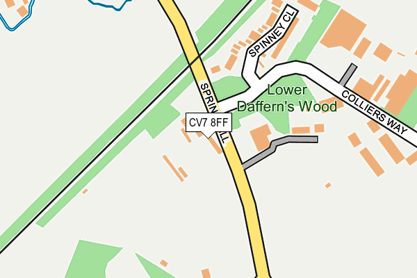
CV7 8FF lies on Spring Hill in Arley, Coventry. CV7 8FF is located in the Arley and Whitacre electoral ward, within the local authority district of North Warwickshire and the English Parliamentary constituency of Nuneaton. The Sub Integrated Care Board (ICB) Location is NHS Coventry and Warwickshire ICB - B2M3M and the police force is Warwickshire. This postcode has been in use since January 1980.


GetTheData
Source: OS OpenMap – Local (Ordnance Survey)
Source: OS VectorMap District (Ordnance Survey)
Licence: Open Government Licence (requires attribution)
| Easting | 428353 |
| Northing | 289757 |
| Latitude | 52.504978 |
| Longitude | -1.583720 |
GetTheData
Source: Open Postcode Geo
Licence: Open Government Licence
| Street | Spring Hill |
| Locality | Arley |
| Town/City | Coventry |
| Country | England |
| Postcode District | CV7 |
➜ See where CV7 is on a map ➜ Where is New Arley? | |
GetTheData
Source: Land Registry Price Paid Data
Licence: Open Government Licence
Elevation or altitude of CV7 8FF as distance above sea level:
| Metres | Feet | |
|---|---|---|
| Elevation | 120m | 394ft |
Elevation is measured from the approximate centre of the postcode, to the nearest point on an OS contour line from OS Terrain 50, which has contour spacing of ten vertical metres.
➜ How high above sea level am I? Find the elevation of your current position using your device's GPS.
GetTheData
Source: Open Postcode Elevation
Licence: Open Government Licence
| Ward | Arley And Whitacre |
| Constituency | Nuneaton |
GetTheData
Source: ONS Postcode Database
Licence: Open Government Licence
| Colliers Way (Spring Hill) | New Arley | 16m |
| Colliers Way (Spring Hill) | New Arley | 52m |
| Stonehouse Lane (Spring Hill) | New Arley | 239m |
| Stonehouse Lane (Spring Hill) | New Arley | 247m |
| Rectory Road (Spring Hill) | Old Arley | 334m |
GetTheData
Source: NaPTAN
Licence: Open Government Licence
| Percentage of properties with Next Generation Access | 100.0% |
| Percentage of properties with Superfast Broadband | 100.0% |
| Percentage of properties with Ultrafast Broadband | 0.0% |
| Percentage of properties with Full Fibre Broadband | 0.0% |
Superfast Broadband is between 30Mbps and 300Mbps
Ultrafast Broadband is > 300Mbps
| Percentage of properties unable to receive 2Mbps | 0.0% |
| Percentage of properties unable to receive 5Mbps | 0.0% |
| Percentage of properties unable to receive 10Mbps | 0.0% |
| Percentage of properties unable to receive 30Mbps | 0.0% |
GetTheData
Source: Ofcom
Licence: Ofcom Terms of Use (requires attribution)
GetTheData
Source: ONS Postcode Database
Licence: Open Government Licence


➜ Get more ratings from the Food Standards Agency
GetTheData
Source: Food Standards Agency
Licence: FSA terms & conditions
| Last Collection | |||
|---|---|---|---|
| Location | Mon-Fri | Sat | Distance |
| Bungalow Corner | 16:45 | 10:15 | 380m |
| Ansley Lane | 16:45 | 10:15 | 1,051m |
| Berryfield | 15:30 | 10:45 | 2,214m |
GetTheData
Source: Dracos
Licence: Creative Commons Attribution-ShareAlike
The below table lists the International Territorial Level (ITL) codes (formerly Nomenclature of Territorial Units for Statistics (NUTS) codes) and Local Administrative Units (LAU) codes for CV7 8FF:
| ITL 1 Code | Name |
|---|---|
| TLG | West Midlands (England) |
| ITL 2 Code | Name |
| TLG1 | Herefordshire, Worcestershire and Warwickshire |
| ITL 3 Code | Name |
| TLG13 | Warwickshire CC |
| LAU 1 Code | Name |
| E07000218 | North Warwickshire |
GetTheData
Source: ONS Postcode Directory
Licence: Open Government Licence
The below table lists the Census Output Area (OA), Lower Layer Super Output Area (LSOA), and Middle Layer Super Output Area (MSOA) for CV7 8FF:
| Code | Name | |
|---|---|---|
| OA | E00158060 | |
| LSOA | E01031007 | North Warwickshire 007B |
| MSOA | E02006474 | North Warwickshire 007 |
GetTheData
Source: ONS Postcode Directory
Licence: Open Government Licence
| CV7 8PD | Spinney Close | 173m |
| CV7 8GB | Stonehouse Lane | 254m |
| CV7 8HN | Colliers Way | 318m |
| CV7 8NY | Willow Walk | 454m |
| CV7 8NZ | Bournebrook View | 464m |
| CV7 8FG | Station Road | 466m |
| CV7 8PZ | Phil Collins Way | 542m |
| CV7 8PS | Tremelling Way | 594m |
| CV7 8PR | Morgan Close | 630m |
| CV7 8GS | Ryder Row | 633m |
GetTheData
Source: Open Postcode Geo; Land Registry Price Paid Data
Licence: Open Government Licence