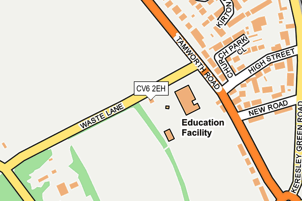
CV6 2EH is located in the Bablake electoral ward, within the metropolitan district of Coventry and the English Parliamentary constituency of Coventry North West. The Sub Integrated Care Board (ICB) Location is NHS Coventry and Warwickshire ICB - B2M3M and the police force is West Midlands. This postcode has been in use since January 1980.


GetTheData
Source: OS OpenMap – Local (Ordnance Survey)
Source: OS VectorMap District (Ordnance Survey)
Licence: Open Government Licence (requires attribution)
| Easting | 431662 |
| Northing | 282283 |
| Latitude | 52.437624 |
| Longitude | -1.535669 |
GetTheData
Source: Open Postcode Geo
Licence: Open Government Licence
| Country | England |
| Postcode District | CV6 |
➜ See where CV6 is on a map ➜ Where is Coventry? | |
GetTheData
Source: Land Registry Price Paid Data
Licence: Open Government Licence
Elevation or altitude of CV6 2EH as distance above sea level:
| Metres | Feet | |
|---|---|---|
| Elevation | 120m | 394ft |
Elevation is measured from the approximate centre of the postcode, to the nearest point on an OS contour line from OS Terrain 50, which has contour spacing of ten vertical metres.
➜ How high above sea level am I? Find the elevation of your current position using your device's GPS.
GetTheData
Source: Open Postcode Elevation
Licence: Open Government Licence
| Ward | Bablake |
| Constituency | Coventry North West |
GetTheData
Source: ONS Postcode Database
Licence: Open Government Licence
| Keresley Church (Tamworth Rd) | Brownshill Green | 134m |
| Keresley Church (Tamworth Rd) | Brownshill Green | 212m |
| New Rd (Keresley Green Rd) | Whitmore Park | 291m |
| New Rd (Keresley Green Rd) | Whitmore Park | 301m |
| Waste Lane (Brownshill Green Rd) | Brownshill Green | 329m |
| Coventry Arena Station | 3km |
| Canley Station | 4.3km |
| Coventry Station | 4.4km |
GetTheData
Source: NaPTAN
Licence: Open Government Licence
GetTheData
Source: ONS Postcode Database
Licence: Open Government Licence


➜ Get more ratings from the Food Standards Agency
GetTheData
Source: Food Standards Agency
Licence: FSA terms & conditions
| Last Collection | |||
|---|---|---|---|
| Location | Mon-Fri | Sat | Distance |
| Keresley Post Office | 18:15 | 12:00 | 472m |
| Sadler Road | 18:15 | 10:00 | 1,246m |
| Burnaby Road | 19:00 | 11:15 | 1,384m |
GetTheData
Source: Dracos
Licence: Creative Commons Attribution-ShareAlike
The below table lists the International Territorial Level (ITL) codes (formerly Nomenclature of Territorial Units for Statistics (NUTS) codes) and Local Administrative Units (LAU) codes for CV6 2EH:
| ITL 1 Code | Name |
|---|---|
| TLG | West Midlands (England) |
| ITL 2 Code | Name |
| TLG3 | West Midlands |
| ITL 3 Code | Name |
| TLG33 | Coventry |
| LAU 1 Code | Name |
| E08000026 | Coventry |
GetTheData
Source: ONS Postcode Directory
Licence: Open Government Licence
The below table lists the Census Output Area (OA), Lower Layer Super Output Area (LSOA), and Middle Layer Super Output Area (MSOA) for CV6 2EH:
| Code | Name | |
|---|---|---|
| OA | E00048220 | |
| LSOA | E01009526 | Coventry 010B |
| MSOA | E02001967 | Coventry 010 |
GetTheData
Source: ONS Postcode Directory
Licence: Open Government Licence
| CV6 2EJ | Tamworth Road | 132m |
| CV6 2EL | Tamworth Road | 159m |
| CV6 2EQ | Church Park Close | 176m |
| CV6 2PG | Kirton Close | 217m |
| CV6 2EP | New Road | 221m |
| CV6 2EN | High Street | 234m |
| CV6 2JH | Tamworth Road | 262m |
| CV6 2PD | Wickham Close | 267m |
| CV6 2FL | Bennetts Road South | 315m |
| CV6 2FG | Keresley Green Road | 332m |
GetTheData
Source: Open Postcode Geo; Land Registry Price Paid Data
Licence: Open Government Licence