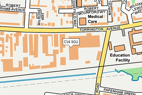
CV4 9GU is located in the Westwood electoral ward, within the metropolitan district of Coventry and the English Parliamentary constituency of Coventry South. The Sub Integrated Care Board (ICB) Location is NHS Coventry and Warwickshire ICB - B2M3M and the police force is West Midlands. This postcode has been in use since January 1980.


GetTheData
Source: OS OpenMap – Local (Ordnance Survey)
Source: OS VectorMap District (Ordnance Survey)
Licence: Open Government Licence (requires attribution)
| Easting | 428859 |
| Northing | 277772 |
| Latitude | 52.397226 |
| Longitude | -1.577288 |
GetTheData
Source: Open Postcode Geo
Licence: Open Government Licence
| Country | England |
| Postcode District | CV4 |
➜ See where CV4 is on a map ➜ Where is Coventry? | |
GetTheData
Source: Land Registry Price Paid Data
Licence: Open Government Licence
Elevation or altitude of CV4 9GU as distance above sea level:
| Metres | Feet | |
|---|---|---|
| Elevation | 100m | 328ft |
Elevation is measured from the approximate centre of the postcode, to the nearest point on an OS contour line from OS Terrain 50, which has contour spacing of ten vertical metres.
➜ How high above sea level am I? Find the elevation of your current position using your device's GPS.
GetTheData
Source: Open Postcode Elevation
Licence: Open Government Licence
| Ward | Westwood |
| Constituency | Coventry South |
GetTheData
Source: ONS Postcode Database
Licence: Open Government Licence
| Wolfe Rd (Torrington Ave) | Tile Hill North | 109m |
| Gravel Hill (Torrington Ave) | Tile Hill North | 137m |
| Gravel Hill (Torrington Ave) | Tile Hill North | 176m |
| Hancock Green (Wolfe Rd) | Westwood Business Park | 229m |
| Hancock Green (Wolfe Rd) | Westwood Business Park | 255m |
| Tile Hill Station | 1.4km |
| Canley Station | 2km |
| Coventry Station | 4.4km |
GetTheData
Source: NaPTAN
Licence: Open Government Licence
GetTheData
Source: ONS Postcode Database
Licence: Open Government Licence


➜ Get more ratings from the Food Standards Agency
GetTheData
Source: Food Standards Agency
Licence: FSA terms & conditions
| Last Collection | |||
|---|---|---|---|
| Location | Mon-Fri | Sat | Distance |
| Torrington Avenue | 16:30 | 09:45 | 76m |
| Jobs Lane | 17:00 | 09:45 | 744m |
| Westwood Way | 18:30 | 11:45 | 1,022m |
GetTheData
Source: Dracos
Licence: Creative Commons Attribution-ShareAlike
The below table lists the International Territorial Level (ITL) codes (formerly Nomenclature of Territorial Units for Statistics (NUTS) codes) and Local Administrative Units (LAU) codes for CV4 9GU:
| ITL 1 Code | Name |
|---|---|
| TLG | West Midlands (England) |
| ITL 2 Code | Name |
| TLG3 | West Midlands |
| ITL 3 Code | Name |
| TLG33 | Coventry |
| LAU 1 Code | Name |
| E08000026 | Coventry |
GetTheData
Source: ONS Postcode Directory
Licence: Open Government Licence
The below table lists the Census Output Area (OA), Lower Layer Super Output Area (LSOA), and Middle Layer Super Output Area (MSOA) for CV4 9GU:
| Code | Name | |
|---|---|---|
| OA | E00048989 | |
| LSOA | E01032531 | Coventry 036E |
| MSOA | E02001993 | Coventry 036 |
GetTheData
Source: ONS Postcode Directory
Licence: Open Government Licence
| CV4 9UP | Wolfe Road | 88m |
| CV4 9HG | Torrington Avenue | 129m |
| CV4 9HD | Meadowcroft Close | 184m |
| CV4 8BT | Hancock Green | 205m |
| CV4 9HF | Hedgefield Way | 219m |
| CV4 9JF | Gravel Hill | 231m |
| CV4 9JH | Gravel Hill | 262m |
| CV4 8DG | Whitchurch Way | 297m |
| CV4 8BS | Founder Close | 318m |
| CV4 9JD | Gravel Hill | 322m |
GetTheData
Source: Open Postcode Geo; Land Registry Price Paid Data
Licence: Open Government Licence