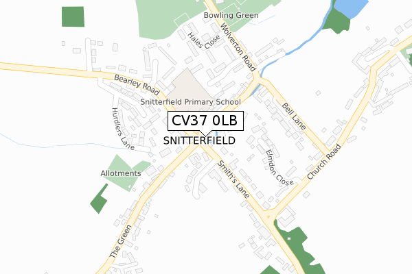
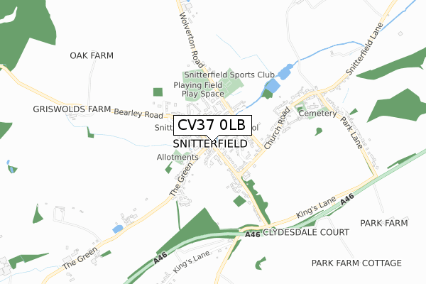
CV37 0LB is located in the Claverdon & Snitterfield electoral ward, within the local authority district of Stratford-on-Avon and the English Parliamentary constituency of Stratford-on-Avon. The Sub Integrated Care Board (ICB) Location is NHS Coventry and Warwickshire ICB - B2M3M and the police force is Warwickshire. This postcode has been in use since November 2017.


GetTheData
Source: OS Open Zoomstack (Ordnance Survey)
Licence: Open Government Licence (requires attribution)
Attribution: Contains OS data © Crown copyright and database right 2024
Source: Open Postcode Geo
Licence: Open Government Licence (requires attribution)
Attribution: Contains OS data © Crown copyright and database right 2024; Contains Royal Mail data © Royal Mail copyright and database right 2024; Source: Office for National Statistics licensed under the Open Government Licence v.3.0
| Easting | 421339 |
| Northing | 259873 |
| Latitude | 52.236654 |
| Longitude | -1.688934 |
GetTheData
Source: Open Postcode Geo
Licence: Open Government Licence
| Country | England |
| Postcode District | CV37 |
| ➜ CV37 open data dashboard ➜ See where CV37 is on a map ➜ Where is Snitterfield? | |
GetTheData
Source: Land Registry Price Paid Data
Licence: Open Government Licence
| Ward | Claverdon & Snitterfield |
| Constituency | Stratford-on-avon |
GetTheData
Source: ONS Postcode Database
Licence: Open Government Licence
| October 2023 | Public order | On or near Hales Close | 233m |
| July 2023 | Anti-social behaviour | On or near Hales Close | 233m |
| April 2023 | Vehicle crime | On or near Hales Close | 233m |
| ➜ Get more crime data in our Crime section | |||
GetTheData
Source: data.police.uk
Licence: Open Government Licence
| Bus Shelter (School Road) | Snitterfield | 16m |
| Bus Shelter (School Road) | Snitterfield | 33m |
| Church Road (White Horse Hill) | Snitterfield | 278m |
| Church Road (White Horse Hill) | Snitterfield | 279m |
| Memorial (Kings Lane) | Snitterfield | 580m |
| Bearley Station | 4.3km |
| Stratford-upon-Avon Parkway Station | 4.4km |
| Claverdon Station | 4.5km |
GetTheData
Source: NaPTAN
Licence: Open Government Licence
| Percentage of properties with Next Generation Access | 100.0% |
| Percentage of properties with Superfast Broadband | 100.0% |
| Percentage of properties with Ultrafast Broadband | 0.0% |
| Percentage of properties with Full Fibre Broadband | 0.0% |
Superfast Broadband is between 30Mbps and 300Mbps
Ultrafast Broadband is > 300Mbps
| Percentage of properties unable to receive 2Mbps | 0.0% |
| Percentage of properties unable to receive 5Mbps | 0.0% |
| Percentage of properties unable to receive 10Mbps | 0.0% |
| Percentage of properties unable to receive 30Mbps | 0.0% |
GetTheData
Source: Ofcom
Licence: Ofcom Terms of Use (requires attribution)
GetTheData
Source: ONS Postcode Database
Licence: Open Government Licence


➜ Get more ratings from the Food Standards Agency
GetTheData
Source: Food Standards Agency
Licence: FSA terms & conditions
| Last Collection | |||
|---|---|---|---|
| Location | Mon-Fri | Sat | Distance |
| Snitterfield | 16:45 | 10:00 | 93m |
| The Square | 16:45 | 08:00 | 281m |
| Snitterfield Park Lane Corner | 17:00 | 09:00 | 647m |
GetTheData
Source: Dracos
Licence: Creative Commons Attribution-ShareAlike
| Facility | Distance |
|---|---|
| Snitterfield Sports Club Wolverton Road, Snitterfield Sports Hall, Outdoor Tennis Courts, Grass Pitches | 344m |
| Large Playing Field Wolverton Road, Snitterfield Grass Pitches | 347m |
| Stratford Park Hotel & Golf Club Ingon Lane, Stratford-upon-avon Golf | 2km |
GetTheData
Source: Active Places
Licence: Open Government Licence
| School | Phase of Education | Distance |
|---|---|---|
| Snitterfield Primary School School Road, Snitterfield, Stratford-upon-Avon, CV37 0JL | Primary | 50m |
| Wolverton Primary School Wolverton Fields, Norton Lindsey, Warwick, CV35 8JN | Primary | 3.5km |
| Welcombe Hills School Blue Cap Road, Stratford-upon-Avon, CV37 6TQ | Not applicable | 3.9km |
GetTheData
Source: Edubase
Licence: Open Government Licence
| Risk of CV37 0LB flooding from rivers and sea | Medium |
| ➜ CV37 0LB flood map | |
GetTheData
Source: Open Flood Risk by Postcode
Licence: Open Government Licence
The below table lists the International Territorial Level (ITL) codes (formerly Nomenclature of Territorial Units for Statistics (NUTS) codes) and Local Administrative Units (LAU) codes for CV37 0LB:
| ITL 1 Code | Name |
|---|---|
| TLG | West Midlands (England) |
| ITL 2 Code | Name |
| TLG1 | Herefordshire, Worcestershire and Warwickshire |
| ITL 3 Code | Name |
| TLG13 | Warwickshire CC |
| LAU 1 Code | Name |
| E07000221 | Stratford-on-Avon |
GetTheData
Source: ONS Postcode Directory
Licence: Open Government Licence
The below table lists the Census Output Area (OA), Lower Layer Super Output Area (LSOA), and Middle Layer Super Output Area (MSOA) for CV37 0LB:
| Code | Name | |
|---|---|---|
| OA | E00159159 | |
| LSOA | E01031217 | Stratford-on-Avon 008A |
| MSOA | E02006511 | Stratford-on-Avon 008 |
GetTheData
Source: ONS Postcode Directory
Licence: Open Government Licence
| CV37 0JN | Bell Brook | 76m |
| CV37 0JD | The Terrace | 103m |
| CV37 0LA | Frogmore Road | 104m |
| CV37 0JL | School Road | 110m |
| CV37 0JY | Smiths Lane | 177m |
| CV37 0JF | The Green | 180m |
| CV37 0JR | Duttons Close | 181m |
| CV37 0JU | Bell Lane | 187m |
| CV37 0RT | Hurdlers Lane | 196m |
| CV37 0RP | Woodward Court | 199m |
GetTheData
Source: Open Postcode Geo; Land Registry Price Paid Data
Licence: Open Government Licence