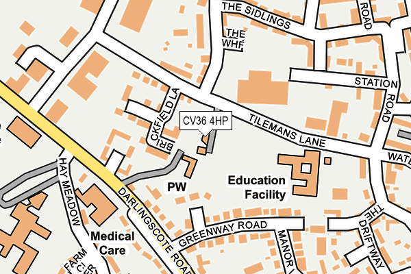
CV36 4HP is located in the Shipston North electoral ward, within the local authority district of Stratford-on-Avon and the English Parliamentary constituency of Stratford-on-Avon. The Sub Integrated Care Board (ICB) Location is NHS Coventry and Warwickshire ICB - B2M3M and the police force is Warwickshire. This postcode has been in use since January 1980.


GetTheData
Source: OS OpenMap – Local (Ordnance Survey)
Source: OS VectorMap District (Ordnance Survey)
Licence: Open Government Licence (requires attribution)
| Easting | 425494 |
| Northing | 240973 |
| Latitude | 52.066560 |
| Longitude | -1.629500 |
GetTheData
Source: Open Postcode Geo
Licence: Open Government Licence
| Country | England |
| Postcode District | CV36 |
➜ See where CV36 is on a map ➜ Where is Shipston-on-Stour? | |
GetTheData
Source: Land Registry Price Paid Data
Licence: Open Government Licence
Elevation or altitude of CV36 4HP as distance above sea level:
| Metres | Feet | |
|---|---|---|
| Elevation | 80m | 262ft |
Elevation is measured from the approximate centre of the postcode, to the nearest point on an OS contour line from OS Terrain 50, which has contour spacing of ten vertical metres.
➜ How high above sea level am I? Find the elevation of your current position using your device's GPS.
GetTheData
Source: Open Postcode Elevation
Licence: Open Government Licence
| Ward | Shipston North |
| Constituency | Stratford-on-avon |
GetTheData
Source: ONS Postcode Database
Licence: Open Government Licence
| Beecham Road (Tilemans Lane) | Shipston On Stour | 145m |
| Beecham Road (Tilemans Lane) | Shipston On Stour | 152m |
| Warwick Place (Darlingscote Road) | Shipston On Stour | 238m |
| Shipston High School (Private Road) | Shipston On Stour | 270m |
| Pound Close (The Driftway) | Shipston On Stour | 342m |
GetTheData
Source: NaPTAN
Licence: Open Government Licence
GetTheData
Source: ONS Postcode Database
Licence: Open Government Licence


➜ Get more ratings from the Food Standards Agency
GetTheData
Source: Food Standards Agency
Licence: FSA terms & conditions
| Last Collection | |||
|---|---|---|---|
| Location | Mon-Fri | Sat | Distance |
| Warwick Place | 17:00 | 11:30 | 235m |
| Stratford Road | 17:00 | 11:30 | 435m |
| Shipston On Stour Post Office | 17:30 | 12:15 | 512m |
GetTheData
Source: Dracos
Licence: Creative Commons Attribution-ShareAlike
The below table lists the International Territorial Level (ITL) codes (formerly Nomenclature of Territorial Units for Statistics (NUTS) codes) and Local Administrative Units (LAU) codes for CV36 4HP:
| ITL 1 Code | Name |
|---|---|
| TLG | West Midlands (England) |
| ITL 2 Code | Name |
| TLG1 | Herefordshire, Worcestershire and Warwickshire |
| ITL 3 Code | Name |
| TLG13 | Warwickshire CC |
| LAU 1 Code | Name |
| E07000221 | Stratford-on-Avon |
GetTheData
Source: ONS Postcode Directory
Licence: Open Government Licence
The below table lists the Census Output Area (OA), Lower Layer Super Output Area (LSOA), and Middle Layer Super Output Area (MSOA) for CV36 4HP:
| Code | Name | |
|---|---|---|
| OA | E00159141 | |
| LSOA | E01031215 | Stratford-on-Avon 015D |
| MSOA | E02006518 | Stratford-on-Avon 015 |
GetTheData
Source: ONS Postcode Directory
Licence: Open Government Licence
| CV36 4EB | Greenway Close | 70m |
| CV36 4RR | Brickhill Close | 106m |
| CV36 4EA | Greenway Road | 106m |
| CV36 4NB | Tilemans Lane | 108m |
| CV36 4RF | The Wharf | 173m |
| CV36 4DX | Worcester Place | 175m |
| CV36 4RB | Darnley Close | 176m |
| CV36 4RA | The Sidings | 203m |
| CV36 4JD | Oxway Close | 203m |
| CV36 4QJ | Husbandmans Close | 209m |
GetTheData
Source: Open Postcode Geo; Land Registry Price Paid Data
Licence: Open Government Licence