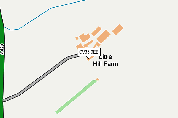
CV35 9EB is located in the Wellesbourne North & Rural electoral ward, within the local authority district of Stratford-on-Avon and the English Parliamentary constituency of Stratford-on-Avon. The Sub Integrated Care Board (ICB) Location is NHS Coventry and Warwickshire ICB - B2M3M and the police force is Warwickshire. This postcode has been in use since January 1980.


GetTheData
Source: OS OpenMap – Local (Ordnance Survey)
Source: OS VectorMap District (Ordnance Survey)
Licence: Open Government Licence (requires attribution)
| Easting | 427817 |
| Northing | 256686 |
| Latitude | 52.207714 |
| Longitude | -1.594334 |
GetTheData
Source: Open Postcode Geo
Licence: Open Government Licence
| Country | England |
| Postcode District | CV35 |
➜ See where CV35 is on a map | |
GetTheData
Source: Land Registry Price Paid Data
Licence: Open Government Licence
Elevation or altitude of CV35 9EB as distance above sea level:
| Metres | Feet | |
|---|---|---|
| Elevation | 50m | 164ft |
Elevation is measured from the approximate centre of the postcode, to the nearest point on an OS contour line from OS Terrain 50, which has contour spacing of ten vertical metres.
➜ How high above sea level am I? Find the elevation of your current position using your device's GPS.
GetTheData
Source: Open Postcode Elevation
Licence: Open Government Licence
| Ward | Wellesbourne North & Rural |
| Constituency | Stratford-on-avon |
GetTheData
Source: ONS Postcode Database
Licence: Open Government Licence
| Horticultural Research International (Wellesbourne Road) | Wellesbourne | 536m |
| Lawrence Mackie House (St Peters Road) | Wellesbourne | 745m |
| Willett House (St Peters Road) | Wellesbourne | 988m |
| Shell Garage (Charlecote Road) | Wellesbourne | 1,028m |
| Kings Head (Charlecote Road) | Wellesbourne | 1,048m |
GetTheData
Source: NaPTAN
Licence: Open Government Licence
GetTheData
Source: ONS Postcode Database
Licence: Open Government Licence


➜ Get more ratings from the Food Standards Agency
GetTheData
Source: Food Standards Agency
Licence: FSA terms & conditions
| Last Collection | |||
|---|---|---|---|
| Location | Mon-Fri | Sat | Distance |
| Selwyn Close | 17:15 | 09:00 | 871m |
| Newbold Road | 17:00 | 09:00 | 1,063m |
| Warwick Road | 17:15 | 09:00 | 1,085m |
GetTheData
Source: Dracos
Licence: Creative Commons Attribution-ShareAlike
The below table lists the International Territorial Level (ITL) codes (formerly Nomenclature of Territorial Units for Statistics (NUTS) codes) and Local Administrative Units (LAU) codes for CV35 9EB:
| ITL 1 Code | Name |
|---|---|
| TLG | West Midlands (England) |
| ITL 2 Code | Name |
| TLG1 | Herefordshire, Worcestershire and Warwickshire |
| ITL 3 Code | Name |
| TLG13 | Warwickshire CC |
| LAU 1 Code | Name |
| E07000221 | Stratford-on-Avon |
GetTheData
Source: ONS Postcode Directory
Licence: Open Government Licence
The below table lists the Census Output Area (OA), Lower Layer Super Output Area (LSOA), and Middle Layer Super Output Area (MSOA) for CV35 9EB:
| Code | Name | |
|---|---|---|
| OA | E00159156 | |
| LSOA | E01031218 | Stratford-on-Avon 008B |
| MSOA | E02006511 | Stratford-on-Avon 008 |
GetTheData
Source: ONS Postcode Directory
Licence: Open Government Licence
| CV35 9UE | Hopkins Way | 640m |
| CV35 9UD | Daniell Road | 720m |
| CV35 9EY | Hammond Green | 772m |
| CV35 9UF | Frost Road | 777m |
| CV35 9EA | Warwick Road | 779m |
| CV35 9EG | Fountain Gardens | 786m |
| CV35 9PS | Hastings Road | 812m |
| CV35 9UB | Warwick Road | 816m |
| CV35 9EE | Ramsay Green | 840m |
| CV35 9PP | Hastings Road | 851m |
GetTheData
Source: Open Postcode Geo; Land Registry Price Paid Data
Licence: Open Government Licence