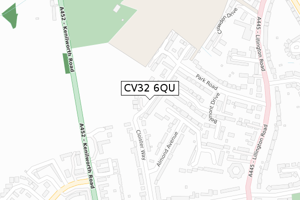
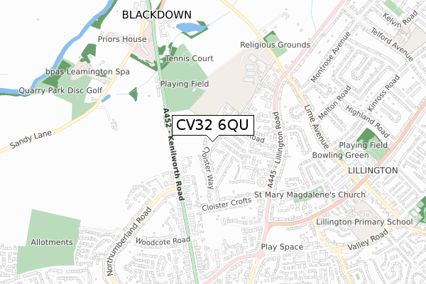
CV32 6QU is located in the Leamington Milverton electoral ward, within the local authority district of Warwick and the English Parliamentary constituency of Kenilworth and Southam. The Sub Integrated Care Board (ICB) Location is NHS Coventry and Warwickshire ICB - B2M3M and the police force is Warwickshire. This postcode has been in use since December 2019.


GetTheData
Source: OS Open Zoomstack (Ordnance Survey)
Licence: Open Government Licence (requires attribution)
Attribution: Contains OS data © Crown copyright and database right 2024
Source: Open Postcode Geo
Licence: Open Government Licence (requires attribution)
Attribution: Contains OS data © Crown copyright and database right 2024; Contains Royal Mail data © Royal Mail copyright and database right 2024; Source: Office for National Statistics licensed under the Open Government Licence v.3.0
| Easting | 431842 |
| Northing | 267646 |
| Latitude | 52.306029 |
| Longitude | -1.534405 |
GetTheData
Source: Open Postcode Geo
Licence: Open Government Licence
| Country | England |
| Postcode District | CV32 |
| ➜ CV32 open data dashboard ➜ See where CV32 is on a map ➜ Where is Royal Leamington Spa? | |
GetTheData
Source: Land Registry Price Paid Data
Licence: Open Government Licence
| Ward | Leamington Milverton |
| Constituency | Kenilworth And Southam |
GetTheData
Source: ONS Postcode Database
Licence: Open Government Licence
| November 2023 | Criminal damage and arson | On or near Crowden Drive | 377m |
| November 2023 | Violence and sexual offences | On or near Crowden Drive | 377m |
| August 2023 | Violence and sexual offences | On or near Crowden Drive | 377m |
| ➜ Get more crime data in our Crime section | |||
GetTheData
Source: data.police.uk
Licence: Open Government Licence
| Northumberland Road (Kenilworth Road) | Leamington Spa | 376m |
| Northumberland Road (Kenilworth Road) | Leamington Spa | 388m |
| Castle Froma (Lillington Road) | Lillington | 405m |
| Oak Bank House (Kenilworth Road) | Leamington Spa | 407m |
| Church Lane (Lillington Road) | Leamington Spa | 420m |
| Leamington Spa Station | 2.4km |
| Warwick Station | 3.9km |
GetTheData
Source: NaPTAN
Licence: Open Government Licence
GetTheData
Source: ONS Postcode Database
Licence: Open Government Licence


➜ Get more ratings from the Food Standards Agency
GetTheData
Source: Food Standards Agency
Licence: FSA terms & conditions
| Last Collection | |||
|---|---|---|---|
| Location | Mon-Fri | Sat | Distance |
| Northumberland Court | 16:00 | 12:00 | 372m |
| Lillington Road | 16:00 | 11:45 | 442m |
| Lime Avenue | 16:00 | 12:00 | 556m |
GetTheData
Source: Dracos
Licence: Creative Commons Attribution-ShareAlike
| Facility | Distance |
|---|---|
| The Kingsley School Playing Fields Sandy Lane, Blackdown, Leamington Spa Outdoor Tennis Courts, Grass Pitches | 394m |
| North Leamington School Sandy Lane, Blackdown, Leamington Spa Sports Hall, Artificial Grass Pitch, Health and Fitness Gym, Grass Pitches, Studio, Outdoor Tennis Courts | 520m |
| Leamington Cricket Club Arlington Avenue, Leamington Spa Grass Pitches | 625m |
GetTheData
Source: Active Places
Licence: Open Government Licence
| School | Phase of Education | Distance |
|---|---|---|
| North Leamington School Sandy Lane, Blackdown, Leamington Spa, CV32 6RD | Secondary | 507m |
| Arnold Lodge School 15-17 Kenilworth Road, Leamington Spa, CV32 5TW | Not applicable | 981m |
| Lillington Primary School Cubbington Road, Lillington, Leamington Spa, CV32 7AG | Primary | 997m |
GetTheData
Source: Edubase
Licence: Open Government Licence
The below table lists the International Territorial Level (ITL) codes (formerly Nomenclature of Territorial Units for Statistics (NUTS) codes) and Local Administrative Units (LAU) codes for CV32 6QU:
| ITL 1 Code | Name |
|---|---|
| TLG | West Midlands (England) |
| ITL 2 Code | Name |
| TLG1 | Herefordshire, Worcestershire and Warwickshire |
| ITL 3 Code | Name |
| TLG13 | Warwickshire CC |
| LAU 1 Code | Name |
| E07000222 | Warwick |
GetTheData
Source: ONS Postcode Directory
Licence: Open Government Licence
The below table lists the Census Output Area (OA), Lower Layer Super Output Area (LSOA), and Middle Layer Super Output Area (MSOA) for CV32 6QU:
| Code | Name | |
|---|---|---|
| OA | E00159496 | |
| LSOA | E01031278 | Warwick 005B |
| MSOA | E02006523 | Warwick 005 |
GetTheData
Source: ONS Postcode Directory
Licence: Open Government Licence
| CV32 6RF | Sir Frank Whittle Gardens | 92m |
| CV32 6LH | Garway Close | 128m |
| CV32 6QE | Cloister Way | 135m |
| CV32 6LG | Park Road | 152m |
| CV32 6RH | Brightsmith Way | 179m |
| CV32 6QD | Almond Avenue | 191m |
| CV32 6JX | Kenilworth Road | 204m |
| CV32 6LU | Park Road | 271m |
| CV32 6NU | Belmont Mews | 281m |
| CV32 6LT | Arbury Close | 283m |
GetTheData
Source: Open Postcode Geo; Land Registry Price Paid Data
Licence: Open Government Licence