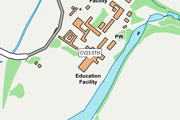
CV23 0TH is located in the Revel and Binley Woods electoral ward, within the local authority district of Rugby and the English Parliamentary constituency of Rugby. The Sub Integrated Care Board (ICB) Location is NHS Coventry and Warwickshire ICB - B2M3M and the police force is Warwickshire. This postcode has been in use since March 1988.


GetTheData
Source: OS OpenMap – Local (Ordnance Survey)
Source: OS VectorMap District (Ordnance Survey)
Licence: Open Government Licence (requires attribution)
| Easting | 445547 |
| Northing | 280822 |
| Latitude | 52.423497 |
| Longitude | -1.331642 |
GetTheData
Source: Open Postcode Geo
Licence: Open Government Licence
| Country | England |
| Postcode District | CV23 |
➜ See where CV23 is on a map ➜ Where is Stretton under Fosse? | |
GetTheData
Source: Land Registry Price Paid Data
Licence: Open Government Licence
Elevation or altitude of CV23 0TH as distance above sea level:
| Metres | Feet | |
|---|---|---|
| Elevation | 90m | 295ft |
Elevation is measured from the approximate centre of the postcode, to the nearest point on an OS contour line from OS Terrain 50, which has contour spacing of ten vertical metres.
➜ How high above sea level am I? Find the elevation of your current position using your device's GPS.
GetTheData
Source: Open Postcode Elevation
Licence: Open Government Licence
| Ward | Revel And Binley Woods |
| Constituency | Rugby |
GetTheData
Source: ONS Postcode Database
Licence: Open Government Licence
| Farriers Court (Main Street) | Stretton Under Fosse | 716m |
| Farriers Court (Main Street) | Stretton Under Fosse | 730m |
| Home Farm (Main Street) | Stretton Under Fosse | 763m |
| Wharf (Main Street) | Stretton Under Fosse | 1,384m |
| Wharf (Main Street) | Stretton Under Fosse | 1,400m |
GetTheData
Source: NaPTAN
Licence: Open Government Licence
GetTheData
Source: ONS Postcode Database
Licence: Open Government Licence


➜ Get more ratings from the Food Standards Agency
GetTheData
Source: Food Standards Agency
Licence: FSA terms & conditions
| Last Collection | |||
|---|---|---|---|
| Location | Mon-Fri | Sat | Distance |
| Stretton Under Fosse | 16:30 | 09:30 | 746m |
| Brinklow Post Office | 17:00 | 11:00 | 2,507m |
| Coventry Road | 16:45 | 11:00 | 2,825m |
GetTheData
Source: Dracos
Licence: Creative Commons Attribution-ShareAlike
The below table lists the International Territorial Level (ITL) codes (formerly Nomenclature of Territorial Units for Statistics (NUTS) codes) and Local Administrative Units (LAU) codes for CV23 0TH:
| ITL 1 Code | Name |
|---|---|
| TLG | West Midlands (England) |
| ITL 2 Code | Name |
| TLG1 | Herefordshire, Worcestershire and Warwickshire |
| ITL 3 Code | Name |
| TLG13 | Warwickshire CC |
| LAU 1 Code | Name |
| E07000220 | Rugby |
GetTheData
Source: ONS Postcode Directory
Licence: Open Government Licence
The below table lists the Census Output Area (OA), Lower Layer Super Output Area (LSOA), and Middle Layer Super Output Area (MSOA) for CV23 0TH:
| Code | Name | |
|---|---|---|
| OA | E00158829 | |
| LSOA | E01031160 | Rugby 001D |
| MSOA | E02006492 | Rugby 001 |
GetTheData
Source: ONS Postcode Directory
Licence: Open Government Licence
| CV23 0PF | Main Street | 697m |
| CV23 0PE | Main Street | 728m |
| CV23 0PN | Farriers Court | 759m |
| CV23 0JB | Farm Lane | 1282m |
| CV23 0PH | 1329m | |
| CV23 0JD | Brinklow Road | 1442m |
| CV23 0JE | Brinklow Road | 1490m |
| CV23 0QA | Coventry Road | 1507m |
| CV23 0JA | Main Street | 1507m |
| CV23 0PU | 1536m |
GetTheData
Source: Open Postcode Geo; Land Registry Price Paid Data
Licence: Open Government Licence