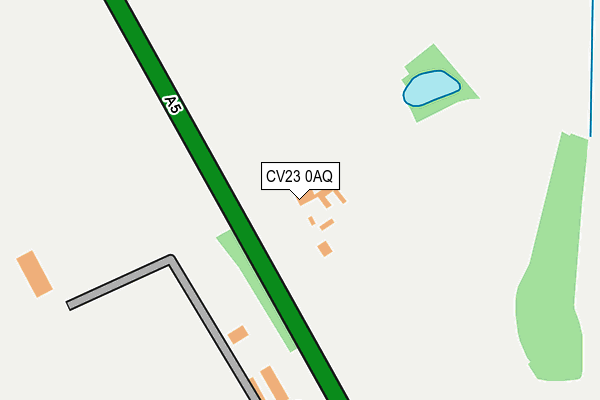
CV23 0AQ lies on Watling Street in Clifton Upon Dunsmore, Rugby. CV23 0AQ is located in the Braunston and Crick electoral ward, within the unitary authority of West Northamptonshire and the English Parliamentary constituency of Daventry. The Sub Integrated Care Board (ICB) Location is NHS Northamptonshire ICB - 78H and the police force is Northamptonshire. This postcode has been in use since January 1980.


GetTheData
Source: OS OpenMap – Local (Ordnance Survey)
Source: OS VectorMap District (Ordnance Survey)
Licence: Open Government Licence (requires attribution)
| Easting | 454714 |
| Northing | 277392 |
| Latitude | 52.391825 |
| Longitude | -1.197411 |
GetTheData
Source: Open Postcode Geo
Licence: Open Government Licence
| Street | Watling Street |
| Locality | Clifton Upon Dunsmore |
| Town/City | Rugby |
| Country | England |
| Postcode District | CV23 |
➜ See where CV23 is on a map | |
GetTheData
Source: Land Registry Price Paid Data
Licence: Open Government Licence
Elevation or altitude of CV23 0AQ as distance above sea level:
| Metres | Feet | |
|---|---|---|
| Elevation | 120m | 394ft |
Elevation is measured from the approximate centre of the postcode, to the nearest point on an OS contour line from OS Terrain 50, which has contour spacing of ten vertical metres.
➜ How high above sea level am I? Find the elevation of your current position using your device's GPS.
GetTheData
Source: Open Postcode Elevation
Licence: Open Government Licence
| Ward | Braunston And Crick |
| Constituency | Daventry |
GetTheData
Source: ONS Postcode Database
Licence: Open Government Licence
| Cherry Tree (Main Street) | Catthorpe | 903m |
| Cherry Tree (Main Street) | Catthorpe | 921m |
| Dunsmore House (Lilbourne Road) | Clifton Upon Dunsmore | 958m |
| Phone Box (The Green) | Lilbourne | 1,553m |
| Phone Box (The Green) | Lilbourne | 1,559m |
| Rugby Station | 3.9km |
GetTheData
Source: NaPTAN
Licence: Open Government Licence
| Percentage of properties with Next Generation Access | 100.0% |
| Percentage of properties with Superfast Broadband | 28.6% |
| Percentage of properties with Ultrafast Broadband | 0.0% |
| Percentage of properties with Full Fibre Broadband | 0.0% |
Superfast Broadband is between 30Mbps and 300Mbps
Ultrafast Broadband is > 300Mbps
| Median download speed | 23.7Mbps |
| Average download speed | 25.2Mbps |
| Maximum download speed | 37.92Mbps |
| Median upload speed | 4.7Mbps |
| Average upload speed | 4.2Mbps |
| Maximum upload speed | 7.63Mbps |
| Percentage of properties unable to receive 2Mbps | 0.0% |
| Percentage of properties unable to receive 5Mbps | 0.0% |
| Percentage of properties unable to receive 10Mbps | 0.0% |
| Percentage of properties unable to receive 30Mbps | 71.4% |
GetTheData
Source: Ofcom
Licence: Ofcom Terms of Use (requires attribution)
GetTheData
Source: ONS Postcode Database
Licence: Open Government Licence


➜ Get more ratings from the Food Standards Agency
GetTheData
Source: Food Standards Agency
Licence: FSA terms & conditions
| Last Collection | |||
|---|---|---|---|
| Location | Mon-Fri | Sat | Distance |
| Swinford Rso | 17:00 | 11:30 | 3,073m |
| Campion Way | 16:45 | 12:30 | 3,407m |
| The Local Centre | 16:00 | 11:00 | 3,419m |
GetTheData
Source: Dracos
Licence: Creative Commons Attribution-ShareAlike
The below table lists the International Territorial Level (ITL) codes (formerly Nomenclature of Territorial Units for Statistics (NUTS) codes) and Local Administrative Units (LAU) codes for CV23 0AQ:
| ITL 1 Code | Name |
|---|---|
| TLF | East Midlands (England) |
| ITL 2 Code | Name |
| TLF2 | Leicestershire, Rutland and Northamptonshire |
| ITL 3 Code | Name |
| TLF24 | West Northamptonshire |
| LAU 1 Code | Name |
| E07000151 | Daventry |
GetTheData
Source: ONS Postcode Directory
Licence: Open Government Licence
The below table lists the Census Output Area (OA), Lower Layer Super Output Area (LSOA), and Middle Layer Super Output Area (MSOA) for CV23 0AQ:
| Code | Name | |
|---|---|---|
| OA | E00137480 | |
| LSOA | E01027030 | Daventry 001C |
| MSOA | E02005619 | Daventry 001 |
GetTheData
Source: ONS Postcode Directory
Licence: Open Government Licence
| LE17 6DA | Rugby Road | 749m |
| LE17 6DB | Main Street | 896m |
| LE17 6EH | Lilbourne Lane | 979m |
| LE17 6DD | Elm Lane | 993m |
| LE17 6EJ | Hermitage Close | 1019m |
| LE17 6DG | Swinford Road | 1027m |
| CV23 0BB | Lilbourne Road | 1093m |
| CV23 0AH | Watling Crescent | 1136m |
| LE17 6DF | Lilbourne Road | 1374m |
| CV23 0BJ | Buckwell Lane | 1496m |
GetTheData
Source: Open Postcode Geo; Land Registry Price Paid Data
Licence: Open Government Licence