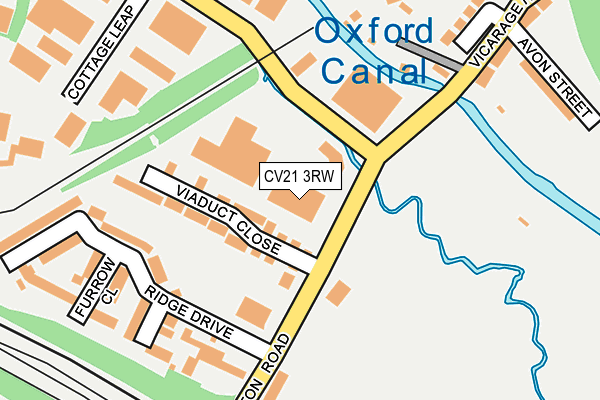
CV21 3RW is located in the Newbold and Brownsover electoral ward, within the local authority district of Rugby and the English Parliamentary constituency of Rugby. The Sub Integrated Care Board (ICB) Location is NHS Coventry and Warwickshire ICB - B2M3M and the police force is Warwickshire. This postcode has been in use since January 1993.


GetTheData
Source: OS OpenMap – Local (Ordnance Survey)
Source: OS VectorMap District (Ordnance Survey)
Licence: Open Government Licence (requires attribution)
| Easting | 452031 |
| Northing | 275843 |
| Latitude | 52.378162 |
| Longitude | -1.237073 |
GetTheData
Source: Open Postcode Geo
Licence: Open Government Licence
| Country | England |
| Postcode District | CV21 |
➜ See where CV21 is on a map ➜ Where is Rugby? | |
GetTheData
Source: Land Registry Price Paid Data
Licence: Open Government Licence
Elevation or altitude of CV21 3RW as distance above sea level:
| Metres | Feet | |
|---|---|---|
| Elevation | 90m | 295ft |
Elevation is measured from the approximate centre of the postcode, to the nearest point on an OS contour line from OS Terrain 50, which has contour spacing of ten vertical metres.
➜ How high above sea level am I? Find the elevation of your current position using your device's GPS.
GetTheData
Source: Open Postcode Elevation
Licence: Open Government Licence
| Ward | Newbold And Brownsover |
| Constituency | Rugby |
GetTheData
Source: ONS Postcode Database
Licence: Open Government Licence
| Viaduct Close (Clifton Road) | Rugby | 58m |
| Butlers Leap (Clifton Road) | Rugby | 60m |
| Avon Street (Vicarage Hill) | Clifton Upon Dunsmore | 239m |
| Avon Street (Vicarage Hill) | Clifton Upon Dunsmore | 244m |
| Cottage Leap (Butlers Leap) | Rugby | 245m |
| Rugby Station | 0.9km |
GetTheData
Source: NaPTAN
Licence: Open Government Licence
GetTheData
Source: ONS Postcode Database
Licence: Open Government Licence

➜ Get more ratings from the Food Standards Agency
GetTheData
Source: Food Standards Agency
Licence: FSA terms & conditions
| Last Collection | |||
|---|---|---|---|
| Location | Mon-Fri | Sat | Distance |
| Clifton Road Post Office | 17:15 | 12:10 | 520m |
| Cambridge Street | 17:00 | 12:00 | 625m |
| Midland Station | 18:00 | 12:00 | 854m |
GetTheData
Source: Dracos
Licence: Creative Commons Attribution-ShareAlike
The below table lists the International Territorial Level (ITL) codes (formerly Nomenclature of Territorial Units for Statistics (NUTS) codes) and Local Administrative Units (LAU) codes for CV21 3RW:
| ITL 1 Code | Name |
|---|---|
| TLG | West Midlands (England) |
| ITL 2 Code | Name |
| TLG1 | Herefordshire, Worcestershire and Warwickshire |
| ITL 3 Code | Name |
| TLG13 | Warwickshire CC |
| LAU 1 Code | Name |
| E07000220 | Rugby |
GetTheData
Source: ONS Postcode Directory
Licence: Open Government Licence
The below table lists the Census Output Area (OA), Lower Layer Super Output Area (LSOA), and Middle Layer Super Output Area (MSOA) for CV21 3RW:
| Code | Name | |
|---|---|---|
| OA | E00158682 | |
| LSOA | E01031130 | Rugby 005A |
| MSOA | E02006496 | Rugby 005 |
GetTheData
Source: ONS Postcode Directory
Licence: Open Government Licence
| CV21 3FD | Viaduct Close | 93m |
| CV21 3FG | Braids Close | 189m |
| CV23 0EY | Clifton Wharf | 193m |
| CV21 3FE | Ridge Drive | 232m |
| CV21 3FF | Furrow Close | 238m |
| CV23 0DQ | Avon Street | 272m |
| CV23 0DG | Vicarage Hill | 281m |
| CV21 3SL | East Street | 387m |
| CV21 3SQ | East Street | 403m |
| CV23 0DF | Newall Close | 426m |
GetTheData
Source: Open Postcode Geo; Land Registry Price Paid Data
Licence: Open Government Licence