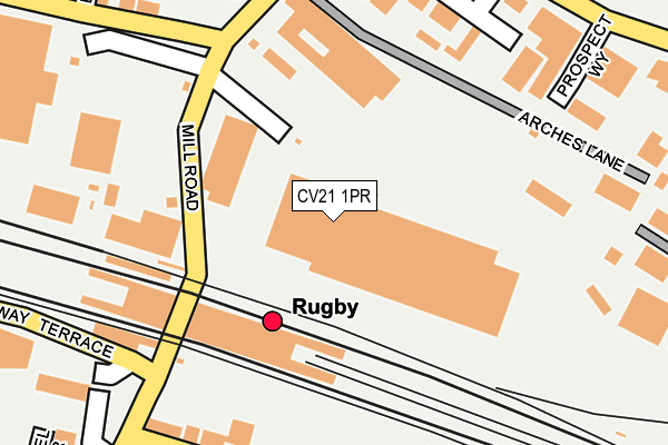
CV21 1PR is located in the Newbold and Brownsover electoral ward, within the local authority district of Rugby and the English Parliamentary constituency of Rugby. The Sub Integrated Care Board (ICB) Location is NHS Coventry and Warwickshire ICB - B2M3M and the police force is Warwickshire. This postcode has been in use since February 2022.


GetTheData
Source: OS OpenMap – Local (Ordnance Survey)
Source: OS VectorMap District (Ordnance Survey)
Licence: Open Government Licence (requires attribution)
| Easting | 451281 |
| Northing | 276015 |
| Latitude | 52.379795 |
| Longitude | -1.248050 |
GetTheData
Source: Open Postcode Geo
Licence: Open Government Licence
| Country | England |
| Postcode District | CV21 |
➜ See where CV21 is on a map ➜ Where is Rugby? | |
GetTheData
Source: Land Registry Price Paid Data
Licence: Open Government Licence
Elevation or altitude of CV21 1PR as distance above sea level:
| Metres | Feet | |
|---|---|---|
| Elevation | 90m | 295ft |
Elevation is measured from the approximate centre of the postcode, to the nearest point on an OS contour line from OS Terrain 50, which has contour spacing of ten vertical metres.
➜ How high above sea level am I? Find the elevation of your current position using your device's GPS.
GetTheData
Source: Open Postcode Elevation
Licence: Open Government Licence
| Ward | Newbold And Brownsover |
| Constituency | Rugby |
GetTheData
Source: ONS Postcode Database
Licence: Open Government Licence
| Carillion Rail Depot (Mill Road) | Rugby | 191m |
| Carillion Rail Depot (Mill Road) | Rugby | 202m |
| Abbey Street (Murray Road) | Rugby | 230m |
| Railway Station (Railway Terrace) | Rugby | 232m |
| Abbey Street (Murray Road) | Rugby | 241m |
| Rugby Station | 0.2km |
GetTheData
Source: NaPTAN
Licence: Open Government Licence
GetTheData
Source: ONS Postcode Database
Licence: Open Government Licence


➜ Get more ratings from the Food Standards Agency
GetTheData
Source: Food Standards Agency
Licence: FSA terms & conditions
| Last Collection | |||
|---|---|---|---|
| Location | Mon-Fri | Sat | Distance |
| Midland Station | 18:00 | 12:00 | 129m |
| Mill Road Delivery Office | 18:30 | 12:00 | 134m |
| Mill Road Delivery Office | 18:30 | 12:00 | 134m |
GetTheData
Source: Dracos
Licence: Creative Commons Attribution-ShareAlike
The below table lists the International Territorial Level (ITL) codes (formerly Nomenclature of Territorial Units for Statistics (NUTS) codes) and Local Administrative Units (LAU) codes for CV21 1PR:
| ITL 1 Code | Name |
|---|---|
| TLG | West Midlands (England) |
| ITL 2 Code | Name |
| TLG1 | Herefordshire, Worcestershire and Warwickshire |
| ITL 3 Code | Name |
| TLG13 | Warwickshire CC |
| LAU 1 Code | Name |
| E07000220 | Rugby |
GetTheData
Source: ONS Postcode Directory
Licence: Open Government Licence
The below table lists the Census Output Area (OA), Lower Layer Super Output Area (LSOA), and Middle Layer Super Output Area (MSOA) for CV21 1PR:
| Code | Name | |
|---|---|---|
| OA | E00158681 | |
| LSOA | E01031130 | Rugby 005A |
| MSOA | E02006496 | Rugby 005 |
GetTheData
Source: ONS Postcode Directory
Licence: Open Government Licence
| CV21 3UY | Avon Industrial Estate | 208m |
| CV21 3LL | Abbey Street | 249m |
| CV21 3LH | Abbey Street | 254m |
| CV21 1QW | Arches Business Centre | 256m |
| CV21 1BB | Mill Road | 278m |
| CV21 1FE | Technology Drive | 288m |
| CV21 3LN | Abbey Street | 288m |
| CV21 3LG | Sandown Road | 293m |
| CV21 3LQ | Sandown Road | 293m |
| CV21 3XH | Great Central Way | 338m |
GetTheData
Source: Open Postcode Geo; Land Registry Price Paid Data
Licence: Open Government Licence