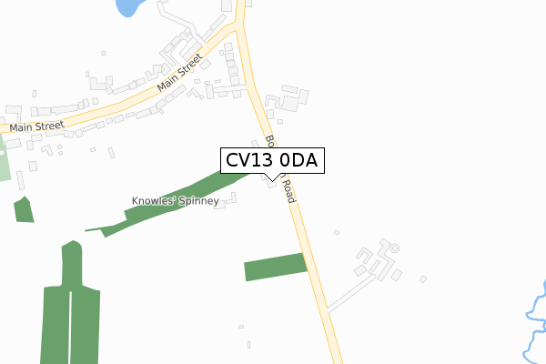
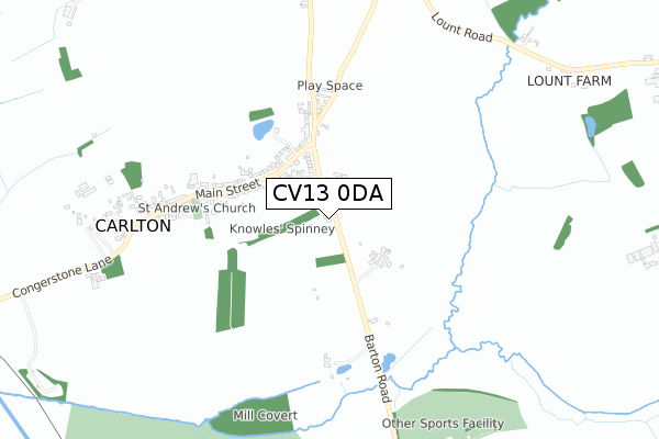
CV13 0DA lies on Bosworth Road in Carlton, Nuneaton. CV13 0DA is located in the Cadeby, Carlton and Market Bosworth with Shackerstone electoral ward, within the local authority district of Hinckley and Bosworth and the English Parliamentary constituency of Bosworth. The Sub Integrated Care Board (ICB) Location is NHS Leicester, Leicestershire and Rutland ICB - 04V and the police force is Leicestershire. This postcode has been in use since January 1980.


GetTheData
Source: OS Open Zoomstack (Ordnance Survey)
Licence: Open Government Licence (requires attribution)
Attribution: Contains OS data © Crown copyright and database right 2025
Source: Open Postcode Geo
Licence: Open Government Licence (requires attribution)
Attribution: Contains OS data © Crown copyright and database right 2025; Contains Royal Mail data © Royal Mail copyright and database right 2025; Source: Office for National Statistics licensed under the Open Government Licence v.3.0
| Easting | 440152 |
| Northing | 304934 |
| Latitude | 52.640671 |
| Longitude | -1.408066 |
GetTheData
Source: Open Postcode Geo
Licence: Open Government Licence
| Street | Bosworth Road |
| Locality | Carlton |
| Town/City | Nuneaton |
| Country | England |
| Postcode District | CV13 |
➜ See where CV13 is on a map ➜ Where is Carlton? | |
GetTheData
Source: Land Registry Price Paid Data
Licence: Open Government Licence
Elevation or altitude of CV13 0DA as distance above sea level:
| Metres | Feet | |
|---|---|---|
| Elevation | 110m | 361ft |
Elevation is measured from the approximate centre of the postcode, to the nearest point on an OS contour line from OS Terrain 50, which has contour spacing of ten vertical metres.
➜ How high above sea level am I? Find the elevation of your current position using your device's GPS.
GetTheData
Source: Open Postcode Elevation
Licence: Open Government Licence
| Ward | Cadeby, Carlton And Market Bosworth With Shackerstone |
| Constituency | Bosworth |
GetTheData
Source: ONS Postcode Database
Licence: Open Government Licence
PARK VIEW FARM, BOSWORTH ROAD, CARLTON, NUNEATON, CV13 0DA 2013 9 JUL £540,000 |
GetTheData
Source: HM Land Registry Price Paid Data
Licence: Contains HM Land Registry data © Crown copyright and database right 2025. This data is licensed under the Open Government Licence v3.0.
| Gate Hangs Well (Barton Road) | Carlton | 296m |
| Gate Hangs Well (Barton Road) | Carlton | 367m |
| Harcourt Spinney (Carlton Road) | Market Bosworth | 1,412m |
| Harcourt Spinney (Carlton Road) | Market Bosworth | 1,471m |
| Carlton Road (Nailstone Road) | Barton-in-the-beans | 1,489m |
GetTheData
Source: NaPTAN
Licence: Open Government Licence
GetTheData
Source: ONS Postcode Database
Licence: Open Government Licence


➜ Get more ratings from the Food Standards Agency
GetTheData
Source: Food Standards Agency
Licence: FSA terms & conditions
| Last Collection | |||
|---|---|---|---|
| Location | Mon-Fri | Sat | Distance |
| Station Road | 16:45 | 11:15 | 1,798m |
| Market Bosworth Post Office | 17:00 | 11:15 | 1,827m |
| Railway Station | 16:45 | 10:45 | 1,901m |
GetTheData
Source: Dracos
Licence: Creative Commons Attribution-ShareAlike
The below table lists the International Territorial Level (ITL) codes (formerly Nomenclature of Territorial Units for Statistics (NUTS) codes) and Local Administrative Units (LAU) codes for CV13 0DA:
| ITL 1 Code | Name |
|---|---|
| TLF | East Midlands (England) |
| ITL 2 Code | Name |
| TLF2 | Leicestershire, Rutland and Northamptonshire |
| ITL 3 Code | Name |
| TLF22 | Leicestershire CC and Rutland |
| LAU 1 Code | Name |
| E07000132 | Hinckley and Bosworth |
GetTheData
Source: ONS Postcode Directory
Licence: Open Government Licence
The below table lists the Census Output Area (OA), Lower Layer Super Output Area (LSOA), and Middle Layer Super Output Area (MSOA) for CV13 0DA:
| Code | Name | |
|---|---|---|
| OA | E00131109 | |
| LSOA | E01025838 | Hinckley and Bosworth 004D |
| MSOA | E02005380 | Hinckley and Bosworth 004 |
GetTheData
Source: ONS Postcode Directory
Licence: Open Government Licence
| CV13 0BX | Bosworth Road | 175m |
| CV13 0DU | Orton Close | 311m |
| CV13 0EZ | Main Street | 385m |
| CV13 0DB | Barton Road | 404m |
| CV13 0RL | Barton Road | 420m |
| CV13 0BZ | Main Street | 422m |
| CV13 0DH | Nailstone Road | 444m |
| CV13 0BQ | Main Street | 592m |
| CV13 0BU | Congerstone Lane | 805m |
| CV13 0BY | Shackerstone Walk | 819m |
GetTheData
Source: Open Postcode Geo; Land Registry Price Paid Data
Licence: Open Government Licence