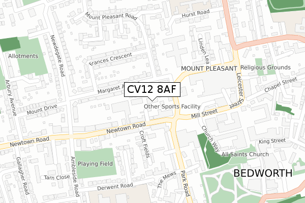
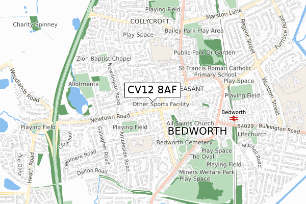
CV12 8AF is located in the Slough electoral ward, within the local authority district of Nuneaton and Bedworth and the English Parliamentary constituency of North Warwickshire. The Sub Integrated Care Board (ICB) Location is NHS Coventry and Warwickshire ICB - B2M3M and the police force is Warwickshire. This postcode has been in use since October 2018.


GetTheData
Source: OS Open Zoomstack (Ordnance Survey)
Licence: Open Government Licence (requires attribution)
Attribution: Contains OS data © Crown copyright and database right 2024
Source: Open Postcode Geo
Licence: Open Government Licence (requires attribution)
Attribution: Contains OS data © Crown copyright and database right 2024; Contains Royal Mail data © Royal Mail copyright and database right 2024; Source: Office for National Statistics licensed under the Open Government Licence v.3.0
| Easting | 435600 |
| Northing | 287098 |
| Latitude | 52.480669 |
| Longitude | -1.477233 |
GetTheData
Source: Open Postcode Geo
Licence: Open Government Licence
| Country | England |
| Postcode District | CV12 |
| ➜ CV12 open data dashboard ➜ See where CV12 is on a map ➜ Where is Bedworth? | |
GetTheData
Source: Land Registry Price Paid Data
Licence: Open Government Licence
| Ward | Slough |
| Constituency | North Warwickshire |
GetTheData
Source: ONS Postcode Database
Licence: Open Government Licence
| January 2024 | Violence and sexual offences | On or near Petrol Station | 317m |
| December 2023 | Other theft | On or near Margaret Avenue | 111m |
| December 2023 | Other theft | On or near Margaret Avenue | 111m |
| ➜ Get more crime data in our Crime section | |||
GetTheData
Source: data.police.uk
Licence: Open Government Licence
| Park Road (Mill Street) | Bedworth | 79m |
| Mill Street (Park Road) | Bedworth | 127m |
| Mill Street (Park Road) | Bedworth | 132m |
| Iceland (Mill Street) | Bedworth | 227m |
| Newdigate Road (Newtown Road) | Bedworth | 234m |
| Bedworth Station | 0.7km |
| Bermuda Park Station | 2.3km |
| Coventry Arena Station | 3.8km |
GetTheData
Source: NaPTAN
Licence: Open Government Licence
| Percentage of properties with Next Generation Access | 100.0% |
| Percentage of properties with Superfast Broadband | 100.0% |
| Percentage of properties with Ultrafast Broadband | 0.0% |
| Percentage of properties with Full Fibre Broadband | 0.0% |
Superfast Broadband is between 30Mbps and 300Mbps
Ultrafast Broadband is > 300Mbps
| Percentage of properties unable to receive 2Mbps | 0.0% |
| Percentage of properties unable to receive 5Mbps | 0.0% |
| Percentage of properties unable to receive 10Mbps | 0.0% |
| Percentage of properties unable to receive 30Mbps | 0.0% |
GetTheData
Source: Ofcom
Licence: Ofcom Terms of Use (requires attribution)
GetTheData
Source: ONS Postcode Database
Licence: Open Government Licence


➜ Get more ratings from the Food Standards Agency
GetTheData
Source: Food Standards Agency
Licence: FSA terms & conditions
| Last Collection | |||
|---|---|---|---|
| Location | Mon-Fri | Sat | Distance |
| Park Road | 16:30 | 12:15 | 275m |
| Ambleside Road | 16:45 | 12:15 | 307m |
| Co-op (Fpo) Outside | 18:30 | 12:00 | 406m |
GetTheData
Source: Dracos
Licence: Creative Commons Attribution-ShareAlike
| Facility | Distance |
|---|---|
| Ambleside Road Ambleside Road, Bedworth Grass Pitches | 279m |
| Race Leys Junior School Barton Road, Bedworth Grass Pitches | 487m |
| The Oval Coventry Road, Bedworth Grass Pitches, Artificial Grass Pitch | 598m |
GetTheData
Source: Active Places
Licence: Open Government Licence
| School | Phase of Education | Distance |
|---|---|---|
| The Canons C of E Primary School Derwent Road, Bedworth, CV12 8RT | Primary | 333m |
| Race Leys Infant School Hurst Road, Bedworth, CV12 8AD | Primary | 341m |
| Race Leys Junior School Barton Road, Bedworth, CV12 8HG | Primary | 487m |
GetTheData
Source: Edubase
Licence: Open Government Licence
The below table lists the International Territorial Level (ITL) codes (formerly Nomenclature of Territorial Units for Statistics (NUTS) codes) and Local Administrative Units (LAU) codes for CV12 8AF:
| ITL 1 Code | Name |
|---|---|
| TLG | West Midlands (England) |
| ITL 2 Code | Name |
| TLG1 | Herefordshire, Worcestershire and Warwickshire |
| ITL 3 Code | Name |
| TLG13 | Warwickshire CC |
| LAU 1 Code | Name |
| E07000219 | Nuneaton and Bedworth |
GetTheData
Source: ONS Postcode Directory
Licence: Open Government Licence
The below table lists the Census Output Area (OA), Lower Layer Super Output Area (LSOA), and Middle Layer Super Output Area (MSOA) for CV12 8AF:
| Code | Name | |
|---|---|---|
| OA | E00158577 | |
| LSOA | E01031105 | Nuneaton and Bedworth 012A |
| MSOA | E02006486 | Nuneaton and Bedworth 012 |
GetTheData
Source: ONS Postcode Directory
Licence: Open Government Licence
| CV12 8QB | Newtown Road | 54m |
| CV12 8EB | George Street Ringway | 59m |
| CV12 8QU | Newtown Road | 87m |
| CV12 8QA | Newtown Road | 91m |
| CV12 8ED | Margaret Avenue | 102m |
| CV12 8EH | Margaret Avenue | 143m |
| CV12 8QD | Newtown Road | 146m |
| CV12 8EN | Frances Crescent | 146m |
| CV12 8QS | Newtown Road | 167m |
| CV12 8QT | Croft Fields | 174m |
GetTheData
Source: Open Postcode Geo; Land Registry Price Paid Data
Licence: Open Government Licence