The Oval - Bedworth
The Oval is located in Bedworth (CV12), and offers Artificial Grass Pitch.
| Address | THE OVAL, Coventry Road, Bedworth, CV12 8NN |
| Car Park | Yes |
| Car Park Capacity | 140 |
| Management Type | Sport Club |
| Management Group | Others |
| Owner Type | Local Authority |
| Owner Group | Local Authority |
| Education Phase | Not applicable |
Facilities
| Closure Date | 27th Apr 2014 |
| Closure Reason | Strategic Review - facility/site to be replaced at existing site |
| Accessibility | Sports Club / Community Association |
| Management Type | Sport Club |
| Year Built | 1954 |
| Year Refurbished | 2008 |
| Changing Rooms | Yes |
| Date Record Checked | 26th Apr 2022 |
| Opening Times | Dawn To Dusk |
Facility specifics
Disabled access
| Disabled Access | Yes |
| Disabled Parking | Yes |
| Activity Areas | Yes |
| Spectator Areas | Yes |
| Emergency Exits | Yes |
| Accessibility | Sports Club / Community Association |
| Management Type | Sport Club |
| Year Built | 2014 |
| Changing Rooms | Yes |
| Date Record Checked | 26th Apr 2022 |
Opening times
| Access description | Sports Club / Community Association |
|---|
| Opening time | 09:00 |
| Closing time | 21:00 |
| Period open for | Every day |
Facility specifics
| Area | 7350m² |
| Fill | Yes - Rubber |
| Floodlit | Yes |
| Indoor | No |
| Length | 105m |
| Pile Length | 30mm |
| Width | 70m |
| WR22 Compliant Pitch | No |
Disabled access
| Disabled Access | Yes |
| Disabled Parking | Yes |
| Finding/Reaching Entrance | Yes |
| Reception Area | Yes |
| Doorways | Yes |
| Disabled Changing Facilities | Yes |
| Activity Areas | Yes |
| Disabled Toilets | Yes |
| Social Areas | Yes |
| Spectator Areas | Yes |
| Emergency Exits | Yes |
Contact
Disabled access
Disabled access for The Oval
| Disabled Access | Yes |
| Disabled Parking | Yes |
| Finding/Reaching Entrance | Yes |
| Reception Area | Yes |
| Doorways | Yes |
| Disabled Changing Facilities | Yes |
| Activity Areas | Yes |
| Disabled Toilets | Yes |
| Social Areas | Yes |
| Spectator Areas | Yes |
| Emergency Exits | Yes |
Where is The Oval?
| Sub Building Name | |
| Building Name | THE OVAL |
| Building Number | 0 |
| Dependent Thoroughfare | |
| Thoroughfare Name | COVENTRY ROAD |
| Double Dependent Locality | |
| Dependent Locality | |
| PostTown | BEDWORTH |
| Postcode | CV12 8NN |
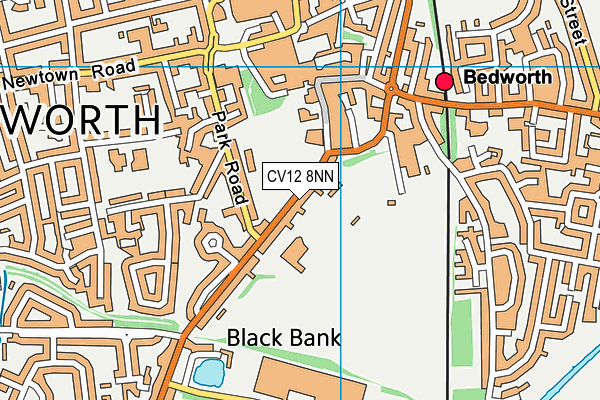
The Oval on a map

The Oval geodata
| Easting | 436001.08 |
| Northing | 286653.85 |
| Latitude | 52.476633 |
| Longitude | -1.471384 |
| Local Authority Name | Nuneaton and Bedworth |
| Local Authority Code | E07000219 |
| Parliamentary Constituency Name | North Warwickshire |
| Parliamentary Constituency Code | E14000854 |
| Region Name | West Midlands |
| Region Code | E15000005 |
| Ward Name | Poplar |
| Ward Code | E05007485 |
| Output Area Code | E00158525 |
About this data
This data is open data sourced from Active Places Power and licenced under the Active Places Open Data Licence.
| Created On | 28th Sep 2005 |
| Audited On | 26th Apr 2022 |
| Checked On | 28th Jun 2022 |
