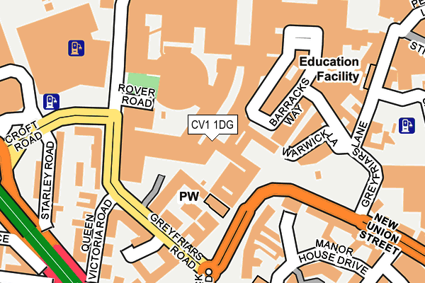
CV1 1DG is located in the St Michael's electoral ward, within the metropolitan district of Coventry and the English Parliamentary constituency of Coventry South. The Sub Integrated Care Board (ICB) Location is NHS Coventry and Warwickshire ICB - B2M3M and the police force is West Midlands. This postcode has been in use since January 1980.


GetTheData
Source: OS OpenMap – Local (Ordnance Survey)
Source: OS VectorMap District (Ordnance Survey)
Licence: Open Government Licence (requires attribution)
| Easting | 433180 |
| Northing | 278797 |
| Latitude | 52.406180 |
| Longitude | -1.513695 |
GetTheData
Source: Open Postcode Geo
Licence: Open Government Licence
| Country | England |
| Postcode District | CV1 |
➜ See where CV1 is on a map ➜ Where is Coventry? | |
GetTheData
Source: Land Registry Price Paid Data
Licence: Open Government Licence
Elevation or altitude of CV1 1DG as distance above sea level:
| Metres | Feet | |
|---|---|---|
| Elevation | 80m | 262ft |
Elevation is measured from the approximate centre of the postcode, to the nearest point on an OS contour line from OS Terrain 50, which has contour spacing of ten vertical metres.
➜ How high above sea level am I? Find the elevation of your current position using your device's GPS.
GetTheData
Source: Open Postcode Elevation
Licence: Open Government Licence
| Ward | St Michael's |
| Constituency | Coventry South |
GetTheData
Source: ONS Postcode Database
Licence: Open Government Licence
| The Quadrant (Warwick Road) | Coventry | 83m |
| The Quadrant (Warwick Road) | Coventry | 89m |
| Quadrant (New Union St) | Coventry | 140m |
| Queen Victoria Rd (Greyfriars Rd) | Coventry | 141m |
| Quadrant (New Union St) | Coventry | 154m |
| Coventry Station | 0.6km |
| Canley Station | 2.4km |
| Coventry Arena Station | 4.8km |
GetTheData
Source: NaPTAN
Licence: Open Government Licence
| Median download speed | 14.4Mbps |
| Average download speed | 14.4Mbps |
| Maximum download speed | 23.43Mbps |
| Median upload speed | 0.9Mbps |
| Average upload speed | 0.9Mbps |
| Maximum upload speed | 1.26Mbps |
GetTheData
Source: Ofcom
Licence: Ofcom Terms of Use (requires attribution)
GetTheData
Source: ONS Postcode Database
Licence: Open Government Licence


➜ Get more ratings from the Food Standards Agency
GetTheData
Source: Food Standards Agency
Licence: FSA terms & conditions
| Last Collection | |||
|---|---|---|---|
| Location | Mon-Fri | Sat | Distance |
| New Union Street | 18:30 | 09:45 | 95m |
| New Union Street | 18:30 | 09:45 | 95m |
| Market Way | 18:30 | 09:45 | 151m |
GetTheData
Source: Dracos
Licence: Creative Commons Attribution-ShareAlike
The below table lists the International Territorial Level (ITL) codes (formerly Nomenclature of Territorial Units for Statistics (NUTS) codes) and Local Administrative Units (LAU) codes for CV1 1DG:
| ITL 1 Code | Name |
|---|---|
| TLG | West Midlands (England) |
| ITL 2 Code | Name |
| TLG3 | West Midlands |
| ITL 3 Code | Name |
| TLG33 | Coventry |
| LAU 1 Code | Name |
| E08000026 | Coventry |
GetTheData
Source: ONS Postcode Directory
Licence: Open Government Licence
The below table lists the Census Output Area (OA), Lower Layer Super Output Area (LSOA), and Middle Layer Super Output Area (MSOA) for CV1 1DG:
| Code | Name | |
|---|---|---|
| OA | E00172194 | |
| LSOA | E01009642 | Coventry 031C |
| MSOA | E02001988 | Coventry 031 |
GetTheData
Source: ONS Postcode Directory
Licence: Open Government Licence
| CV1 3RX | Greyfriars Road | 83m |
| CV1 1EX | Warwick Row | 115m |
| CV1 3RW | Greyfriars Road | 125m |
| CV1 2EY | Manor House Drive | 144m |
| CV1 1LF | Hertford Street | 161m |
| CV1 1ET | Warwick Row | 172m |
| CV1 3JS | Queen Victoria Road | 195m |
| CV1 1LB | Hertford Street | 198m |
| CV1 1DS | Lower Precinct | 210m |
| CV1 3JH | Queen Victoria Road | 211m |
GetTheData
Source: Open Postcode Geo; Land Registry Price Paid Data
Licence: Open Government Licence