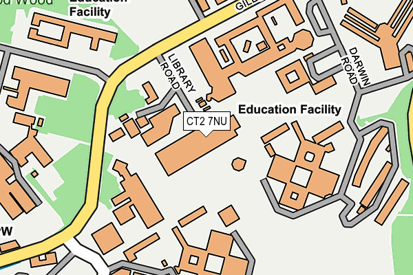
CT2 7NU is located in the Blean Forest electoral ward, within the local authority district of Canterbury and the English Parliamentary constituency of Canterbury. The Sub Integrated Care Board (ICB) Location is NHS Kent and Medway ICB - 91Q and the police force is Kent. This postcode has been in use since January 1980.


GetTheData
Source: OS OpenMap – Local (Ordnance Survey)
Source: OS VectorMap District (Ordnance Survey)
Licence: Open Government Licence (requires attribution)
| Easting | 614059 |
| Northing | 159864 |
| Latitude | 51.297643 |
| Longitude | 1.069124 |
GetTheData
Source: Open Postcode Geo
Licence: Open Government Licence
| Country | England |
| Postcode District | CT2 |
➜ See where CT2 is on a map ➜ Where is Canterbury? | |
GetTheData
Source: Land Registry Price Paid Data
Licence: Open Government Licence
Elevation or altitude of CT2 7NU as distance above sea level:
| Metres | Feet | |
|---|---|---|
| Elevation | 60m | 197ft |
Elevation is measured from the approximate centre of the postcode, to the nearest point on an OS contour line from OS Terrain 50, which has contour spacing of ten vertical metres.
➜ How high above sea level am I? Find the elevation of your current position using your device's GPS.
GetTheData
Source: Open Postcode Elevation
Licence: Open Government Licence
| Ward | Blean Forest |
| Constituency | Canterbury |
GetTheData
Source: ONS Postcode Database
Licence: Open Government Licence
| Gulbenkian Theatre (Giles Lane) | University Of Kent | 142m |
| Science Building (Giles Lane) | University Of Kent | 157m |
| Science Building (Giles Lane) | University Of Kent | 166m |
| Darwin College (Darwin Road) | University Of Kent | 231m |
| Gulbenkian Theatre (Giles Lane) | University Of Kent | 236m |
| Canterbury West Station | 1.5km |
| Canterbury East Station | 2.6km |
| Sturry Station | 3.7km |
GetTheData
Source: NaPTAN
Licence: Open Government Licence
GetTheData
Source: ONS Postcode Database
Licence: Open Government Licence


➜ Get more ratings from the Food Standards Agency
GetTheData
Source: Food Standards Agency
Licence: FSA terms & conditions
| Last Collection | |||
|---|---|---|---|
| Location | Mon-Fri | Sat | Distance |
| The University Of Kent | 17:30 | 09:00 | 209m |
| Giles Lane | 17:30 | 09:00 | 434m |
| Manwood Avenue | 17:30 | 12:00 | 613m |
GetTheData
Source: Dracos
Licence: Creative Commons Attribution-ShareAlike
The below table lists the International Territorial Level (ITL) codes (formerly Nomenclature of Territorial Units for Statistics (NUTS) codes) and Local Administrative Units (LAU) codes for CT2 7NU:
| ITL 1 Code | Name |
|---|---|
| TLJ | South East (England) |
| ITL 2 Code | Name |
| TLJ4 | Kent |
| ITL 3 Code | Name |
| TLJ44 | East Kent |
| LAU 1 Code | Name |
| E07000106 | Canterbury |
GetTheData
Source: ONS Postcode Directory
Licence: Open Government Licence
The below table lists the Census Output Area (OA), Lower Layer Super Output Area (LSOA), and Middle Layer Super Output Area (MSOA) for CT2 7NU:
| Code | Name | |
|---|---|---|
| OA | E00167557 | |
| LSOA | E01032809 | Canterbury 012F |
| MSOA | E02005021 | Canterbury 012 |
GetTheData
Source: ONS Postcode Directory
Licence: Open Government Licence
| CT2 7LT | Giles Lane | 379m |
| CT2 7BB | Hackington Close | 399m |
| CT2 7AS | St Stephens Hill | 408m |
| CT2 7LS | Woodland Way | 430m |
| CT2 7AT | St Stephens Hill | 491m |
| CT2 9LS | Canterbury Hill | 534m |
| CT2 7AR | St Stephens Hill | 552m |
| CT2 7AY | Downs Road | 553m |
| CT2 7LR | Giles Lane | 590m |
| CT2 7LB | Leycroft Close | 622m |
GetTheData
Source: Open Postcode Geo; Land Registry Price Paid Data
Licence: Open Government Licence