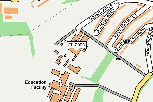
CT17 0DQ is located in the Tower Hamlets electoral ward, within the local authority district of Dover and the English Parliamentary constituency of Dover. The Sub Integrated Care Board (ICB) Location is NHS Kent and Medway ICB - 91Q and the police force is Kent. This postcode has been in use since January 1980.


GetTheData
Source: OS OpenMap – Local (Ordnance Survey)
Source: OS VectorMap District (Ordnance Survey)
Licence: Open Government Licence (requires attribution)
| Easting | 630305 |
| Northing | 141711 |
| Latitude | 51.128349 |
| Longitude | 1.290116 |
GetTheData
Source: Open Postcode Geo
Licence: Open Government Licence
| Country | England |
| Postcode District | CT17 |
➜ See where CT17 is on a map ➜ Where is Dover? | |
GetTheData
Source: Land Registry Price Paid Data
Licence: Open Government Licence
Elevation or altitude of CT17 0DQ as distance above sea level:
| Metres | Feet | |
|---|---|---|
| Elevation | 70m | 230ft |
Elevation is measured from the approximate centre of the postcode, to the nearest point on an OS contour line from OS Terrain 50, which has contour spacing of ten vertical metres.
➜ How high above sea level am I? Find the elevation of your current position using your device's GPS.
GetTheData
Source: Open Postcode Elevation
Licence: Open Government Licence
| Ward | Tower Hamlets |
| Constituency | Dover |
GetTheData
Source: ONS Postcode Database
Licence: Open Government Licence
| Dover Boys' Grammar School (Astor Avenue) | Tower Hamlets | 281m |
| Dover Boys' Grammar School (Astor Avenue) | Tower Hamlets | 295m |
| Playground (Northbourne Avenue) | Tower Hamlets | 296m |
| Coombe Close (Coombe Valley Road) | St Radigund's | 303m |
| Chamberlain Road (Northbourne Avenue) | Tower Hamlets | 316m |
| Dover Priory Station | 1.1km |
| Kearsney Station | 2.7km |
| Martin Mill Station | 6.2km |
GetTheData
Source: NaPTAN
Licence: Open Government Licence
GetTheData
Source: ONS Postcode Database
Licence: Open Government Licence


➜ Get more ratings from the Food Standards Agency
GetTheData
Source: Food Standards Agency
Licence: FSA terms & conditions
| Last Collection | |||
|---|---|---|---|
| Location | Mon-Fri | Sat | Distance |
| Lambton Road Post Office | 17:45 | 12:15 | 346m |
| Devonshire Road | 18:15 | 11:30 | 455m |
| Upper Elms Vale | 18:00 | 11:30 | 514m |
GetTheData
Source: Dracos
Licence: Creative Commons Attribution-ShareAlike
The below table lists the International Territorial Level (ITL) codes (formerly Nomenclature of Territorial Units for Statistics (NUTS) codes) and Local Administrative Units (LAU) codes for CT17 0DQ:
| ITL 1 Code | Name |
|---|---|
| TLJ | South East (England) |
| ITL 2 Code | Name |
| TLJ4 | Kent |
| ITL 3 Code | Name |
| TLJ44 | East Kent |
| LAU 1 Code | Name |
| E07000108 | Dover |
GetTheData
Source: ONS Postcode Directory
Licence: Open Government Licence
The below table lists the Census Output Area (OA), Lower Layer Super Output Area (LSOA), and Middle Layer Super Output Area (MSOA) for CT17 0DQ:
| Code | Name | |
|---|---|---|
| OA | E00123094 | |
| LSOA | E01024248 | Dover 011H |
| MSOA | E02005051 | Dover 011 |
GetTheData
Source: ONS Postcode Directory
Licence: Open Government Licence
| CT17 0DG | Anselm Road | 139m |
| CT17 0DF | Anselm Road | 171m |
| CT17 0DA | Hamilton Road | 198m |
| CT17 0BZ | Chamberlain Road | 215m |
| CT17 0HJ | Whinless Road | 231m |
| CT17 0DB | Hamilton Road | 262m |
| CT17 0HH | Coombe Valley Road | 292m |
| CT17 0NL | Noahs Ark Road | 295m |
| CT17 0HG | Coombe Valley Road | 331m |
| CT17 0DE | Noahs Ark Road | 343m |
GetTheData
Source: Open Postcode Geo; Land Registry Price Paid Data
Licence: Open Government Licence