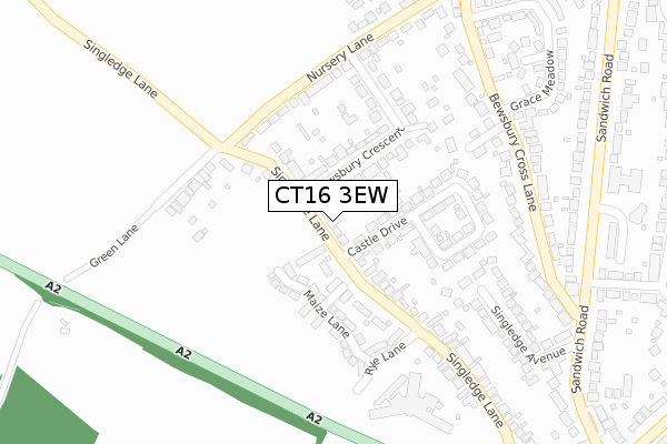
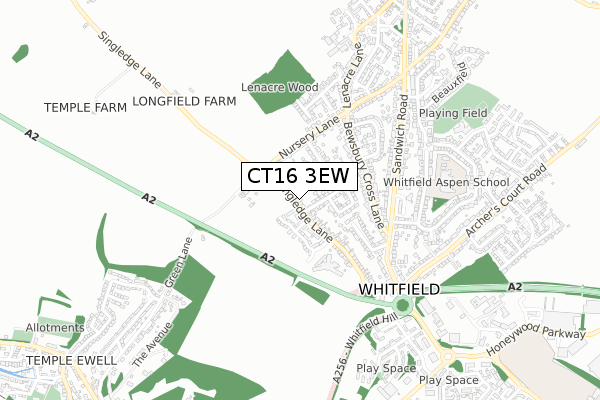
CT16 3EW is located in the Whitfield electoral ward, within the local authority district of Dover and the English Parliamentary constituency of Dover. The Sub Integrated Care Board (ICB) Location is NHS Kent and Medway ICB - 91Q and the police force is Kent. This postcode has been in use since January 1980.


GetTheData
Source: OS Open Zoomstack (Ordnance Survey)
Licence: Open Government Licence (requires attribution)
Attribution: Contains OS data © Crown copyright and database right 2025
Source: Open Postcode Geo
Licence: Open Government Licence (requires attribution)
Attribution: Contains OS data © Crown copyright and database right 2025; Contains Royal Mail data © Royal Mail copyright and database right 2025; Source: Office for National Statistics licensed under the Open Government Licence v.3.0
| Easting | 629714 |
| Northing | 145050 |
| Latitude | 51.158568 |
| Longitude | 1.283844 |
GetTheData
Source: Open Postcode Geo
Licence: Open Government Licence
| Country | England |
| Postcode District | CT16 |
➜ See where CT16 is on a map ➜ Where is Whitfield? | |
GetTheData
Source: Land Registry Price Paid Data
Licence: Open Government Licence
Elevation or altitude of CT16 3EW as distance above sea level:
| Metres | Feet | |
|---|---|---|
| Elevation | 130m | 427ft |
Elevation is measured from the approximate centre of the postcode, to the nearest point on an OS contour line from OS Terrain 50, which has contour spacing of ten vertical metres.
➜ How high above sea level am I? Find the elevation of your current position using your device's GPS.
GetTheData
Source: Open Postcode Elevation
Licence: Open Government Licence
| Ward | Whitfield |
| Constituency | Dover |
GetTheData
Source: ONS Postcode Database
Licence: Open Government Licence
70, SINGLEDGE LANE, WHITFIELD, DOVER, CT16 3EW 2024 14 NOV £355,000 |
GetTheData
Source: HM Land Registry Price Paid Data
Licence: Contains HM Land Registry data © Crown copyright and database right 2025. This data is licensed under the Open Government Licence v3.0.
| Manley House (Sandwich Road) | Whitfield | 403m |
| Manley House (Sandwich Road) | Whitfield | 406m |
| Sandwich Road The Archer (Sandwich Road) | Whitfield | 472m |
| Sandwich Road The Archer (Sandwich Road) | Whitfield | 494m |
| Fire Station (Sandwich Road) | Whitfield | 529m |
| Kearsney Station | 1.3km |
| Dover Priory Station | 4km |
| Martin Mill Station | 4.7km |
GetTheData
Source: NaPTAN
Licence: Open Government Licence
| Percentage of properties with Next Generation Access | 100.0% |
| Percentage of properties with Superfast Broadband | 100.0% |
| Percentage of properties with Ultrafast Broadband | 100.0% |
| Percentage of properties with Full Fibre Broadband | 0.0% |
Superfast Broadband is between 30Mbps and 300Mbps
Ultrafast Broadband is > 300Mbps
| Percentage of properties unable to receive 2Mbps | 0.0% |
| Percentage of properties unable to receive 5Mbps | 0.0% |
| Percentage of properties unable to receive 10Mbps | 0.0% |
| Percentage of properties unable to receive 30Mbps | 0.0% |
GetTheData
Source: Ofcom
Licence: Ofcom Terms of Use (requires attribution)
GetTheData
Source: ONS Postcode Database
Licence: Open Government Licence


➜ Get more ratings from the Food Standards Agency
GetTheData
Source: Food Standards Agency
Licence: FSA terms & conditions
| Last Collection | |||
|---|---|---|---|
| Location | Mon-Fri | Sat | Distance |
| Castle Drive | 17:00 | 09:00 | 45m |
| Whitfield | 17:15 | 11:45 | 381m |
| Bewsbury Lane | 17:00 | 09:15 | 431m |
GetTheData
Source: Dracos
Licence: Creative Commons Attribution-ShareAlike
The below table lists the International Territorial Level (ITL) codes (formerly Nomenclature of Territorial Units for Statistics (NUTS) codes) and Local Administrative Units (LAU) codes for CT16 3EW:
| ITL 1 Code | Name |
|---|---|
| TLJ | South East (England) |
| ITL 2 Code | Name |
| TLJ4 | Kent |
| ITL 3 Code | Name |
| TLJ44 | East Kent |
| LAU 1 Code | Name |
| E07000108 | Dover |
GetTheData
Source: ONS Postcode Directory
Licence: Open Government Licence
The below table lists the Census Output Area (OA), Lower Layer Super Output Area (LSOA), and Middle Layer Super Output Area (MSOA) for CT16 3EW:
| Code | Name | |
|---|---|---|
| OA | E00123141 | |
| LSOA | E01024254 | Dover 010E |
| MSOA | E02005050 | Dover 010 |
GetTheData
Source: ONS Postcode Directory
Licence: Open Government Licence
| CT16 3EP | Singledge Lane | 121m |
| CT16 3EU | Bewsbury Crescent | 124m |
| CT16 3EN | Castle Drive | 154m |
| CT16 3ET | Bewsbury Crescent | 189m |
| CT16 3ES | Nursery Lane | 196m |
| CT16 3PL | Bramley Gardens | 205m |
| CT16 3ER | Green Lane | 224m |
| CT16 3NH | Bridleway | 249m |
| CT16 3EZ | Bewsbury Cross Lane | 292m |
| CT16 3EL | Singledge Lane | 302m |
GetTheData
Source: Open Postcode Geo; Land Registry Price Paid Data
Licence: Open Government Licence