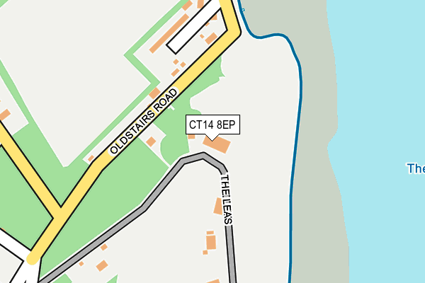
CT14 8EP is located in the Guston, Kingsdown & St Margaret's-at-Cliffe electoral ward, within the local authority district of Dover and the English Parliamentary constituency of Dover. The Sub Integrated Care Board (ICB) Location is NHS Kent and Medway ICB - 91Q and the police force is Kent. This postcode has been in use since January 1980.


GetTheData
Source: OS OpenMap – Local (Ordnance Survey)
Source: OS VectorMap District (Ordnance Survey)
Licence: Open Government Licence (requires attribution)
| Easting | 637961 |
| Northing | 147671 |
| Latitude | 51.178720 |
| Longitude | 1.403268 |
GetTheData
Source: Open Postcode Geo
Licence: Open Government Licence
| Country | England |
| Postcode District | CT14 |
➜ See where CT14 is on a map ➜ Where is Kingsdown? | |
GetTheData
Source: Land Registry Price Paid Data
Licence: Open Government Licence
Elevation or altitude of CT14 8EP as distance above sea level:
| Metres | Feet | |
|---|---|---|
| Elevation | 30m | 98ft |
Elevation is measured from the approximate centre of the postcode, to the nearest point on an OS contour line from OS Terrain 50, which has contour spacing of ten vertical metres.
➜ How high above sea level am I? Find the elevation of your current position using your device's GPS.
GetTheData
Source: Open Postcode Elevation
Licence: Open Government Licence
| Ward | Guston, Kingsdown & St Margaret's-at-cliffe |
| Constituency | Dover |
GetTheData
Source: ONS Postcode Database
Licence: Open Government Licence
| Victoria Road | Kingsdown | 637m |
| Primary School (Glen Road) | Kingsdown | 913m |
| Jarvist Place (Cliffe Road) | Kingsdown | 941m |
| Primary School (Glen Road) | Kingsdown | 952m |
| Courtlands (Kingsdown Road) | Kingsdown | 1,205m |
| Walmer Station | 3.1km |
| Martin Mill Station | 4km |
| Deal Station | 4.9km |
GetTheData
Source: NaPTAN
Licence: Open Government Licence
GetTheData
Source: ONS Postcode Database
Licence: Open Government Licence


➜ Get more ratings from the Food Standards Agency
GetTheData
Source: Food Standards Agency
Licence: FSA terms & conditions
| Last Collection | |||
|---|---|---|---|
| Location | Mon-Fri | Sat | Distance |
| Coastguard Station | 16:00 | 09:00 | 164m |
| Chalk Hill | 16:00 | 09:00 | 691m |
| Kingsdown Post Office | 16:45 | 11:45 | 726m |
GetTheData
Source: Dracos
Licence: Creative Commons Attribution-ShareAlike
The below table lists the International Territorial Level (ITL) codes (formerly Nomenclature of Territorial Units for Statistics (NUTS) codes) and Local Administrative Units (LAU) codes for CT14 8EP:
| ITL 1 Code | Name |
|---|---|
| TLJ | South East (England) |
| ITL 2 Code | Name |
| TLJ4 | Kent |
| ITL 3 Code | Name |
| TLJ44 | East Kent |
| LAU 1 Code | Name |
| E07000108 | Dover |
GetTheData
Source: ONS Postcode Directory
Licence: Open Government Licence
The below table lists the Census Output Area (OA), Lower Layer Super Output Area (LSOA), and Middle Layer Super Output Area (MSOA) for CT14 8EP:
| Code | Name | |
|---|---|---|
| OA | E00123014 | |
| LSOA | E01024232 | Dover 009A |
| MSOA | E02005049 | Dover 009 |
GetTheData
Source: ONS Postcode Directory
Licence: Open Government Licence
| CT14 8ES | Oldstairs Road | 112m |
| CT14 8ET | Coastguard Cottages | 176m |
| CT14 8EW | The Leas | 232m |
| CT14 8ED | Northcote Road | 355m |
| CT14 8EH | Oldstairs Road | 402m |
| CT14 8EQ | Northcote Road | 410m |
| CT14 8EE | Queensdown Road | 423m |
| CT14 8DZ | Hillcrest Road | 445m |
| CT14 8ER | The Leas | 474m |
| CT14 8EB | Hillcrest Road | 479m |
GetTheData
Source: Open Postcode Geo; Land Registry Price Paid Data
Licence: Open Government Licence