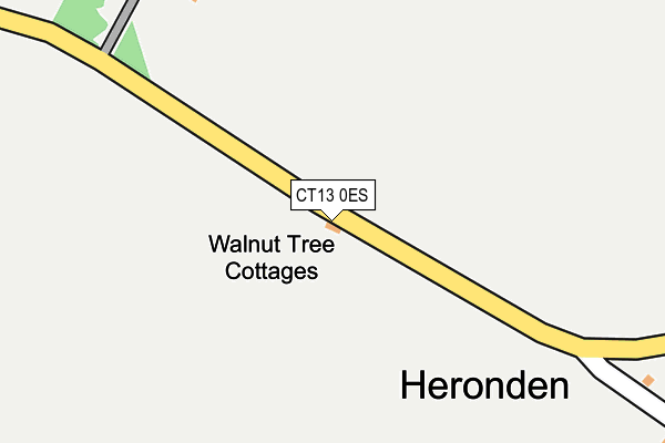
CT13 0ES lies on Heronden Road in Eastry, Sandwich. CT13 0ES is located in the Eastry Rural electoral ward, within the local authority district of Dover and the English Parliamentary constituency of Dover. The Sub Integrated Care Board (ICB) Location is NHS Kent and Medway ICB - 91Q and the police force is Kent. This postcode has been in use since January 1980.


GetTheData
Source: OS OpenMap – Local (Ordnance Survey)
Source: OS VectorMap District (Ordnance Survey)
Licence: Open Government Licence (requires attribution)
| Easting | 629262 |
| Northing | 154462 |
| Latitude | 51.243242 |
| Longitude | 1.283395 |
GetTheData
Source: Open Postcode Geo
Licence: Open Government Licence
| Street | Heronden Road |
| Locality | Eastry |
| Town/City | Sandwich |
| Country | England |
| Postcode District | CT13 |
➜ See where CT13 is on a map | |
GetTheData
Source: Land Registry Price Paid Data
Licence: Open Government Licence
Elevation or altitude of CT13 0ES as distance above sea level:
| Metres | Feet | |
|---|---|---|
| Elevation | 40m | 131ft |
Elevation is measured from the approximate centre of the postcode, to the nearest point on an OS contour line from OS Terrain 50, which has contour spacing of ten vertical metres.
➜ How high above sea level am I? Find the elevation of your current position using your device's GPS.
GetTheData
Source: Open Postcode Elevation
Licence: Open Government Licence
| Ward | Eastry Rural |
| Constituency | Dover |
GetTheData
Source: ONS Postcode Database
Licence: Open Government Licence
| Mill Green (Mill Lane) | Eastry | 1,099m |
| Albion Road (Gore Lane) | Eastry | 1,137m |
| Mill Green (Mill Lane) | Eastry | 1,190m |
| Albion Road (Gore Lane) | Eastry | 1,227m |
| Brickworks (Hammill Road) | Hammill | 1,319m |
| Sandwich Station | 5.1km |
| Snowdown Station | 5.8km |
GetTheData
Source: NaPTAN
Licence: Open Government Licence
| Percentage of properties with Next Generation Access | 100.0% |
| Percentage of properties with Superfast Broadband | 0.0% |
| Percentage of properties with Ultrafast Broadband | 0.0% |
| Percentage of properties with Full Fibre Broadband | 0.0% |
Superfast Broadband is between 30Mbps and 300Mbps
Ultrafast Broadband is > 300Mbps
| Percentage of properties unable to receive 2Mbps | 0.0% |
| Percentage of properties unable to receive 5Mbps | 0.0% |
| Percentage of properties unable to receive 10Mbps | 0.0% |
| Percentage of properties unable to receive 30Mbps | 100.0% |
GetTheData
Source: Ofcom
Licence: Ofcom Terms of Use (requires attribution)
GetTheData
Source: ONS Postcode Database
Licence: Open Government Licence


➜ Get more ratings from the Food Standards Agency
GetTheData
Source: Food Standards Agency
Licence: FSA terms & conditions
| Last Collection | |||
|---|---|---|---|
| Location | Mon-Fri | Sat | Distance |
| Heronden | 16:30 | 09:00 | 482m |
| Mill Lane | 16:30 | 09:00 | 1,141m |
| Knowlton | 16:30 | 09:00 | 1,545m |
GetTheData
Source: Dracos
Licence: Creative Commons Attribution-ShareAlike
The below table lists the International Territorial Level (ITL) codes (formerly Nomenclature of Territorial Units for Statistics (NUTS) codes) and Local Administrative Units (LAU) codes for CT13 0ES:
| ITL 1 Code | Name |
|---|---|
| TLJ | South East (England) |
| ITL 2 Code | Name |
| TLJ4 | Kent |
| ITL 3 Code | Name |
| TLJ44 | East Kent |
| LAU 1 Code | Name |
| E07000108 | Dover |
GetTheData
Source: ONS Postcode Directory
Licence: Open Government Licence
The below table lists the Census Output Area (OA), Lower Layer Super Output Area (LSOA), and Middle Layer Super Output Area (MSOA) for CT13 0ES:
| Code | Name | |
|---|---|---|
| OA | E00122853 | |
| LSOA | E01024202 | Dover 002A |
| MSOA | E02005042 | Dover 002 |
GetTheData
Source: ONS Postcode Directory
Licence: Open Government Licence
| CT13 0ET | Heronden Road | 469m |
| CT13 0EH | 858m | |
| CT13 0EZ | Heronden View | 927m |
| CT13 0EU | Thornton Lane | 933m |
| CT13 0EX | Mill Bank | 971m |
| CT13 0LF | Mill Lane | 1081m |
| CT13 0LQ | Gore Lane | 1082m |
| CT13 0LH | Upper Gore Lane | 1144m |
| CT13 0LE | Mill Green | 1160m |
| CT13 0LL | Albion Road | 1165m |
GetTheData
Source: Open Postcode Geo; Land Registry Price Paid Data
Licence: Open Government Licence