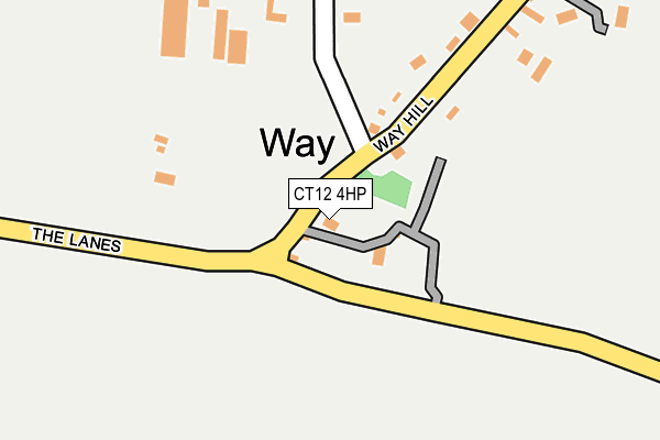
CT12 4HP lies on Way Hill in Minster, Ramsgate. CT12 4HP is located in the Thanet Villages electoral ward, within the local authority district of Thanet and the English Parliamentary constituency of North Thanet. The Sub Integrated Care Board (ICB) Location is NHS Kent and Medway ICB - 91Q and the police force is Kent. This postcode has been in use since June 1981.


GetTheData
Source: OS OpenMap – Local (Ordnance Survey)
Source: OS VectorMap District (Ordnance Survey)
Licence: Open Government Licence (requires attribution)
| Easting | 631969 |
| Northing | 164838 |
| Latitude | 51.335290 |
| Longitude | 1.328843 |
GetTheData
Source: Open Postcode Geo
Licence: Open Government Licence
| Street | Way Hill |
| Locality | Minster |
| Town/City | Ramsgate |
| Country | England |
| Postcode District | CT12 |
➜ See where CT12 is on a map ➜ Where is Way? | |
GetTheData
Source: Land Registry Price Paid Data
Licence: Open Government Licence
Elevation or altitude of CT12 4HP as distance above sea level:
| Metres | Feet | |
|---|---|---|
| Elevation | 20m | 66ft |
Elevation is measured from the approximate centre of the postcode, to the nearest point on an OS contour line from OS Terrain 50, which has contour spacing of ten vertical metres.
➜ How high above sea level am I? Find the elevation of your current position using your device's GPS.
GetTheData
Source: Open Postcode Elevation
Licence: Open Government Licence
| Ward | Thanet Villages |
| Constituency | North Thanet |
GetTheData
Source: ONS Postcode Database
Licence: Open Government Licence
| Way Hill (Grinsell Hill) | Way | 20m |
| Way Hill (Grinsell Hill) | Way | 25m |
| Abbey (Bedlam Court Lane) | Minster | 796m |
| Foxborough Lane (Tothill Street) | Minster | 989m |
| Foxborough Lane (Tothill Street) | Minster | 994m |
| Minster Station | 1.1km |
| Birchington-on-Sea Station | 5.1km |
GetTheData
Source: NaPTAN
Licence: Open Government Licence
| Percentage of properties with Next Generation Access | 100.0% |
| Percentage of properties with Superfast Broadband | 0.0% |
| Percentage of properties with Ultrafast Broadband | 0.0% |
| Percentage of properties with Full Fibre Broadband | 0.0% |
Superfast Broadband is between 30Mbps and 300Mbps
Ultrafast Broadband is > 300Mbps
| Percentage of properties unable to receive 2Mbps | 0.0% |
| Percentage of properties unable to receive 5Mbps | 0.0% |
| Percentage of properties unable to receive 10Mbps | 0.0% |
| Percentage of properties unable to receive 30Mbps | 100.0% |
GetTheData
Source: Ofcom
Licence: Ofcom Terms of Use (requires attribution)
GetTheData
Source: ONS Postcode Database
Licence: Open Government Licence


➜ Get more ratings from the Food Standards Agency
GetTheData
Source: Food Standards Agency
Licence: FSA terms & conditions
| Last Collection | |||
|---|---|---|---|
| Location | Mon-Fri | Sat | Distance |
| Way Hill | 16:30 | 09:00 | 151m |
| Pinks Corner | 16:30 | 09:00 | 374m |
| Minster Post Office | 17:00 | 12:00 | 980m |
GetTheData
Source: Dracos
Licence: Creative Commons Attribution-ShareAlike
The below table lists the International Territorial Level (ITL) codes (formerly Nomenclature of Territorial Units for Statistics (NUTS) codes) and Local Administrative Units (LAU) codes for CT12 4HP:
| ITL 1 Code | Name |
|---|---|
| TLJ | South East (England) |
| ITL 2 Code | Name |
| TLJ4 | Kent |
| ITL 3 Code | Name |
| TLJ44 | East Kent |
| LAU 1 Code | Name |
| E07000114 | Thanet |
GetTheData
Source: ONS Postcode Directory
Licence: Open Government Licence
The below table lists the Census Output Area (OA), Lower Layer Super Output Area (LSOA), and Middle Layer Super Output Area (MSOA) for CT12 4HP:
| Code | Name | |
|---|---|---|
| OA | E00125389 | |
| LSOA | E01024701 | Thanet 014A |
| MSOA | E02005145 | Thanet 014 |
GetTheData
Source: ONS Postcode Directory
Licence: Open Government Licence
| CT12 4HS | Way Hill | 263m |
| CT12 4HN | The Lanes | 308m |
| CT12 4HH | Laundry Road | 390m |
| CT12 4HT | Way Hill | 404m |
| CT12 4HJ | Laundry Road | 408m |
| CT12 4HR | Wayborough Hill | 424m |
| CT12 4HU | Way Hill | 727m |
| CT12 4HG | Bedlam Court Lane | 755m |
| CT12 4HE | Durlock | 764m |
| CT12 4HD | Durlock | 795m |
GetTheData
Source: Open Postcode Geo; Land Registry Price Paid Data
Licence: Open Government Licence