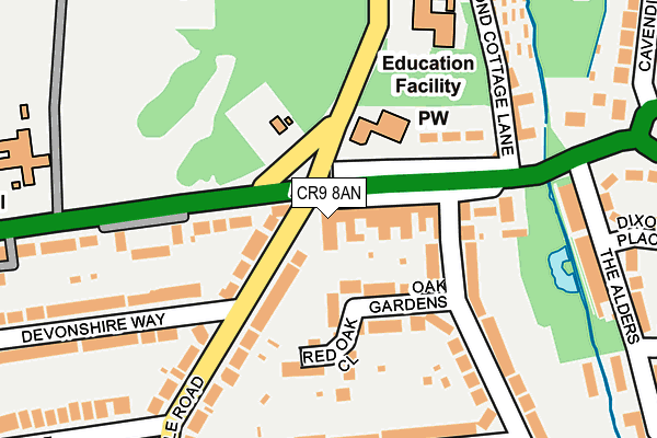
CR9 8AN is located in the Shirley South electoral ward, within the London borough of Croydon and the English Parliamentary constituency of Croydon Central. The Sub Integrated Care Board (ICB) Location is NHS South West London ICB - 36L and the police force is Metropolitan Police. This postcode has been in use since January 1993.


GetTheData
Source: OS OpenMap – Local (Ordnance Survey)
Source: OS VectorMap District (Ordnance Survey)
Licence: Open Government Licence (requires attribution)
| Easting | 537301 |
| Northing | 166059 |
| Latitude | 51.376989 |
| Longitude | -0.028629 |
GetTheData
Source: Open Postcode Geo
Licence: Open Government Licence
| Country | England |
| Postcode District | CR9 |
➜ Where is London? | |
GetTheData
Source: Land Registry Price Paid Data
Licence: Open Government Licence
Elevation or altitude of CR9 8AN as distance above sea level:
| Metres | Feet | |
|---|---|---|
| Elevation | 70m | 230ft |
Elevation is measured from the approximate centre of the postcode, to the nearest point on an OS contour line from OS Terrain 50, which has contour spacing of ten vertical metres.
➜ How high above sea level am I? Find the elevation of your current position using your device's GPS.
GetTheData
Source: Open Postcode Elevation
Licence: Open Government Licence
| Ward | Shirley South |
| Constituency | Croydon Central |
GetTheData
Source: ONS Postcode Database
Licence: Open Government Licence
| Monks Orchard Road (Bridle Road) | Spring Park | 25m |
| West Wickham Baptist Church (Wickham Road) | Spring Park | 46m |
| Shirley Wickham Road | Spring Park | 69m |
| Shirley Wickham Road (Monks Orchard Road) | Spring Park | 80m |
| West Wickham Baptist Church | Spring Park | 90m |
| West Wickham Station | 1.1km |
| Eden Park Station | 1.5km |
| Hayes (Kent) Station | 2.7km |
GetTheData
Source: NaPTAN
Licence: Open Government Licence
GetTheData
Source: ONS Postcode Database
Licence: Open Government Licence


➜ Get more ratings from the Food Standards Agency
GetTheData
Source: Food Standards Agency
Licence: FSA terms & conditions
| Last Collection | |||
|---|---|---|---|
| Location | Mon-Fri | Sat | Distance |
| 806 Wickham Road P.o. | 17:30 | 12:00 | 33m |
| Oak Avenue (51) | 17:30 | 12:00 | 335m |
| Bushey Road(73) | 17:30 | 12:00 | 402m |
GetTheData
Source: Dracos
Licence: Creative Commons Attribution-ShareAlike
The below table lists the International Territorial Level (ITL) codes (formerly Nomenclature of Territorial Units for Statistics (NUTS) codes) and Local Administrative Units (LAU) codes for CR9 8AN:
| ITL 1 Code | Name |
|---|---|
| TLI | London |
| ITL 2 Code | Name |
| TLI6 | Outer London - South |
| ITL 3 Code | Name |
| TLI62 | Croydon |
| LAU 1 Code | Name |
| E09000008 | Croydon |
GetTheData
Source: ONS Postcode Directory
Licence: Open Government Licence
The below table lists the Census Output Area (OA), Lower Layer Super Output Area (LSOA), and Middle Layer Super Output Area (MSOA) for CR9 8AN:
| Code | Name | |
|---|---|---|
| OA | E00005617 | |
| LSOA | E01001135 | Croydon 025D |
| MSOA | E02000218 | Croydon 025 |
GetTheData
Source: ONS Postcode Directory
Licence: Open Government Licence
| CR0 8EB | Wickham Road | 55m |
| CR0 8ES | Oak Gardens | 74m |
| CR0 8HA | Bridle Road | 76m |
| CR0 8EH | Wickham Road | 133m |
| CR0 8ED | Wickham Road | 135m |
| CR0 8EA | Wickham Road | 138m |
| CR0 8HN | Bridle Road | 148m |
| CR0 8EE | Oak Avenue | 160m |
| CR0 8EN | Oak Avenue | 192m |
| BR4 0QD | Pond Cottage Lane | 193m |
GetTheData
Source: Open Postcode Geo; Land Registry Price Paid Data
Licence: Open Government Licence