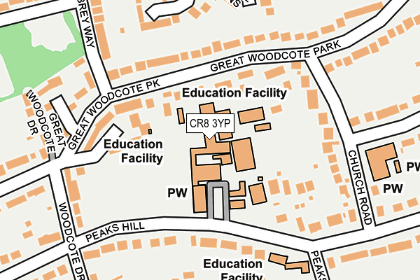
CR8 3YP is located in the South Beddington & Roundshaw electoral ward, within the London borough of Sutton and the English Parliamentary constituency of Carshalton and Wallington. The Sub Integrated Care Board (ICB) Location is NHS South West London ICB - 36L and the police force is Metropolitan Police. This postcode has been in use since February 1990.


GetTheData
Source: OS OpenMap – Local (Ordnance Survey)
Source: OS VectorMap District (Ordnance Survey)
Licence: Open Government Licence (requires attribution)
| Easting | 530068 |
| Northing | 162321 |
| Latitude | 51.345097 |
| Longitude | -0.133833 |
GetTheData
Source: Open Postcode Geo
Licence: Open Government Licence
| Country | England |
| Postcode District | CR8 |
➜ See where CR8 is on a map ➜ Where is London? | |
GetTheData
Source: Land Registry Price Paid Data
Licence: Open Government Licence
Elevation or altitude of CR8 3YP as distance above sea level:
| Metres | Feet | |
|---|---|---|
| Elevation | 100m | 328ft |
Elevation is measured from the approximate centre of the postcode, to the nearest point on an OS contour line from OS Terrain 50, which has contour spacing of ten vertical metres.
➜ How high above sea level am I? Find the elevation of your current position using your device's GPS.
GetTheData
Source: Open Postcode Elevation
Licence: Open Government Licence
| Ward | South Beddington & Roundshaw |
| Constituency | Carshalton And Wallington |
GetTheData
Source: ONS Postcode Database
Licence: Open Government Licence
| Woodcote Drive (Foxley Lane) | Woodcote | 206m |
| The Bridle Road | Purley | 329m |
| The Bridle Road | Purley | 354m |
| Woodcote Drive | Woodcote | 376m |
| Woodcote Lane | Woodcote | 562m |
| Purley Station | 1.6km |
| Reedham (Surrey) Station | 1.7km |
| Wallington Station | 2.1km |
GetTheData
Source: NaPTAN
Licence: Open Government Licence
GetTheData
Source: ONS Postcode Database
Licence: Open Government Licence


➜ Get more ratings from the Food Standards Agency
GetTheData
Source: Food Standards Agency
Licence: FSA terms & conditions
| Last Collection | |||
|---|---|---|---|
| Location | Mon-Fri | Sat | Distance |
| Forresters Drive (Near 232) | 17:15 | 12:00 | 391m |
| Apeldoorn Drive (29) | 17:15 | 12:00 | 625m |
| Alington Grove (72) | 17:30 | 12:00 | 665m |
GetTheData
Source: Dracos
Licence: Creative Commons Attribution-ShareAlike
The below table lists the International Territorial Level (ITL) codes (formerly Nomenclature of Territorial Units for Statistics (NUTS) codes) and Local Administrative Units (LAU) codes for CR8 3YP:
| ITL 1 Code | Name |
|---|---|
| TLI | London |
| ITL 2 Code | Name |
| TLI6 | Outer London - South |
| ITL 3 Code | Name |
| TLI63 | Merton, Kingston upon Thames and Sutton |
| LAU 1 Code | Name |
| E09000029 | Sutton |
GetTheData
Source: ONS Postcode Directory
Licence: Open Government Licence
The below table lists the Census Output Area (OA), Lower Layer Super Output Area (LSOA), and Middle Layer Super Output Area (MSOA) for CR8 3YP:
| Code | Name | |
|---|---|---|
| OA | E00020587 | |
| LSOA | E01004085 | Sutton 024B |
| MSOA | E02000863 | Sutton 024 |
GetTheData
Source: ONS Postcode Directory
Licence: Open Government Licence
| CR8 3JJ | Peaks Hill | 106m |
| CR8 3QT | Great Woodcote Park | 114m |
| CR8 3QW | Goldcrest Way | 140m |
| CR8 3JF | Peaks Hill | 146m |
| CR8 3QR | Great Woodcote Park | 169m |
| CR8 3QQ | Church Road | 174m |
| CR8 3NB | Foxley Lane | 181m |
| CR8 3PD | Woodcote Drive | 200m |
| CR8 3JH | Peaks Hill Rise | 216m |
| CR8 3AY | Foxley Lane | 239m |
GetTheData
Source: Open Postcode Geo; Land Registry Price Paid Data
Licence: Open Government Licence