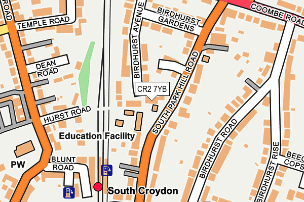
CR2 7YB is located in the South Croydon electoral ward, within the London borough of Croydon and the English Parliamentary constituency of Croydon South. The Sub Integrated Care Board (ICB) Location is NHS South West London ICB - 36L and the police force is Metropolitan Police. This postcode has been in use since January 1980.


GetTheData
Source: OS OpenMap – Local (Ordnance Survey)
Source: OS VectorMap District (Ordnance Survey)
Licence: Open Government Licence (requires attribution)
| Easting | 532938 |
| Northing | 164518 |
| Latitude | 51.364178 |
| Longitude | -0.091855 |
GetTheData
Source: Open Postcode Geo
Licence: Open Government Licence
| Country | England |
| Postcode District | CR2 |
➜ See where CR2 is on a map ➜ Where is Croydon? | |
GetTheData
Source: Land Registry Price Paid Data
Licence: Open Government Licence
Elevation or altitude of CR2 7YB as distance above sea level:
| Metres | Feet | |
|---|---|---|
| Elevation | 60m | 197ft |
Elevation is measured from the approximate centre of the postcode, to the nearest point on an OS contour line from OS Terrain 50, which has contour spacing of ten vertical metres.
➜ How high above sea level am I? Find the elevation of your current position using your device's GPS.
GetTheData
Source: Open Postcode Elevation
Licence: Open Government Licence
| Ward | South Croydon |
| Constituency | Croydon South |
GetTheData
Source: ONS Postcode Database
Licence: Open Government Licence
| Elmhurst School (South Park Hill Road) | South Croydon | 16m |
| Elmhurst School (South Park Hill Road) | South Croydon | 55m |
| Birdhurst Gardens (South Park Hill Road) | South Croydon | 161m |
| Birdhurst Gardens (South Park Hill Road) | South Croydon | 205m |
| South Croydon (St Peter's Road) | South Croydon | 226m |
| Lloyd Park Tram Stop (Coombe Road) | South Croydon | 772m |
| East Croydon Tram Stop (George Street) | Croydon | 1,189m |
| George Street Tram Stop (George Street) | Croydon | 1,191m |
| Wellesley Road Tram Stop (Wellesley Road) | Croydon | 1,306m |
| Lebanon Road Tram Stop (Addiscombe Road) | Addiscombe | 1,316m |
| South Croydon Station | 0.2km |
| East Croydon Station | 1.3km |
| West Croydon Station | 1.8km |
GetTheData
Source: NaPTAN
Licence: Open Government Licence
| Percentage of properties with Next Generation Access | 100.0% |
| Percentage of properties with Superfast Broadband | 100.0% |
| Percentage of properties with Ultrafast Broadband | 100.0% |
| Percentage of properties with Full Fibre Broadband | 0.0% |
Superfast Broadband is between 30Mbps and 300Mbps
Ultrafast Broadband is > 300Mbps
| Percentage of properties unable to receive 2Mbps | 0.0% |
| Percentage of properties unable to receive 5Mbps | 0.0% |
| Percentage of properties unable to receive 10Mbps | 0.0% |
| Percentage of properties unable to receive 30Mbps | 0.0% |
GetTheData
Source: Ofcom
Licence: Ofcom Terms of Use (requires attribution)
GetTheData
Source: ONS Postcode Database
Licence: Open Government Licence


➜ Get more ratings from the Food Standards Agency
GetTheData
Source: Food Standards Agency
Licence: FSA terms & conditions
| Last Collection | |||
|---|---|---|---|
| Location | Mon-Fri | Sat | Distance |
| Birdhurst Road (23) | 16:45 | 12:00 | 162m |
| Croham Road (70) | 16:45 | 12:00 | 312m |
| Coombe Road(159) | 16:15 | 12:00 | 385m |
GetTheData
Source: Dracos
Licence: Creative Commons Attribution-ShareAlike
The below table lists the International Territorial Level (ITL) codes (formerly Nomenclature of Territorial Units for Statistics (NUTS) codes) and Local Administrative Units (LAU) codes for CR2 7YB:
| ITL 1 Code | Name |
|---|---|
| TLI | London |
| ITL 2 Code | Name |
| TLI6 | Outer London - South |
| ITL 3 Code | Name |
| TLI62 | Croydon |
| LAU 1 Code | Name |
| E09000008 | Croydon |
GetTheData
Source: ONS Postcode Directory
Licence: Open Government Licence
The below table lists the Census Output Area (OA), Lower Layer Super Output Area (LSOA), and Middle Layer Super Output Area (MSOA) for CR2 7YB:
| Code | Name | |
|---|---|---|
| OA | E00005134 | |
| LSOA | E01001035 | Croydon 027A |
| MSOA | E02000220 | Croydon 027 |
GetTheData
Source: ONS Postcode Directory
Licence: Open Government Licence
| CR2 7EW | Rosamund Close | 86m |
| CR2 7DZ | South Park Hill Road | 89m |
| CR2 7DX | Birdhurst Avenue | 133m |
| CR2 7DW | South Park Hill Road | 133m |
| CR2 7DU | South Park Hill Road | 146m |
| CR2 7DY | South Park Hill Road | 152m |
| CR0 1JT | Hurst Road | 154m |
| CR2 7EB | Birdhurst Road | 167m |
| CR2 7EF | Birdhurst Road | 174m |
| CR0 1JU | Deanfield Gardens | 178m |
GetTheData
Source: Open Postcode Geo; Land Registry Price Paid Data
Licence: Open Government Licence