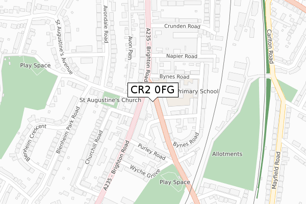
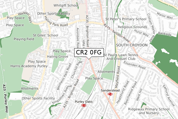
CR2 0FG is located in the South Croydon electoral ward, within the London borough of Croydon and the English Parliamentary constituency of Croydon South. The Sub Integrated Care Board (ICB) Location is NHS South West London ICB - 36L and the police force is Metropolitan Police. This postcode has been in use since November 2018.


GetTheData
Source: OS Open Zoomstack (Ordnance Survey)
Licence: Open Government Licence (requires attribution)
Attribution: Contains OS data © Crown copyright and database right 2024
Source: Open Postcode Geo
Licence: Open Government Licence (requires attribution)
Attribution: Contains OS data © Crown copyright and database right 2024; Contains Royal Mail data © Royal Mail copyright and database right 2024; Source: Office for National Statistics licensed under the Open Government Licence v.3.0
| Easting | 532568 |
| Northing | 163233 |
| Latitude | 51.352716 |
| Longitude | -0.097619 |
GetTheData
Source: Open Postcode Geo
Licence: Open Government Licence
| Country | England |
| Postcode District | CR2 |
| ➜ CR2 open data dashboard ➜ See where CR2 is on a map ➜ Where is Croydon? | |
GetTheData
Source: Land Registry Price Paid Data
Licence: Open Government Licence
| Ward | South Croydon |
| Constituency | Croydon South |
GetTheData
Source: ONS Postcode Database
Licence: Open Government Licence
| June 2022 | Burglary | On or near Sanderstead Road | 55m |
| June 2022 | Robbery | On or near Sanderstead Road | 55m |
| June 2022 | Drugs | On or near Sanderstead Road | 55m |
| ➜ Get more crime data in our Crime section | |||
GetTheData
Source: data.police.uk
Licence: Open Government Licence
| Sanderstead Road (Brighton Road) | South Croydon | 56m |
| Sanderstead Road (Brighton Road) | South Croydon | 102m |
| South Croydon Bus Garage (Brighton Road) | South Croydon | 128m |
| South Croydon Bus Garage (Brighton Road) | South Croydon | 228m |
| South Croydon Bus Garage (Brighton Road) | South Croydon | 279m |
| Lloyd Park Tram Stop (Coombe Road) | South Croydon | 1,742m |
| Sanderstead Station | 0.6km |
| Purley Oaks Station | 0.6km |
| South Croydon Station | 1.2km |
GetTheData
Source: NaPTAN
Licence: Open Government Licence
| Percentage of properties with Next Generation Access | 100.0% |
| Percentage of properties with Superfast Broadband | 100.0% |
| Percentage of properties with Ultrafast Broadband | 0.0% |
| Percentage of properties with Full Fibre Broadband | 0.0% |
Superfast Broadband is between 30Mbps and 300Mbps
Ultrafast Broadband is > 300Mbps
| Percentage of properties unable to receive 2Mbps | 0.0% |
| Percentage of properties unable to receive 5Mbps | 0.0% |
| Percentage of properties unable to receive 10Mbps | 0.0% |
| Percentage of properties unable to receive 30Mbps | 0.0% |
GetTheData
Source: Ofcom
Licence: Ofcom Terms of Use (requires attribution)
GetTheData
Source: ONS Postcode Database
Licence: Open Government Licence


➜ Get more ratings from the Food Standards Agency
GetTheData
Source: Food Standards Agency
Licence: FSA terms & conditions
| Last Collection | |||
|---|---|---|---|
| Location | Mon-Fri | Sat | Distance |
| St Augustines Avenue(13) | 16:00 | 12:00 | 231m |
| Brighton Road (404) | 16:45 | 12:00 | 357m |
| Mayfield Road(27) | 16:45 | 12:00 | 595m |
GetTheData
Source: Dracos
Licence: Creative Commons Attribution-ShareAlike
| Facility | Distance |
|---|---|
| St Augustine's Centre St. Augustines Avenue, South Croydon Sports Hall | 143m |
| South Croydon Recreation Ground (Closed) Sanderstead Road, South Croydon Grass Pitches | 389m |
| Haling Grove Haling Grove, South Croydon Grass Pitches | 402m |
GetTheData
Source: Active Places
Licence: Open Government Licence
| School | Phase of Education | Distance |
|---|---|---|
| Purley Oaks Primary School Bynes Road, South Croydon, CR2 0PR | Primary | 117m |
| Regina Coeli Catholic Primary School 173 Pampisford Road, South Croydon, CR2 6DF | Primary | 680m |
| St Giles School Pampisford Road, South Croydon, CR2 6DF | Not applicable | 688m |
GetTheData
Source: Edubase
Licence: Open Government Licence
| Risk of CR2 0FG flooding from rivers and sea | Medium |
| ➜ CR2 0FG flood map | |
GetTheData
Source: Open Flood Risk by Postcode
Licence: Open Government Licence
The below table lists the International Territorial Level (ITL) codes (formerly Nomenclature of Territorial Units for Statistics (NUTS) codes) and Local Administrative Units (LAU) codes for CR2 0FG:
| ITL 1 Code | Name |
|---|---|
| TLI | London |
| ITL 2 Code | Name |
| TLI6 | Outer London - South |
| ITL 3 Code | Name |
| TLI62 | Croydon |
| LAU 1 Code | Name |
| E09000008 | Croydon |
GetTheData
Source: ONS Postcode Directory
Licence: Open Government Licence
The below table lists the Census Output Area (OA), Lower Layer Super Output Area (LSOA), and Middle Layer Super Output Area (MSOA) for CR2 0FG:
| Code | Name | |
|---|---|---|
| OA | E00005171 | |
| LSOA | E01001041 | Croydon 031C |
| MSOA | E02000224 | Croydon 031 |
GetTheData
Source: ONS Postcode Directory
Licence: Open Government Licence
| CR2 0PE | Sanderstead Road | 26m |
| CR2 0PA | Sanderstead Road | 61m |
| CR2 6AG | Brighton Road | 67m |
| CR2 6AH | Brighton Road | 86m |
| CR2 6EQ | Brighton Road | 87m |
| CR2 0PF | Sanderstead Road | 104m |
| CR2 0PT | Rolleston Road | 104m |
| CR2 6BS | St Augustines Avenue | 108m |
| CR2 6HX | Darmaine Close | 117m |
| CR2 6EN | Brighton Road | 119m |
GetTheData
Source: Open Postcode Geo; Land Registry Price Paid Data
Licence: Open Government Licence