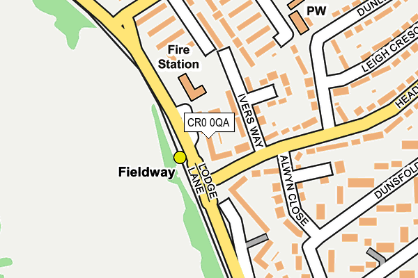
CR0 0QA lies on Lodge Lane in New Addington, Croydon. CR0 0QA is located in the New Addington North electoral ward, within the London borough of Croydon and the English Parliamentary constituency of Croydon Central. The Sub Integrated Care Board (ICB) Location is NHS South West London ICB - 36L and the police force is Metropolitan Police. This postcode has been in use since January 1980.


GetTheData
Source: OS OpenMap – Local (Ordnance Survey)
Source: OS VectorMap District (Ordnance Survey)
Licence: Open Government Licence (requires attribution)
| Easting | 537728 |
| Northing | 163196 |
| Latitude | 51.351158 |
| Longitude | -0.023605 |
GetTheData
Source: Open Postcode Geo
Licence: Open Government Licence
| Street | Lodge Lane |
| Locality | New Addington |
| Town/City | Croydon |
| Country | England |
| Postcode District | CR0 |
➜ See where CR0 is on a map ➜ Where is London? | |
GetTheData
Source: Land Registry Price Paid Data
Licence: Open Government Licence
Elevation or altitude of CR0 0QA as distance above sea level:
| Metres | Feet | |
|---|---|---|
| Elevation | 120m | 394ft |
Elevation is measured from the approximate centre of the postcode, to the nearest point on an OS contour line from OS Terrain 50, which has contour spacing of ten vertical metres.
➜ How high above sea level am I? Find the elevation of your current position using your device's GPS.
GetTheData
Source: Open Postcode Elevation
Licence: Open Government Licence
| Ward | New Addington North |
| Constituency | Croydon Central |
GetTheData
Source: ONS Postcode Database
Licence: Open Government Licence
| Ivers Way | Forestdale | 50m |
| Fieldway Tram Stop (Lodge Lane) | Forestdale | 56m |
| Fieldway Tram Stop (Lodge Lane) | Forestdale | 114m |
| Dunley Drive | New Addington | 191m |
| Applegarth (Fieldway) | Addington | 229m |
| Fieldway Tram Stop (Lodge Lane) | Forestdale | 67m |
| King Henry's Drive Tram Stop (Parkway) | New Addington | 685m |
| Addington Village Tram Stop (Kent Gate Way) | Addington | 849m |
| New Addington Tram Stop (Central Park) | New Addington | 1,046m |
| Gravel Hill Tram Stop (Gravel Hill) | Forestdale | 1,413m |
| West Wickham Station | 3.4km |
| Hayes (Kent) Station | 3.7km |
| Eden Park Station | 4.3km |
GetTheData
Source: NaPTAN
Licence: Open Government Licence
| Percentage of properties with Next Generation Access | 100.0% |
| Percentage of properties with Superfast Broadband | 100.0% |
| Percentage of properties with Ultrafast Broadband | 100.0% |
| Percentage of properties with Full Fibre Broadband | 0.0% |
Superfast Broadband is between 30Mbps and 300Mbps
Ultrafast Broadband is > 300Mbps
| Median download speed | 74.1Mbps |
| Average download speed | 75.8Mbps |
| Maximum download speed | 200.00Mbps |
| Median upload speed | 1.1Mbps |
| Average upload speed | 2.9Mbps |
| Maximum upload speed | 19.53Mbps |
| Percentage of properties unable to receive 2Mbps | 0.0% |
| Percentage of properties unable to receive 5Mbps | 0.0% |
| Percentage of properties unable to receive 10Mbps | 0.0% |
| Percentage of properties unable to receive 30Mbps | 0.0% |
GetTheData
Source: Ofcom
Licence: Ofcom Terms of Use (requires attribution)
Estimated total energy consumption in CR0 0QA by fuel type, 2015.
| Consumption (kWh) | 254,449 |
|---|---|
| Meter count | 31 |
| Mean (kWh/meter) | 8,208 |
| Median (kWh/meter) | 7,155 |
| Consumption (kWh) | 75,761 |
|---|---|
| Meter count | 29 |
| Mean (kWh/meter) | 2,612 |
| Median (kWh/meter) | 2,474 |
GetTheData
Source: Postcode level gas estimates: 2015 (experimental)
Source: Postcode level electricity estimates: 2015 (experimental)
Licence: Open Government Licence
GetTheData
Source: ONS Postcode Database
Licence: Open Government Licence

➜ Get more ratings from the Food Standards Agency
GetTheData
Source: Food Standards Agency
Licence: FSA terms & conditions
| Last Collection | |||
|---|---|---|---|
| Location | Mon-Fri | Sat | Distance |
| Leigh Crescent (43) | 17:45 | 12:00 | 184m |
| Walton Green (42) | 18:00 | 12:00 | 340m |
| Headley Drive Tso (118) | 18:00 | 12:00 | 554m |
GetTheData
Source: Dracos
Licence: Creative Commons Attribution-ShareAlike
The below table lists the International Territorial Level (ITL) codes (formerly Nomenclature of Territorial Units for Statistics (NUTS) codes) and Local Administrative Units (LAU) codes for CR0 0QA:
| ITL 1 Code | Name |
|---|---|
| TLI | London |
| ITL 2 Code | Name |
| TLI6 | Outer London - South |
| ITL 3 Code | Name |
| TLI62 | Croydon |
| LAU 1 Code | Name |
| E09000008 | Croydon |
GetTheData
Source: ONS Postcode Directory
Licence: Open Government Licence
The below table lists the Census Output Area (OA), Lower Layer Super Output Area (LSOA), and Middle Layer Super Output Area (MSOA) for CR0 0QA:
| Code | Name | |
|---|---|---|
| OA | E00005250 | |
| LSOA | E01001054 | Croydon 030C |
| MSOA | E02000223 | Croydon 030 |
GetTheData
Source: ONS Postcode Directory
Licence: Open Government Licence
| CR0 0QQ | Ivers Way | 82m |
| CR0 0QB | Lodge Lane | 96m |
| CR0 0QP | Alwyn Close | 159m |
| CR0 0QE | Headley Drive | 159m |
| CR0 9DB | Applegarth | 168m |
| CR0 9DA | Applegarth | 177m |
| CR0 0QD | Lodge Lane | 179m |
| CR0 9DD | Applegarth | 194m |
| CR0 0QH | Headley Drive | 217m |
| CR0 0TQ | Dunsfold Way | 233m |
GetTheData
Source: Open Postcode Geo; Land Registry Price Paid Data
Licence: Open Government Licence