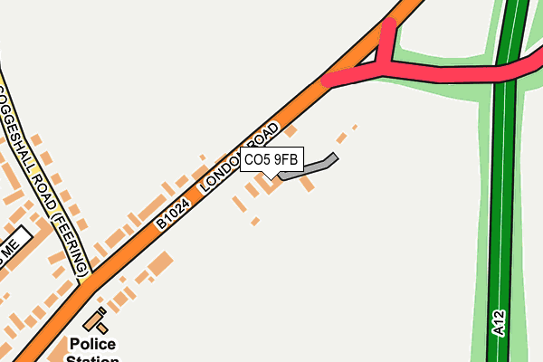
CO5 9FB lies on London Road in Feering, Colchester. CO5 9FB is located in the Kelvedon & Feering electoral ward, within the local authority district of Braintree and the English Parliamentary constituency of Witham. The Sub Integrated Care Board (ICB) Location is NHS Mid and South Essex ICB - 06Q and the police force is Essex. This postcode has been in use since July 2007.


GetTheData
Source: OS OpenMap – Local (Ordnance Survey)
Source: OS VectorMap District (Ordnance Survey)
Licence: Open Government Licence (requires attribution)
| Easting | 587492 |
| Northing | 219892 |
| Latitude | 51.846136 |
| Longitude | 0.720542 |
GetTheData
Source: Open Postcode Geo
Licence: Open Government Licence
| Street | London Road |
| Locality | Feering |
| Town/City | Colchester |
| Country | England |
| Postcode District | CO5 |
➜ See where CO5 is on a map ➜ Where is Feering? | |
GetTheData
Source: Land Registry Price Paid Data
Licence: Open Government Licence
Elevation or altitude of CO5 9FB as distance above sea level:
| Metres | Feet | |
|---|---|---|
| Elevation | 30m | 98ft |
Elevation is measured from the approximate centre of the postcode, to the nearest point on an OS contour line from OS Terrain 50, which has contour spacing of ten vertical metres.
➜ How high above sea level am I? Find the elevation of your current position using your device's GPS.
GetTheData
Source: Open Postcode Elevation
Licence: Open Government Licence
| Ward | Kelvedon & Feering |
| Constituency | Witham |
GetTheData
Source: ONS Postcode Database
Licence: Open Government Licence
| Prested Hall (B1024 London Road Slip From A12) | Feering | 217m |
| Gore Pit Corner (Feering Hill) | Feering | 331m |
| Gore Pit Corner (Feering Hill) | Feering | 333m |
| Gore Pit Corner (Inworth Road) | Feering | 420m |
| Gore Pit Corner (Inworth Road) | Feering | 425m |
| Kelvedon Station | 1.4km |
| Marks Tey Station | 5.8km |
GetTheData
Source: NaPTAN
Licence: Open Government Licence
GetTheData
Source: ONS Postcode Database
Licence: Open Government Licence


➜ Get more ratings from the Food Standards Agency
GetTheData
Source: Food Standards Agency
Licence: FSA terms & conditions
| Last Collection | |||
|---|---|---|---|
| Location | Mon-Fri | Sat | Distance |
| Rye Mill Lane Kelvedon | 17:00 | 10:30 | 414m |
| New Lane Feering | 17:00 | 10:30 | 519m |
| Feering Hill | 16:45 | 10:30 | 862m |
GetTheData
Source: Dracos
Licence: Creative Commons Attribution-ShareAlike
The below table lists the International Territorial Level (ITL) codes (formerly Nomenclature of Territorial Units for Statistics (NUTS) codes) and Local Administrative Units (LAU) codes for CO5 9FB:
| ITL 1 Code | Name |
|---|---|
| TLH | East |
| ITL 2 Code | Name |
| TLH3 | Essex |
| ITL 3 Code | Name |
| TLH34 | Essex Haven Gateway |
| LAU 1 Code | Name |
| E07000067 | Braintree |
GetTheData
Source: ONS Postcode Directory
Licence: Open Government Licence
The below table lists the Census Output Area (OA), Lower Layer Super Output Area (LSOA), and Middle Layer Super Output Area (MSOA) for CO5 9FB:
| Code | Name | |
|---|---|---|
| OA | E00108710 | |
| LSOA | E01021403 | Braintree 014F |
| MSOA | E02004459 | Braintree 014 |
GetTheData
Source: ONS Postcode Directory
Licence: Open Government Licence
| CO5 9ED | London Road | 126m |
| CO5 9ET | Franklin Gate | 212m |
| CO5 9QB | Coggeshall Road | 240m |
| CO5 9EA | London Road | 295m |
| CO5 9SS | Millers Mead | 316m |
| CO5 9SU | Harvest Court | 331m |
| CO5 9SR | Watermill Road | 351m |
| CO5 9QE | Coggeshall Road | 424m |
| CO5 9QF | Coggeshall Road | 427m |
| CO5 9QG | The Green | 442m |
GetTheData
Source: Open Postcode Geo; Land Registry Price Paid Data
Licence: Open Government Licence