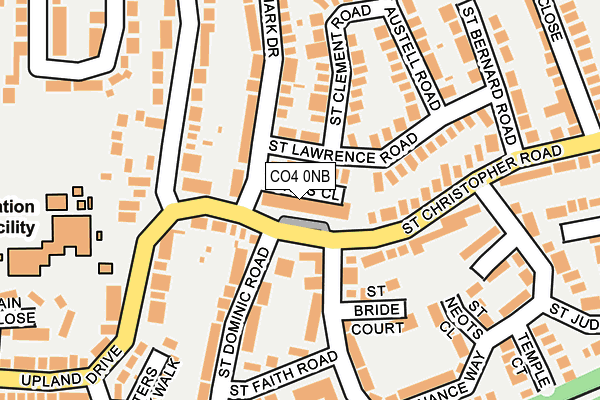
CO4 0NB is located in the St Anne's and St John's electoral ward, within the local authority district of Colchester and the English Parliamentary constituency of Colchester. The Sub Integrated Care Board (ICB) Location is NHS Suffolk and North East Essex ICB - 06T and the police force is Essex. This postcode has been in use since June 2002.


GetTheData
Source: OS OpenMap – Local (Ordnance Survey)
Source: OS VectorMap District (Ordnance Survey)
Licence: Open Government Licence (requires attribution)
| Easting | 601637 |
| Northing | 226771 |
| Latitude | 51.902979 |
| Longitude | 0.929630 |
GetTheData
Source: Open Postcode Geo
Licence: Open Government Licence
| Country | England |
| Postcode District | CO4 |
➜ See where CO4 is on a map ➜ Where is Colchester? | |
GetTheData
Source: Land Registry Price Paid Data
Licence: Open Government Licence
Elevation or altitude of CO4 0NB as distance above sea level:
| Metres | Feet | |
|---|---|---|
| Elevation | 30m | 98ft |
Elevation is measured from the approximate centre of the postcode, to the nearest point on an OS contour line from OS Terrain 50, which has contour spacing of ten vertical metres.
➜ How high above sea level am I? Find the elevation of your current position using your device's GPS.
GetTheData
Source: Open Postcode Elevation
Licence: Open Government Licence
| Ward | St Anne's And St John's |
| Constituency | Colchester |
GetTheData
Source: ONS Postcode Database
Licence: Open Government Licence
| St. John's Estate Shops (St. Christopher Road) | Colchester | 39m |
| St. John's Estate Shops (St. Christopher Road) | Colchester | 67m |
| St. Cyrus Road (St. Christopher Road) | Colchester | 88m |
| St. Columb Court (St. Cyrus Road) | Colchester | 154m |
| Dart St Johns (St Clement Road) | Colchester | 159m |
| Hythe (Essex) Station | 1.9km |
| Colchester Town Station | 2.5km |
| Colchester Station | 2.6km |
GetTheData
Source: NaPTAN
Licence: Open Government Licence
GetTheData
Source: ONS Postcode Database
Licence: Open Government Licence


➜ Get more ratings from the Food Standards Agency
GetTheData
Source: Food Standards Agency
Licence: FSA terms & conditions
| Last Collection | |||
|---|---|---|---|
| Location | Mon-Fri | Sat | Distance |
| St Christopher Road | 17:30 | 11:30 | 51m |
| St Johns Post Office | 17:30 | 12:20 | 396m |
| St Cyrus Road | 17:30 | 11:30 | 408m |
GetTheData
Source: Dracos
Licence: Creative Commons Attribution-ShareAlike
The below table lists the International Territorial Level (ITL) codes (formerly Nomenclature of Territorial Units for Statistics (NUTS) codes) and Local Administrative Units (LAU) codes for CO4 0NB:
| ITL 1 Code | Name |
|---|---|
| TLH | East |
| ITL 2 Code | Name |
| TLH3 | Essex |
| ITL 3 Code | Name |
| TLH34 | Essex Haven Gateway |
| LAU 1 Code | Name |
| E07000071 | Colchester |
GetTheData
Source: ONS Postcode Directory
Licence: Open Government Licence
The below table lists the Census Output Area (OA), Lower Layer Super Output Area (LSOA), and Middle Layer Super Output Area (MSOA) for CO4 0NB:
| Code | Name | |
|---|---|---|
| OA | E00110268 | |
| LSOA | E01021709 | Colchester 022B |
| MSOA | E02006922 | Colchester 022 |
GetTheData
Source: ONS Postcode Directory
Licence: Open Government Licence
| CO4 0LZ | St Lukes Close | 11m |
| CO4 0LH | St Lawrence Road | 30m |
| CO4 0NE | St Christopher Road | 56m |
| CO4 0NF | St Christopher Road | 86m |
| CO4 0PG | St Monance Way | 96m |
| CO4 0NA | St Christopher Road | 101m |
| CO4 0LQ | St Lawrence Road | 106m |
| CO4 0ND | St Christopher Road | 125m |
| CO4 0LN | St Clement Road | 136m |
| CO4 0PY | St Dominic Road | 140m |
GetTheData
Source: Open Postcode Geo; Land Registry Price Paid Data
Licence: Open Government Licence