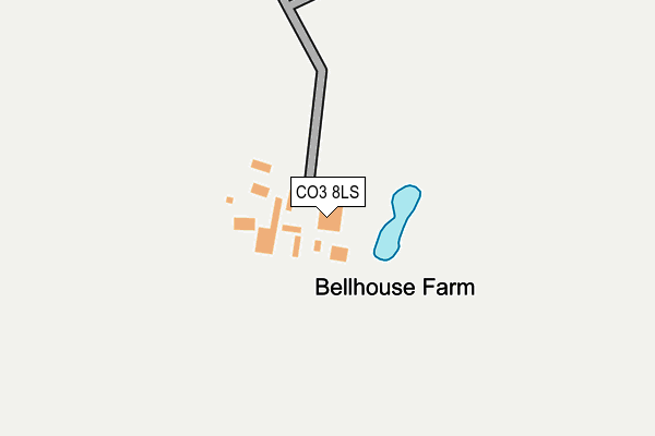
CO3 8LS is located in the Marks Tey and Layer electoral ward, within the local authority district of Colchester and the English Parliamentary constituency of Witham. The Sub Integrated Care Board (ICB) Location is NHS Suffolk and North East Essex ICB - 06T and the police force is Essex. This postcode has been in use since June 2002.


GetTheData
Source: OS OpenMap – Local (Ordnance Survey)
Source: OS VectorMap District (Ordnance Survey)
Licence: Open Government Licence (requires attribution)
| Easting | 594212 |
| Northing | 223127 |
| Latitude | 51.872903 |
| Longitude | 0.819821 |
GetTheData
Source: Open Postcode Geo
Licence: Open Government Licence
| Country | England |
| Postcode District | CO3 |
➜ See where CO3 is on a map | |
GetTheData
Source: Land Registry Price Paid Data
Licence: Open Government Licence
Elevation or altitude of CO3 8LS as distance above sea level:
| Metres | Feet | |
|---|---|---|
| Elevation | 40m | 131ft |
Elevation is measured from the approximate centre of the postcode, to the nearest point on an OS contour line from OS Terrain 50, which has contour spacing of ten vertical metres.
➜ How high above sea level am I? Find the elevation of your current position using your device's GPS.
GetTheData
Source: Open Postcode Elevation
Licence: Open Government Licence
| Ward | Marks Tey And Layer |
| Constituency | Witham |
GetTheData
Source: ONS Postcode Database
Licence: Open Government Licence
| Church Ln (Church Lane) | Stanway | 1,054m |
| Church Ln (Church Lane) | Stanway | 1,079m |
| Wagtail Mews (Plover Rd) | Stanway | 1,140m |
| Wagtail Mews (Plover Rd) | Stanway | 1,159m |
| St Albright's Church (London Road) | Stanway | 1,224m |
| Marks Tey Station | 2.7km |
| Colchester Station | 5.9km |
GetTheData
Source: NaPTAN
Licence: Open Government Licence
GetTheData
Source: ONS Postcode Database
Licence: Open Government Licence


➜ Get more ratings from the Food Standards Agency
GetTheData
Source: Food Standards Agency
Licence: FSA terms & conditions
| Last Collection | |||
|---|---|---|---|
| Location | Mon-Fri | Sat | Distance |
| Churchfields Avenue | 17:30 | 11:30 | 1,154m |
| Stanway Church | 17:30 | 11:30 | 1,218m |
| Stanway Post Office | 17:30 | 12:10 | 1,244m |
GetTheData
Source: Dracos
Licence: Creative Commons Attribution-ShareAlike
The below table lists the International Territorial Level (ITL) codes (formerly Nomenclature of Territorial Units for Statistics (NUTS) codes) and Local Administrative Units (LAU) codes for CO3 8LS:
| ITL 1 Code | Name |
|---|---|
| TLH | East |
| ITL 2 Code | Name |
| TLH3 | Essex |
| ITL 3 Code | Name |
| TLH34 | Essex Haven Gateway |
| LAU 1 Code | Name |
| E07000071 | Colchester |
GetTheData
Source: ONS Postcode Directory
Licence: Open Government Licence
The below table lists the Census Output Area (OA), Lower Layer Super Output Area (LSOA), and Middle Layer Super Output Area (MSOA) for CO3 8LS:
| Code | Name | |
|---|---|---|
| OA | E00109996 | |
| LSOA | E01021654 | Colchester 010A |
| MSOA | E02004515 | Colchester 010 |
GetTheData
Source: ONS Postcode Directory
Licence: Open Government Licence
| CO3 8WB | Magpie Chase | 796m |
| CO3 8WD | Jackdaw Drive | 801m |
| CO3 0LJ | Warren Lane | 856m |
| CO3 8WU | Robin Crescent | 863m |
| CO3 8WA | Osprey Close | 871m |
| CO3 0LL | Warren Lane | 881m |
| CO3 8WH | Heron Close | 882m |
| CO3 8LR | Church Lane | 884m |
| CO3 8WL | Robin Crescent | 886m |
| CO3 8SS | Crane Avenue | 976m |
GetTheData
Source: Open Postcode Geo; Land Registry Price Paid Data
Licence: Open Government Licence