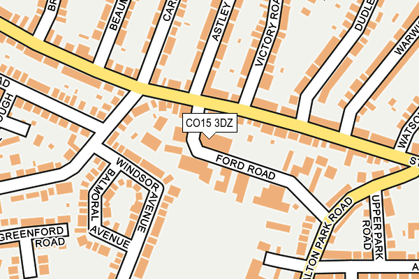
CO15 3DZ is located in the Coppins electoral ward, within the local authority district of Tendring and the English Parliamentary constituency of Clacton. The Sub Integrated Care Board (ICB) Location is NHS Suffolk and North East Essex ICB - 06T and the police force is Essex. This postcode has been in use since January 1980.


GetTheData
Source: OS OpenMap – Local (Ordnance Survey)
Source: OS VectorMap District (Ordnance Survey)
Licence: Open Government Licence (requires attribution)
| Easting | 616721 |
| Northing | 215208 |
| Latitude | 51.793516 |
| Longitude | 1.141308 |
GetTheData
Source: Open Postcode Geo
Licence: Open Government Licence
| Country | England |
| Postcode District | CO15 |
➜ See where CO15 is on a map ➜ Where is Clacton-on-Sea? | |
GetTheData
Source: Land Registry Price Paid Data
Licence: Open Government Licence
Elevation or altitude of CO15 3DZ as distance above sea level:
| Metres | Feet | |
|---|---|---|
| Elevation | 10m | 33ft |
Elevation is measured from the approximate centre of the postcode, to the nearest point on an OS contour line from OS Terrain 50, which has contour spacing of ten vertical metres.
➜ How high above sea level am I? Find the elevation of your current position using your device's GPS.
GetTheData
Source: Open Postcode Elevation
Licence: Open Government Licence
| Ward | Coppins |
| Constituency | Clacton |
GetTheData
Source: ONS Postcode Database
Licence: Open Government Licence
| Dudley Road (St. Osyth Road) | Clacton | 57m |
| Dudley Road (St. Osyth Road) | Clacton | 76m |
| Jameson Road (Coopers Lane) | Clacton | 145m |
| Beaumont Avenue (St. Osyth Road) | Clacton | 195m |
| Beaumont Avenue (St. Osyth Road) | Clacton | 263m |
| Clacton-on-Sea Station | 0.9km |
GetTheData
Source: NaPTAN
Licence: Open Government Licence
GetTheData
Source: ONS Postcode Database
Licence: Open Government Licence


➜ Get more ratings from the Food Standards Agency
GetTheData
Source: Food Standards Agency
Licence: FSA terms & conditions
| Last Collection | |||
|---|---|---|---|
| Location | Mon-Fri | Sat | Distance |
| Carrs Road | 17:30 | 11:00 | 114m |
| St Osyth Road | 17:30 | 11:00 | 213m |
| Upper Park Road | 17:30 | 11:00 | 302m |
GetTheData
Source: Dracos
Licence: Creative Commons Attribution-ShareAlike
The below table lists the International Territorial Level (ITL) codes (formerly Nomenclature of Territorial Units for Statistics (NUTS) codes) and Local Administrative Units (LAU) codes for CO15 3DZ:
| ITL 1 Code | Name |
|---|---|
| TLH | East |
| ITL 2 Code | Name |
| TLH3 | Essex |
| ITL 3 Code | Name |
| TLH34 | Essex Haven Gateway |
| LAU 1 Code | Name |
| E07000076 | Tendring |
GetTheData
Source: ONS Postcode Directory
Licence: Open Government Licence
The below table lists the Census Output Area (OA), Lower Layer Super Output Area (LSOA), and Middle Layer Super Output Area (MSOA) for CO15 3DZ:
| Code | Name | |
|---|---|---|
| OA | E00111580 | |
| LSOA | E01021968 | Tendring 017A |
| MSOA | E02004589 | Tendring 017 |
GetTheData
Source: ONS Postcode Directory
Licence: Open Government Licence
| CO15 3DS | Ford Road | 47m |
| CO15 3DR | St Osyth Road | 71m |
| CO15 3DP | St Osyth Road | 89m |
| CO15 3ES | St Osyth Road | 101m |
| CO15 2AT | Coopers Lane | 113m |
| CO15 2AG | Windsor Avenue | 133m |
| CO15 2AQ | Windsor Avenue | 139m |
| CO15 3EH | Astley Road | 153m |
| CO15 3DX | Victory Road | 157m |
| CO15 3HA | St Osyth Road | 164m |
GetTheData
Source: Open Postcode Geo; Land Registry Price Paid Data
Licence: Open Government Licence