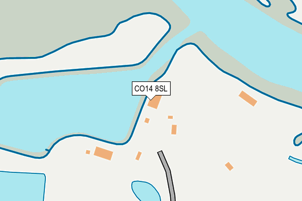
CO14 8SL is located in the Walton electoral ward, within the local authority district of Tendring and the English Parliamentary constituency of Clacton. The Sub Integrated Care Board (ICB) Location is NHS Suffolk and North East Essex ICB - 06T and the police force is Essex. This postcode has been in use since January 1980.


GetTheData
Source: OS OpenMap – Local (Ordnance Survey)
Source: OS VectorMap District (Ordnance Survey)
Licence: Open Government Licence (requires attribution)
| Easting | 624438 |
| Northing | 223288 |
| Latitude | 51.863005 |
| Longitude | 1.258257 |
GetTheData
Source: Open Postcode Geo
Licence: Open Government Licence
| Country | England |
| Postcode District | CO14 |
➜ See where CO14 is on a map | |
GetTheData
Source: Land Registry Price Paid Data
Licence: Open Government Licence
Elevation or altitude of CO14 8SL as distance above sea level:
| Metres | Feet | |
|---|---|---|
| Elevation | 0m | 0ft |
Elevation is measured from the approximate centre of the postcode, to the nearest point on an OS contour line from OS Terrain 50, which has contour spacing of ten vertical metres.
➜ How high above sea level am I? Find the elevation of your current position using your device's GPS.
GetTheData
Source: Open Postcode Elevation
Licence: Open Government Licence
| Ward | Walton |
| Constituency | Clacton |
GetTheData
Source: ONS Postcode Database
Licence: Open Government Licence
| Titchmarsh Marina (Kirby Road) | Walton-on-the-naze | 1,475m |
| Titchmarsh Marina (Kirby Road) | Walton-on-the-naze | 1,482m |
| Baptist Church (Hall Lane) | Walton-on-the-naze | 1,516m |
| Baptist Church (Hall Lane) | Walton-on-the-naze | 1,531m |
| Columbine Centre (Prince's Esplanade) | Walton-on-the-naze | 1,636m |
| Walton-on-the-Naze Station | 2km |
| Frinton-on-Sea Station | 3km |
| Kirby Cross Station | 3.8km |
GetTheData
Source: NaPTAN
Licence: Open Government Licence
GetTheData
Source: ONS Postcode Database
Licence: Open Government Licence


➜ Get more ratings from the Food Standards Agency
GetTheData
Source: Food Standards Agency
Licence: FSA terms & conditions
| Last Collection | |||
|---|---|---|---|
| Location | Mon-Fri | Sat | Distance |
| Five Acres Wade Reach | 17:00 | 11:00 | 1,420m |
| Naze Park Post Office | 17:15 | 11:15 | 1,508m |
| Kirby Road | 17:00 | 11:00 | 1,601m |
GetTheData
Source: Dracos
Licence: Creative Commons Attribution-ShareAlike
The below table lists the International Territorial Level (ITL) codes (formerly Nomenclature of Territorial Units for Statistics (NUTS) codes) and Local Administrative Units (LAU) codes for CO14 8SL:
| ITL 1 Code | Name |
|---|---|
| TLH | East |
| ITL 2 Code | Name |
| TLH3 | Essex |
| ITL 3 Code | Name |
| TLH34 | Essex Haven Gateway |
| LAU 1 Code | Name |
| E07000076 | Tendring |
GetTheData
Source: ONS Postcode Directory
Licence: Open Government Licence
The below table lists the Census Output Area (OA), Lower Layer Super Output Area (LSOA), and Middle Layer Super Output Area (MSOA) for CO14 8SL:
| Code | Name | |
|---|---|---|
| OA | E00112056 | |
| LSOA | E01022054 | Tendring 006C |
| MSOA | E02004578 | Tendring 006 |
GetTheData
Source: ONS Postcode Directory
Licence: Open Government Licence
| CO14 8SG | Hubbards Chase | 1325m |
| CO14 8RH | The Stokes | 1341m |
| CO14 8RF | The Ridge | 1349m |
| CO14 8SQ | Lowe Chase | 1353m |
| CO14 8QH | Brian Bishop Close | 1353m |
| CO14 8RG | Wade Reach | 1390m |
| CO14 8PF | Mill Lane | 1412m |
| CO14 8RE | Wade Reach | 1421m |
| CO14 8HW | Hall Lane | 1458m |
| CO14 8RD | Elliots Drive | 1480m |
GetTheData
Source: Open Postcode Geo; Land Registry Price Paid Data
Licence: Open Government Licence