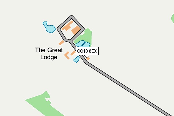
CO10 8EX lies on Stradishall Road in Hundon, Sudbury. CO10 8EX is located in the Clare, Hundon & Kedington electoral ward, within the local authority district of West Suffolk and the English Parliamentary constituency of West Suffolk. The Sub Integrated Care Board (ICB) Location is NHS Suffolk and North East Essex ICB - 07K and the police force is Suffolk. This postcode has been in use since January 1980.


GetTheData
Source: OS OpenMap – Local (Ordnance Survey)
Source: OS VectorMap District (Ordnance Survey)
Licence: Open Government Licence (requires attribution)
| Easting | 573805 |
| Northing | 251116 |
| Latitude | 52.131014 |
| Longitude | 0.537868 |
GetTheData
Source: Open Postcode Geo
Licence: Open Government Licence
| Street | Stradishall Road |
| Locality | Hundon |
| Town/City | Sudbury |
| Country | England |
| Postcode District | CO10 |
➜ See where CO10 is on a map | |
GetTheData
Source: Land Registry Price Paid Data
Licence: Open Government Licence
Elevation or altitude of CO10 8EX as distance above sea level:
| Metres | Feet | |
|---|---|---|
| Elevation | 110m | 361ft |
Elevation is measured from the approximate centre of the postcode, to the nearest point on an OS contour line from OS Terrain 50, which has contour spacing of ten vertical metres.
➜ How high above sea level am I? Find the elevation of your current position using your device's GPS.
GetTheData
Source: Open Postcode Elevation
Licence: Open Government Licence
| Ward | Clare, Hundon & Kedington |
| Constituency | West Suffolk |
GetTheData
Source: ONS Postcode Database
Licence: Open Government Licence
| Hundon Hall Letter Box (Hall Road) | Hundon | 1,334m |
| Hundon Hall Letter Box (Hall Road) | Hundon | 1,353m |
| Post Office | Stradishall | 1,679m |
| Post Office | Stradishall | 1,688m |
| Fox Farm | Hundon | 1,937m |
GetTheData
Source: NaPTAN
Licence: Open Government Licence
| Percentage of properties with Next Generation Access | 100.0% |
| Percentage of properties with Superfast Broadband | 0.0% |
| Percentage of properties with Ultrafast Broadband | 0.0% |
| Percentage of properties with Full Fibre Broadband | 0.0% |
Superfast Broadband is between 30Mbps and 300Mbps
Ultrafast Broadband is > 300Mbps
| Percentage of properties unable to receive 2Mbps | 0.0% |
| Percentage of properties unable to receive 5Mbps | 0.0% |
| Percentage of properties unable to receive 10Mbps | 100.0% |
| Percentage of properties unable to receive 30Mbps | 100.0% |
GetTheData
Source: Ofcom
Licence: Ofcom Terms of Use (requires attribution)
GetTheData
Source: ONS Postcode Database
Licence: Open Government Licence


➜ Get more ratings from the Food Standards Agency
GetTheData
Source: Food Standards Agency
Licence: FSA terms & conditions
| Last Collection | |||
|---|---|---|---|
| Location | Mon-Fri | Sat | Distance |
| High Point Prison | 16:00 | 08:45 | 1,551m |
| Stradishall Cafe | 16:00 | 08:45 | 1,756m |
| The Street | 16:00 | 08:45 | 1,837m |
GetTheData
Source: Dracos
Licence: Creative Commons Attribution-ShareAlike
The below table lists the International Territorial Level (ITL) codes (formerly Nomenclature of Territorial Units for Statistics (NUTS) codes) and Local Administrative Units (LAU) codes for CO10 8EX:
| ITL 1 Code | Name |
|---|---|
| TLH | East |
| ITL 2 Code | Name |
| TLH1 | East Anglia |
| ITL 3 Code | Name |
| TLH14 | Suffolk CC |
| LAU 1 Code | Name |
| E07000245 | West Suffolk |
GetTheData
Source: ONS Postcode Directory
Licence: Open Government Licence
The below table lists the Census Output Area (OA), Lower Layer Super Output Area (LSOA), and Middle Layer Super Output Area (MSOA) for CO10 8EX:
| Code | Name | |
|---|---|---|
| OA | E00169948 | |
| LSOA | E01030120 | St Edmundsbury 011A |
| MSOA | E02006283 | St Edmundsbury 011 |
GetTheData
Source: ONS Postcode Directory
Licence: Open Government Licence
| CO10 8EU | Stradishall Road | 836m |
| CB8 8YR | Edmunds Hill | 1279m |
| CO10 8ET | Hall Road | 1325m |
| CO10 8EY | Folley Road | 1537m |
| CB8 9YD | Sycamore Path | 1585m |
| CB8 9YB | Poplar Walk | 1612m |
| CB8 8PT | 1661m | |
| CO10 8EN | Steeplechase | 1674m |
| CB8 9YE | Ash Walk | 1677m |
| CB8 9XZ | Hawthorne Way | 1707m |
GetTheData
Source: Open Postcode Geo; Land Registry Price Paid Data
Licence: Open Government Licence