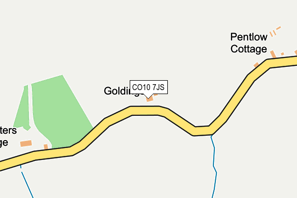
CO10 7JS is in Pentlow, Sudbury. CO10 7JS is located in the Stour Valley North electoral ward, within the local authority district of Braintree and the English Parliamentary constituency of Braintree. The Sub Integrated Care Board (ICB) Location is NHS Mid and South Essex ICB - 06Q and the police force is Essex. This postcode has been in use since January 1980.


GetTheData
Source: OS OpenMap – Local (Ordnance Survey)
Source: OS VectorMap District (Ordnance Survey)
Licence: Open Government Licence (requires attribution)
| Easting | 580584 |
| Northing | 244585 |
| Latitude | 52.070187 |
| Longitude | 0.633339 |
GetTheData
Source: Open Postcode Geo
Licence: Open Government Licence
| Locality | Pentlow |
| Town/City | Sudbury |
| Country | England |
| Postcode District | CO10 |
➜ See where CO10 is on a map | |
GetTheData
Source: Land Registry Price Paid Data
Licence: Open Government Licence
Elevation or altitude of CO10 7JS as distance above sea level:
| Metres | Feet | |
|---|---|---|
| Elevation | 70m | 230ft |
Elevation is measured from the approximate centre of the postcode, to the nearest point on an OS contour line from OS Terrain 50, which has contour spacing of ten vertical metres.
➜ How high above sea level am I? Find the elevation of your current position using your device's GPS.
GetTheData
Source: Open Postcode Elevation
Licence: Open Government Licence
| Ward | Stour Valley North |
| Constituency | Braintree |
GetTheData
Source: ONS Postcode Database
Licence: Open Government Licence
| Pentlow Forge (School Road) | Pentlow | 780m |
| Pentlow Forge (School Road) | Pentlow | 782m |
GetTheData
Source: NaPTAN
Licence: Open Government Licence
| Percentage of properties with Next Generation Access | 100.0% |
| Percentage of properties with Superfast Broadband | 83.3% |
| Percentage of properties with Ultrafast Broadband | 83.3% |
| Percentage of properties with Full Fibre Broadband | 83.3% |
Superfast Broadband is between 30Mbps and 300Mbps
Ultrafast Broadband is > 300Mbps
| Percentage of properties unable to receive 2Mbps | 0.0% |
| Percentage of properties unable to receive 5Mbps | 0.0% |
| Percentage of properties unable to receive 10Mbps | 0.0% |
| Percentage of properties unable to receive 30Mbps | 16.7% |
GetTheData
Source: Ofcom
Licence: Ofcom Terms of Use (requires attribution)
Estimated total energy consumption in CO10 7JS by fuel type, 2015.
| Consumption (kWh) | 37,239 |
|---|---|
| Meter count | 6 |
| Mean (kWh/meter) | 6,206 |
| Median (kWh/meter) | 5,742 |
GetTheData
Source: Postcode level gas estimates: 2015 (experimental)
Source: Postcode level electricity estimates: 2015 (experimental)
Licence: Open Government Licence
GetTheData
Source: ONS Postcode Database
Licence: Open Government Licence


➜ Get more ratings from the Food Standards Agency
GetTheData
Source: Food Standards Agency
Licence: FSA terms & conditions
| Last Collection | |||
|---|---|---|---|
| Location | Mon-Fri | Sat | Distance |
| Belchamp St Paul | 16:30 | 10:30 | 3,126m |
| Clare Post Office | 17:00 | 10:30 | 3,748m |
| Bridewell Street Clare | 16:00 | 10:30 | 3,778m |
GetTheData
Source: Dracos
Licence: Creative Commons Attribution-ShareAlike
The below table lists the International Territorial Level (ITL) codes (formerly Nomenclature of Territorial Units for Statistics (NUTS) codes) and Local Administrative Units (LAU) codes for CO10 7JS:
| ITL 1 Code | Name |
|---|---|
| TLH | East |
| ITL 2 Code | Name |
| TLH3 | Essex |
| ITL 3 Code | Name |
| TLH34 | Essex Haven Gateway |
| LAU 1 Code | Name |
| E07000067 | Braintree |
GetTheData
Source: ONS Postcode Directory
Licence: Open Government Licence
The below table lists the Census Output Area (OA), Lower Layer Super Output Area (LSOA), and Middle Layer Super Output Area (MSOA) for CO10 7JS:
| Code | Name | |
|---|---|---|
| OA | E00108742 | |
| LSOA | E01021406 | Braintree 002B |
| MSOA | E02004447 | Braintree 002 |
GetTheData
Source: ONS Postcode Directory
Licence: Open Government Licence
| CO10 7JU | 476m | |
| CO10 7JR | School Road | 729m |
| CO10 7JT | 744m | |
| CO10 7JP | School Road | 895m |
| CO10 7JW | Pinkuah Lane | 1030m |
| CO10 7JN | 1270m | |
| CO10 8BJ | Mill Lane | 1325m |
| CO10 8BH | Stour Street | 1387m |
| CO10 7DJ | Church Street | 1505m |
| CO10 8BE | Poole Street | 1539m |
GetTheData
Source: Open Postcode Geo; Land Registry Price Paid Data
Licence: Open Government Licence