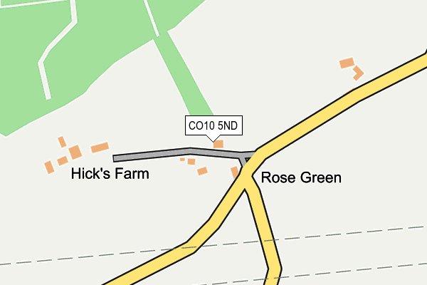
CO10 5ND lies on Hicks Lane in Assington, Sudbury. CO10 5ND is located in the Assington electoral ward, within the local authority district of Babergh and the English Parliamentary constituency of South Suffolk. The Sub Integrated Care Board (ICB) Location is NHS Suffolk and North East Essex ICB - 07K and the police force is Suffolk. This postcode has been in use since January 1993.


GetTheData
Source: OS OpenMap – Local (Ordnance Survey)
Source: OS VectorMap District (Ordnance Survey)
Licence: Open Government Licence (requires attribution)
| Easting | 593037 |
| Northing | 237300 |
| Latitude | 52.000585 |
| Longitude | 0.810725 |
GetTheData
Source: Open Postcode Geo
Licence: Open Government Licence
| Street | Hicks Lane |
| Locality | Assington |
| Town/City | Sudbury |
| Country | England |
| Postcode District | CO10 |
➜ See where CO10 is on a map | |
GetTheData
Source: Land Registry Price Paid Data
Licence: Open Government Licence
Elevation or altitude of CO10 5ND as distance above sea level:
| Metres | Feet | |
|---|---|---|
| Elevation | 60m | 197ft |
Elevation is measured from the approximate centre of the postcode, to the nearest point on an OS contour line from OS Terrain 50, which has contour spacing of ten vertical metres.
➜ How high above sea level am I? Find the elevation of your current position using your device's GPS.
GetTheData
Source: Open Postcode Elevation
Licence: Open Government Licence
| Ward | Assington |
| Constituency | South Suffolk |
GetTheData
Source: ONS Postcode Database
Licence: Open Government Licence
| Post Office (The Street) | Assington | 515m |
| Post Office (The Street) | Assington | 523m |
| Shoulder Of Mutton (Assington Street) | Assington | 873m |
| Shoulder Of Mutton (Assington Street) | Assington | 879m |
| Water Tower (A134) | Assington | 1,509m |
| Bures Station | 4.3km |
GetTheData
Source: NaPTAN
Licence: Open Government Licence
| Percentage of properties with Next Generation Access | 100.0% |
| Percentage of properties with Superfast Broadband | 0.0% |
| Percentage of properties with Ultrafast Broadband | 0.0% |
| Percentage of properties with Full Fibre Broadband | 0.0% |
Superfast Broadband is between 30Mbps and 300Mbps
Ultrafast Broadband is > 300Mbps
| Percentage of properties unable to receive 2Mbps | 100.0% |
| Percentage of properties unable to receive 5Mbps | 100.0% |
| Percentage of properties unable to receive 10Mbps | 100.0% |
| Percentage of properties unable to receive 30Mbps | 100.0% |
GetTheData
Source: Ofcom
Licence: Ofcom Terms of Use (requires attribution)
GetTheData
Source: ONS Postcode Database
Licence: Open Government Licence


➜ Get more ratings from the Food Standards Agency
GetTheData
Source: Food Standards Agency
Licence: FSA terms & conditions
| Last Collection | |||
|---|---|---|---|
| Location | Mon-Fri | Sat | Distance |
| Honey Tye | 16:50 | 10:30 | 2,389m |
| Prospect Hill | 16:00 | 10:30 | 3,840m |
| Eight Bells Bures | 16:30 | 10:30 | 4,216m |
GetTheData
Source: Dracos
Licence: Creative Commons Attribution-ShareAlike
The below table lists the International Territorial Level (ITL) codes (formerly Nomenclature of Territorial Units for Statistics (NUTS) codes) and Local Administrative Units (LAU) codes for CO10 5ND:
| ITL 1 Code | Name |
|---|---|
| TLH | East |
| ITL 2 Code | Name |
| TLH1 | East Anglia |
| ITL 3 Code | Name |
| TLH14 | Suffolk CC |
| LAU 1 Code | Name |
| E07000200 | Babergh |
GetTheData
Source: ONS Postcode Directory
Licence: Open Government Licence
The below table lists the Census Output Area (OA), Lower Layer Super Output Area (LSOA), and Middle Layer Super Output Area (MSOA) for CO10 5ND:
| Code | Name | |
|---|---|---|
| OA | E00152361 | |
| LSOA | E01029899 | Babergh 009B |
| MSOA | E02006235 | Babergh 009 |
GetTheData
Source: ONS Postcode Directory
Licence: Open Government Licence
| CO10 5NB | Rose Green | 43m |
| CO10 5NA | Bures Road | 201m |
| CO10 5LW | The Street | 453m |
| CO10 5NF | Bures Road | 577m |
| CO10 5LP | Barracks Road | 604m |
| CO10 5LN | The Street | 755m |
| CO10 5LJ | The Street | 930m |
| CO10 5LL | Vicary Estate | 969m |
| CO10 5LR | Nayland Road | 1082m |
| CO10 5LH | The Street | 1177m |
GetTheData
Source: Open Postcode Geo; Land Registry Price Paid Data
Licence: Open Government Licence