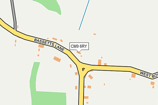
CM9 6RY is located in the Wickham Bishops and Woodham electoral ward, within the local authority district of Maldon and the English Parliamentary constituency of Witham. The Sub Integrated Care Board (ICB) Location is NHS Mid and South Essex ICB - 06Q and the police force is Essex. This postcode has been in use since January 1980.


GetTheData
Source: OS OpenMap – Local (Ordnance Survey)
Source: OS VectorMap District (Ordnance Survey)
Licence: Open Government Licence (requires attribution)
| Easting | 579439 |
| Northing | 207831 |
| Latitude | 51.740452 |
| Longitude | 0.597530 |
GetTheData
Source: Open Postcode Geo
Licence: Open Government Licence
| Country | England |
| Postcode District | CM9 |
➜ See where CM9 is on a map ➜ Where is Little Baddow? | |
GetTheData
Source: Land Registry Price Paid Data
Licence: Open Government Licence
Elevation or altitude of CM9 6RY as distance above sea level:
| Metres | Feet | |
|---|---|---|
| Elevation | 60m | 197ft |
Elevation is measured from the approximate centre of the postcode, to the nearest point on an OS contour line from OS Terrain 50, which has contour spacing of ten vertical metres.
➜ How high above sea level am I? Find the elevation of your current position using your device's GPS.
GetTheData
Source: Open Postcode Elevation
Licence: Open Government Licence
| Ward | Wickham Bishops And Woodham |
| Constituency | Witham |
GetTheData
Source: ONS Postcode Database
Licence: Open Government Licence
| Bassetts Lane (Spring Elms Lane) | Woodham Walter | 395m |
| Bassetts Lane (Spring Elms Lane) | Woodham Walter | 403m |
| Council Houses (Rectory Road) | Woodham Walter | 1,413m |
| Council Houses (Rectory Road) | Woodham Walter | 1,421m |
| Memorial Hall (North Hill) | Little Baddow | 1,481m |
| Hatfield Peverel Station | 4.4km |
GetTheData
Source: NaPTAN
Licence: Open Government Licence
| Percentage of properties with Next Generation Access | 100.0% |
| Percentage of properties with Superfast Broadband | 100.0% |
| Percentage of properties with Ultrafast Broadband | 100.0% |
| Percentage of properties with Full Fibre Broadband | 100.0% |
Superfast Broadband is between 30Mbps and 300Mbps
Ultrafast Broadband is > 300Mbps
| Percentage of properties unable to receive 2Mbps | 0.0% |
| Percentage of properties unable to receive 5Mbps | 0.0% |
| Percentage of properties unable to receive 10Mbps | 0.0% |
| Percentage of properties unable to receive 30Mbps | 0.0% |
GetTheData
Source: Ofcom
Licence: Ofcom Terms of Use (requires attribution)
GetTheData
Source: ONS Postcode Database
Licence: Open Government Licence


➜ Get more ratings from the Food Standards Agency
GetTheData
Source: Food Standards Agency
Licence: FSA terms & conditions
| Last Collection | |||
|---|---|---|---|
| Location | Mon-Fri | Sat | Distance |
| The Ridge | 16:20 | 10:10 | 1,867m |
| Wayside | 16:30 | 10:00 | 2,226m |
| Hopping Jacks Lane | 16:30 | 08:15 | 2,581m |
GetTheData
Source: Dracos
Licence: Creative Commons Attribution-ShareAlike
The below table lists the International Territorial Level (ITL) codes (formerly Nomenclature of Territorial Units for Statistics (NUTS) codes) and Local Administrative Units (LAU) codes for CM9 6RY:
| ITL 1 Code | Name |
|---|---|
| TLH | East |
| ITL 2 Code | Name |
| TLH3 | Essex |
| ITL 3 Code | Name |
| TLH36 | Heart of Essex |
| LAU 1 Code | Name |
| E07000074 | Maldon |
GetTheData
Source: ONS Postcode Directory
Licence: Open Government Licence
The below table lists the Census Output Area (OA), Lower Layer Super Output Area (LSOA), and Middle Layer Super Output Area (MSOA) for CM9 6RY:
| Code | Name | |
|---|---|---|
| OA | E00111310 | |
| LSOA | E01021913 | Maldon 002D |
| MSOA | E02004556 | Maldon 002 |
GetTheData
Source: ONS Postcode Directory
Licence: Open Government Licence
| CM3 4BZ | Bassetts Lane | 106m |
| CM3 4SQ | Spring Elms Lane | 375m |
| CM9 6RZ | 448m | |
| CM3 4SG | Spring Elms Lane | 725m |
| CM9 6NF | Common Lane | 819m |
| CM9 6RU | Little Baddow Road | 951m |
| CM3 4BX | Tofts Chase | 1096m |
| CM9 6SD | Little London Lane | 1125m |
| CM9 6RS | Stivvys Road | 1148m |
| CM9 6RT | 1193m |
GetTheData
Source: Open Postcode Geo; Land Registry Price Paid Data
Licence: Open Government Licence