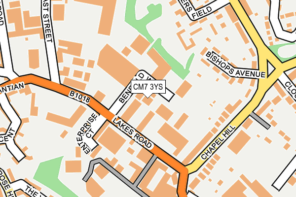
CM7 3YS lies on Benfield Way in Braintree. CM7 3YS is located in the Braintree Central & Beckers Green electoral ward, within the local authority district of Braintree and the English Parliamentary constituency of Braintree. The Sub Integrated Care Board (ICB) Location is NHS Mid and South Essex ICB - 06Q and the police force is Essex. This postcode has been in use since July 1995.


GetTheData
Source: OS OpenMap – Local (Ordnance Survey)
Source: OS VectorMap District (Ordnance Survey)
Licence: Open Government Licence (requires attribution)
| Easting | 576695 |
| Northing | 222953 |
| Latitude | 51.877149 |
| Longitude | 0.565534 |
GetTheData
Source: Open Postcode Geo
Licence: Open Government Licence
| Street | Benfield Way |
| Town/City | Braintree |
| Country | England |
| Postcode District | CM7 |
➜ See where CM7 is on a map ➜ Where is Braintree? | |
GetTheData
Source: Land Registry Price Paid Data
Licence: Open Government Licence
Elevation or altitude of CM7 3YS as distance above sea level:
| Metres | Feet | |
|---|---|---|
| Elevation | 60m | 197ft |
Elevation is measured from the approximate centre of the postcode, to the nearest point on an OS contour line from OS Terrain 50, which has contour spacing of ten vertical metres.
➜ How high above sea level am I? Find the elevation of your current position using your device's GPS.
GetTheData
Source: Open Postcode Elevation
Licence: Open Government Licence
| Ward | Braintree Central & Beckers Green |
| Constituency | Braintree |
GetTheData
Source: ONS Postcode Database
Licence: Open Government Licence
5, BENFIELD WAY, BRAINTREE, CM7 3YS 2008 22 AUG £950,000 |
GetTheData
Source: HM Land Registry Price Paid Data
Licence: Contains HM Land Registry data © Crown copyright and database right 2025. This data is licensed under the Open Government Licence v3.0.
| Sportsman (Lakes Road) | Braintree | 77m |
| Sportsman (Lakes Road) | Braintree | 89m |
| Four Seasons (Lakes Road) | Braintree | 138m |
| Chapel Hill | Braintree | 211m |
| Chapel Hill | Braintree | 215m |
| Braintree Station | 0.6km |
| Braintree Freeport Station | 0.9km |
| Cressing Station | 2.9km |
GetTheData
Source: NaPTAN
Licence: Open Government Licence
| Median download speed | 80.0Mbps |
| Average download speed | 59.9Mbps |
| Maximum download speed | 80.00Mbps |
| Median upload speed | 20.0Mbps |
| Average upload speed | 14.7Mbps |
| Maximum upload speed | 20.00Mbps |
GetTheData
Source: Ofcom
Licence: Ofcom Terms of Use (requires attribution)
Estimated total energy consumption in CM7 3YS by fuel type, 2015.
| Consumption (kWh) | 158,255 |
|---|---|
| Meter count | 12 |
| Mean (kWh/meter) | 13,188 |
| Median (kWh/meter) | 8,611 |
GetTheData
Source: Postcode level gas estimates: 2015 (experimental)
Source: Postcode level electricity estimates: 2015 (experimental)
Licence: Open Government Licence
GetTheData
Source: ONS Postcode Database
Licence: Open Government Licence


➜ Get more ratings from the Food Standards Agency
GetTheData
Source: Food Standards Agency
Licence: FSA terms & conditions
| Last Collection | |||
|---|---|---|---|
| Location | Mon-Fri | Sat | Distance |
| Orchard Drive | 17:30 | 09:15 | 694m |
| Fairfield Road | 17:30 | 12:30 | 849m |
| Little Bradfords | 17:00 | 08:30 | 1,041m |
GetTheData
Source: Dracos
Licence: Creative Commons Attribution-ShareAlike
The below table lists the International Territorial Level (ITL) codes (formerly Nomenclature of Territorial Units for Statistics (NUTS) codes) and Local Administrative Units (LAU) codes for CM7 3YS:
| ITL 1 Code | Name |
|---|---|
| TLH | East |
| ITL 2 Code | Name |
| TLH3 | Essex |
| ITL 3 Code | Name |
| TLH34 | Essex Haven Gateway |
| LAU 1 Code | Name |
| E07000067 | Braintree |
GetTheData
Source: ONS Postcode Directory
Licence: Open Government Licence
The below table lists the Census Output Area (OA), Lower Layer Super Output Area (LSOA), and Middle Layer Super Output Area (MSOA) for CM7 3YS:
| Code | Name | |
|---|---|---|
| OA | E00173957 | |
| LSOA | E01033459 | Braintree 009F |
| MSOA | E02004454 | Braintree 009 |
GetTheData
Source: ONS Postcode Directory
Licence: Open Government Licence
| CM7 3SS | Lakes Road | 89m |
| CM7 3QS | Enterprise Court | 136m |
| CM7 3QX | Chapel Hill | 148m |
| CM7 3PS | Bishops Avenue | 152m |
| CM7 3QZ | Chapel Hill | 181m |
| CM7 3NN | Trotters Field | 190m |
| CM7 3JJ | East Street | 196m |
| CM7 3PN | Cressing Road | 238m |
| CM7 3NW | Trotters Field | 245m |
| CM7 3RF | Stuarts Way | 256m |
GetTheData
Source: Open Postcode Geo; Land Registry Price Paid Data
Licence: Open Government Licence