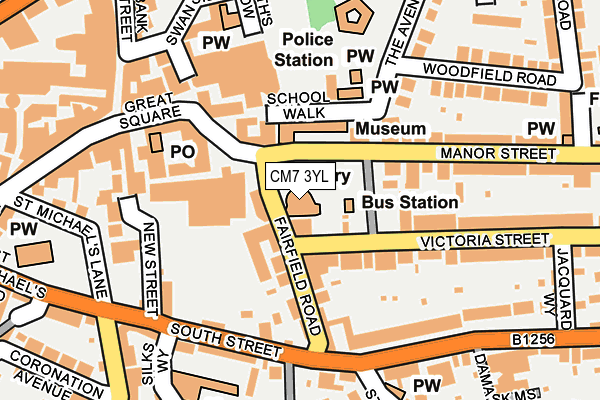
CM7 3YL is located in the Braintree Central & Beckers Green electoral ward, within the local authority district of Braintree and the English Parliamentary constituency of Braintree. The Sub Integrated Care Board (ICB) Location is NHS Mid and South Essex ICB - 06Q and the police force is Essex. This postcode has been in use since December 1996.


GetTheData
Source: OS OpenMap – Local (Ordnance Survey)
Source: OS VectorMap District (Ordnance Survey)
Licence: Open Government Licence (requires attribution)
| Easting | 575873 |
| Northing | 222991 |
| Latitude | 51.877750 |
| Longitude | 0.553624 |
GetTheData
Source: Open Postcode Geo
Licence: Open Government Licence
| Country | England |
| Postcode District | CM7 |
➜ See where CM7 is on a map ➜ Where is Braintree? | |
GetTheData
Source: Land Registry Price Paid Data
Licence: Open Government Licence
Elevation or altitude of CM7 3YL as distance above sea level:
| Metres | Feet | |
|---|---|---|
| Elevation | 60m | 197ft |
Elevation is measured from the approximate centre of the postcode, to the nearest point on an OS contour line from OS Terrain 50, which has contour spacing of ten vertical metres.
➜ How high above sea level am I? Find the elevation of your current position using your device's GPS.
GetTheData
Source: Open Postcode Elevation
Licence: Open Government Licence
| Ward | Braintree Central & Beckers Green |
| Constituency | Braintree |
GetTheData
Source: ONS Postcode Database
Licence: Open Government Licence
| Victoria Street (Fairfield Road) | Braintree Town Centre | 24m |
| Victoria Street (Fairfield Road) | Braintree Town Centre | 53m |
| Manor Street | Braintree Town Centre | 152m |
| South Street | Braintree Town Centre | 190m |
| High Street | Braintree Town Centre | 235m |
| Braintree Station | 0.3km |
| Braintree Freeport Station | 1.4km |
| Cressing Station | 3.3km |
GetTheData
Source: NaPTAN
Licence: Open Government Licence
GetTheData
Source: ONS Postcode Database
Licence: Open Government Licence


➜ Get more ratings from the Food Standards Agency
GetTheData
Source: Food Standards Agency
Licence: FSA terms & conditions
| Last Collection | |||
|---|---|---|---|
| Location | Mon-Fri | Sat | Distance |
| Fairfield Road | 17:30 | 12:30 | 26m |
| High Street | 17:30 | 09:00 | 330m |
| Co-op | 17:30 | 11:15 | 379m |
GetTheData
Source: Dracos
Licence: Creative Commons Attribution-ShareAlike
The below table lists the International Territorial Level (ITL) codes (formerly Nomenclature of Territorial Units for Statistics (NUTS) codes) and Local Administrative Units (LAU) codes for CM7 3YL:
| ITL 1 Code | Name |
|---|---|
| TLH | East |
| ITL 2 Code | Name |
| TLH3 | Essex |
| ITL 3 Code | Name |
| TLH34 | Essex Haven Gateway |
| LAU 1 Code | Name |
| E07000067 | Braintree |
GetTheData
Source: ONS Postcode Directory
Licence: Open Government Licence
The below table lists the Census Output Area (OA), Lower Layer Super Output Area (LSOA), and Middle Layer Super Output Area (MSOA) for CM7 3YL:
| Code | Name | |
|---|---|---|
| OA | E00108516 | |
| LSOA | E01033459 | Braintree 009F |
| MSOA | E02004454 | Braintree 009 |
GetTheData
Source: ONS Postcode Directory
Licence: Open Government Licence
| CM7 3HF | Fairfield Road | 62m |
| CM7 3AG | Fairfield Road | 71m |
| CM7 3HW | Manor Street | 86m |
| CM7 3HA | Fairfield Road | 97m |
| CM7 3HG | Market Place | 118m |
| CM7 3QD | South Street | 124m |
| CM7 3HN | Victoria Street | 137m |
| CM7 1ES | New Street | 161m |
| CM7 1TX | Great Square | 169m |
| CM7 3QH | South Street | 173m |
GetTheData
Source: Open Postcode Geo; Land Registry Price Paid Data
Licence: Open Government Licence