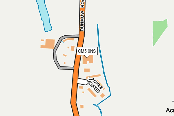
CM5 0NS is located in the Moreton and Fyfield electoral ward, within the local authority district of Epping Forest and the English Parliamentary constituency of Brentwood and Ongar. The Sub Integrated Care Board (ICB) Location is NHS Hertfordshire and West Essex ICB - 07H and the police force is Essex. This postcode has been in use since January 1980.


GetTheData
Source: OS OpenMap – Local (Ordnance Survey)
Source: OS VectorMap District (Ordnance Survey)
Licence: Open Government Licence (requires attribution)
| Easting | 557400 |
| Northing | 208003 |
| Latitude | 51.748616 |
| Longitude | 0.278694 |
GetTheData
Source: Open Postcode Geo
Licence: Open Government Licence
| Country | England |
| Postcode District | CM5 |
➜ See where CM5 is on a map | |
GetTheData
Source: Land Registry Price Paid Data
Licence: Open Government Licence
Elevation or altitude of CM5 0NS as distance above sea level:
| Metres | Feet | |
|---|---|---|
| Elevation | 60m | 197ft |
Elevation is measured from the approximate centre of the postcode, to the nearest point on an OS contour line from OS Terrain 50, which has contour spacing of ten vertical metres.
➜ How high above sea level am I? Find the elevation of your current position using your device's GPS.
GetTheData
Source: Open Postcode Elevation
Licence: Open Government Licence
| Ward | Moreton And Fyfield |
| Constituency | Brentwood And Ongar |
GetTheData
Source: ONS Postcode Database
Licence: Open Government Licence
| Birds Green (Dunmow Road) | Fyfield | 398m |
| Birds Green (Dunmow Road) | Fyfield | 411m |
| Tarrymans Cottage (Birds Green) | Birds Green | 1,102m |
| Tarrymans Cottage (Birds Green) | Birds Green | 1,108m |
| The Queens Head (Dunmow Road) | Fyfield | 1,112m |
GetTheData
Source: NaPTAN
Licence: Open Government Licence
GetTheData
Source: ONS Postcode Database
Licence: Open Government Licence


➜ Get more ratings from the Food Standards Agency
GetTheData
Source: Food Standards Agency
Licence: FSA terms & conditions
The below table lists the International Territorial Level (ITL) codes (formerly Nomenclature of Territorial Units for Statistics (NUTS) codes) and Local Administrative Units (LAU) codes for CM5 0NS:
| ITL 1 Code | Name |
|---|---|
| TLH | East |
| ITL 2 Code | Name |
| TLH3 | Essex |
| ITL 3 Code | Name |
| TLH35 | West Essex |
| LAU 1 Code | Name |
| E07000072 | Epping Forest |
GetTheData
Source: ONS Postcode Directory
Licence: Open Government Licence
The below table lists the Census Output Area (OA), Lower Layer Super Output Area (LSOA), and Middle Layer Super Output Area (MSOA) for CM5 0NS:
| Code | Name | |
|---|---|---|
| OA | E00110720 | |
| LSOA | E01021796 | Epping Forest 003B |
| MSOA | E02004529 | Epping Forest 003 |
GetTheData
Source: ONS Postcode Directory
Licence: Open Government Licence
| CM5 0NQ | Dacres Gate | 109m |
| CM5 0NW | Dunmow Road | 470m |
| CM5 0NN | Dunmow Road | 733m |
| CM5 0RL | Norwood End | 849m |
| CM5 0FE | Fyfield Grange | 1052m |
| CM5 0NT | Dunmow Road | 1081m |
| CM5 0RH | Dunmow Road | 1097m |
| CM5 0RY | Queen Street | 1187m |
| CM5 0SD | Willingale Road | 1192m |
| CM5 0RB | Ongar Road | 1239m |
GetTheData
Source: Open Postcode Geo; Land Registry Price Paid Data
Licence: Open Government Licence