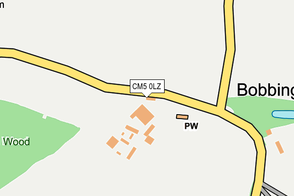
CM5 0LZ lies on Stony Lane in Ongar. CM5 0LZ is located in the Moreton and Fyfield electoral ward, within the local authority district of Epping Forest and the English Parliamentary constituency of Brentwood and Ongar. The Sub Integrated Care Board (ICB) Location is NHS Hertfordshire and West Essex ICB - 07H and the police force is Essex. This postcode has been in use since January 1980.


GetTheData
Source: OS OpenMap – Local (Ordnance Survey)
Source: OS VectorMap District (Ordnance Survey)
Licence: Open Government Licence (requires attribution)
| Easting | 553334 |
| Northing | 205620 |
| Latitude | 51.728338 |
| Longitude | 0.218820 |
GetTheData
Source: Open Postcode Geo
Licence: Open Government Licence
| Street | Stony Lane |
| Town/City | Ongar |
| Country | England |
| Postcode District | CM5 |
➜ See where CM5 is on a map ➜ Where is Bobbingworth? | |
GetTheData
Source: Land Registry Price Paid Data
Licence: Open Government Licence
Elevation or altitude of CM5 0LZ as distance above sea level:
| Metres | Feet | |
|---|---|---|
| Elevation | 70m | 230ft |
Elevation is measured from the approximate centre of the postcode, to the nearest point on an OS contour line from OS Terrain 50, which has contour spacing of ten vertical metres.
➜ How high above sea level am I? Find the elevation of your current position using your device's GPS.
GetTheData
Source: Open Postcode Elevation
Licence: Open Government Licence
| Ward | Moreton And Fyfield |
| Constituency | Brentwood And Ongar |
GetTheData
Source: ONS Postcode Database
Licence: Open Government Licence
| St Germain Church (Stony Lane) | Bobbingworth | 78m |
| St Germain Church (Stony Lane) | Bobbingworth | 80m |
| Blake Hall Turning (Epping Road) | Bobbingworth | 829m |
| Blake Hall Turning (Epping Road) | Bobbingworth | 854m |
| Blake Hall Road (Epping Road) | Bobbingworth | 1,036m |
GetTheData
Source: NaPTAN
Licence: Open Government Licence
| Percentage of properties with Next Generation Access | 100.0% |
| Percentage of properties with Superfast Broadband | 100.0% |
| Percentage of properties with Ultrafast Broadband | 100.0% |
| Percentage of properties with Full Fibre Broadband | 100.0% |
Superfast Broadband is between 30Mbps and 300Mbps
Ultrafast Broadband is > 300Mbps
| Percentage of properties unable to receive 2Mbps | 0.0% |
| Percentage of properties unable to receive 5Mbps | 0.0% |
| Percentage of properties unable to receive 10Mbps | 0.0% |
| Percentage of properties unable to receive 30Mbps | 0.0% |
GetTheData
Source: Ofcom
Licence: Ofcom Terms of Use (requires attribution)
GetTheData
Source: ONS Postcode Database
Licence: Open Government Licence


➜ Get more ratings from the Food Standards Agency
GetTheData
Source: Food Standards Agency
Licence: FSA terms & conditions
| Last Collection | |||
|---|---|---|---|
| Location | Mon-Fri | Sat | Distance |
| Greenstead Green | 16:30 | 07:30 | 2,494m |
| Greenstead Church | 16:30 | 07:00 | 2,773m |
| Crawley Hatch | 18:30 | 11:45 | 3,309m |
GetTheData
Source: Dracos
Licence: Creative Commons Attribution-ShareAlike
The below table lists the International Territorial Level (ITL) codes (formerly Nomenclature of Territorial Units for Statistics (NUTS) codes) and Local Administrative Units (LAU) codes for CM5 0LZ:
| ITL 1 Code | Name |
|---|---|
| TLH | East |
| ITL 2 Code | Name |
| TLH3 | Essex |
| ITL 3 Code | Name |
| TLH35 | West Essex |
| LAU 1 Code | Name |
| E07000072 | Epping Forest |
GetTheData
Source: ONS Postcode Directory
Licence: Open Government Licence
The below table lists the Census Output Area (OA), Lower Layer Super Output Area (LSOA), and Middle Layer Super Output Area (MSOA) for CM5 0LZ:
| Code | Name | |
|---|---|---|
| OA | E00110718 | |
| LSOA | E01021796 | Epping Forest 003B |
| MSOA | E02004529 | Epping Forest 003 |
GetTheData
Source: ONS Postcode Directory
Licence: Open Government Licence
| CM5 0DQ | Stony Lane | 292m |
| CM5 0NF | Gainsthorpe Road | 325m |
| CM5 0LX | Hobbans Farm Chase | 407m |
| CM5 0DH | Newhouse Lane | 422m |
| CM5 0NG | Gainsthorpe Road | 422m |
| CM5 0LU | Moreton Road | 686m |
| CM5 0LN | Moreton Bridge | 717m |
| CM5 0NE | Lower Bovinger Green | 804m |
| CM5 0LL | Moreton Bridge | 1084m |
| CM5 0LR | Pedlars End | 1116m |
GetTheData
Source: Open Postcode Geo; Land Registry Price Paid Data
Licence: Open Government Licence