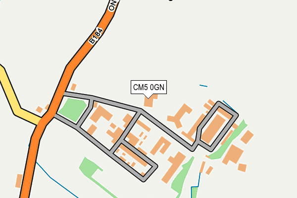
CM5 0GN is located in the Shelley electoral ward, within the local authority district of Epping Forest and the English Parliamentary constituency of Brentwood and Ongar. The Sub Integrated Care Board (ICB) Location is NHS Hertfordshire and West Essex ICB - 07H and the police force is Essex. This postcode has been in use since June 2002.


GetTheData
Source: OS OpenMap – Local (Ordnance Survey)
Source: OS VectorMap District (Ordnance Survey)
Licence: Open Government Licence (requires attribution)
| Easting | 555945 |
| Northing | 204978 |
| Latitude | 51.721850 |
| Longitude | 0.256307 |
GetTheData
Source: Open Postcode Geo
Licence: Open Government Licence
| Country | England |
| Postcode District | CM5 |
➜ See where CM5 is on a map ➜ Where is Shelley? | |
GetTheData
Source: Land Registry Price Paid Data
Licence: Open Government Licence
Elevation or altitude of CM5 0GN as distance above sea level:
| Metres | Feet | |
|---|---|---|
| Elevation | 60m | 197ft |
Elevation is measured from the approximate centre of the postcode, to the nearest point on an OS contour line from OS Terrain 50, which has contour spacing of ten vertical metres.
➜ How high above sea level am I? Find the elevation of your current position using your device's GPS.
GetTheData
Source: Open Postcode Elevation
Licence: Open Government Licence
| Ward | Shelley |
| Constituency | Brentwood And Ongar |
GetTheData
Source: ONS Postcode Database
Licence: Open Government Licence
| Shelley Church (Fyfield Road (184)) | Ongar | 297m |
| Shelley Church (Fyfield Road (B184)) | Ongar | 302m |
| The Gables (Fyfield Road (B184)) | Ongar | 873m |
| The Gables (Fyfield Road (B184)) | Ongar | 874m |
| Hospital (Fyfield Road) | Ongar | 1,089m |
GetTheData
Source: NaPTAN
Licence: Open Government Licence
GetTheData
Source: ONS Postcode Database
Licence: Open Government Licence


➜ Get more ratings from the Food Standards Agency
GetTheData
Source: Food Standards Agency
Licence: FSA terms & conditions
| Last Collection | |||
|---|---|---|---|
| Location | Mon-Fri | Sat | Distance |
| Marden Ash | 17:30 | 12:00 | 2,697m |
| Greenstead Church | 16:30 | 07:00 | 2,937m |
| Greenstead Green | 16:30 | 07:30 | 3,921m |
GetTheData
Source: Dracos
Licence: Creative Commons Attribution-ShareAlike
The below table lists the International Territorial Level (ITL) codes (formerly Nomenclature of Territorial Units for Statistics (NUTS) codes) and Local Administrative Units (LAU) codes for CM5 0GN:
| ITL 1 Code | Name |
|---|---|
| TLH | East |
| ITL 2 Code | Name |
| TLH3 | Essex |
| ITL 3 Code | Name |
| TLH35 | West Essex |
| LAU 1 Code | Name |
| E07000072 | Epping Forest |
GetTheData
Source: ONS Postcode Directory
Licence: Open Government Licence
The below table lists the Census Output Area (OA), Lower Layer Super Output Area (LSOA), and Middle Layer Super Output Area (MSOA) for CM5 0GN:
| Code | Name | |
|---|---|---|
| OA | E00110757 | |
| LSOA | E01021802 | Epping Forest 004D |
| MSOA | E02004530 | Epping Forest 004 |
GetTheData
Source: ONS Postcode Directory
Licence: Open Government Licence
| CM5 0HG | Fyfield Road | 386m |
| CM5 0HN | Fyfield Road | 534m |
| CM5 9LZ | High Ongar Road | 872m |
| CM5 0AL | Fyfield Road | 881m |
| CM5 0AN | Fyfield Road | 922m |
| CM5 9LY | High Ongar Road | 928m |
| CM5 0GA | The Gables | 989m |
| CM5 0HP | Ongar Road | 1015m |
| CM5 0AZ | Abigail Court | 1032m |
| CM5 0AJ | Fyfield Road | 1069m |
GetTheData
Source: Open Postcode Geo; Land Registry Price Paid Data
Licence: Open Government Licence